
ATTENTION OUR NEW HISTORICAL LAKE COEUR D'ALENE WEBSITE IS COMING SOON WITH OUR NEW LAKE CHART (2nd Edition) AND ASSOCIATED PRODUCTS!
HistoricalLakeCdA.com or HistoricalLakeCoeurd'Alene.com (these web addresses will work as soon as the site is finished). See our Lake Chart for the first at the up coming Hunters Fest as the Kootenai County Fair Grounds.
Click Links to view... Coeur d'Alene River and Chain Lakes, Fernan Lake, Spokane River/Post Falls Reservoir, St. Joe River, and St. Maries River


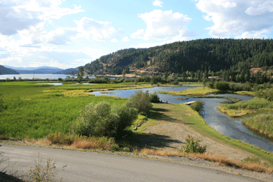
Lake Coeur d’Alene (31,872 acres) is 25.6 miles long, ranges from 1 to 3 miles wide, is 197 ft. deep at its deepest (off of Driftwood Point), and offers over 109 miles of shoreline. The elevation of the lake is 2,125 feet (648 m) above sea level. The Coeur d’Alene and St. Joe rivers feed Lake Coeur d’Alene, and the Spokane River is its outflow. Get information about anticipated changes in water elevation and flow at 208-769-1357 or online at USGS or NOAA
There are many recreational and scenic sites to be enjoyed off Lake Coeur d’Alene… Among my children’s favorites are two beautiful little islands: Kid Island in Kid Bay (North End of lake); and Corine Island at the mouth of Swede Bay. Corine Island is very simple, with not much more than a small tree occupying it. Kid Island is its contrast, with dense trees, short trail, a rock wall around part of it, and even a nice fire pit. On its east shore lies the steamboat St. Marie’s Boiler, giving the island a fun, shipwrecked look. It is privately owned, but fun to sail around and take photos of. A third island on Lake Coeur d’Alene appeals to the golfing population: the famous Floating Golf Green, as part of the Coeur d’Alene Golf Course. There are two other golf courses on the lake. Camp sites are another feature of Lake Coeur d’Alene; there are several very nice camp sites on the lake that can even be accessed by boat. My family and I enjoyed one of our most memorable vacations sailing to various camping sites and staying a night or two at each of them over the course of a week. Camping and golfing are only the beginning of the list of activities enjoyed on the lake… which list, of course, is dominated by boating, sailing, and ferry cruises; including a cruise to the “North Pole” around Christmas time and pirate cruises in the summer. Depending upon the time of year, many go to the lake to view Bald Eagles, Osprey, and other wildlife. For anglers, the lake is also known for its great fishing (some of which include Chinook salmon, trout, and Northern Pike)!
Lake Coeur d'Alene before it was called by this name has an incredible history of the native peoples of this area, know as the --- people, later called by the French fur traders as the Coeur d'Alene's due to their smart sharp trading skills in reference to the tool the Awl. Coeur d'Alene interpreted is "Heart of the Awl." The native people adopted this name and now are known as the Coeur d'Alene Tribe.
The Coeur d'Alene Tribe had 18 camps around the lake, six big camps along the Coeur d'Alene River heading toward Cataldo where the Old Sacred Heart Mission is located, a big camp at the mouth of the Spokane River where North Idaho College and the city of Coeur d'Alene are located, and right accross the river on what today is called Blackwell Island (was not an Island pre 1906 Post Falls dam), and 16 smaller camps from the mouth of the Spokane River to about where Plante's Ferry is. The point is these native peoples have lived and loved this area for thousands of year. And because of their love and history they are working hard to protect this lake and the lands around it.
 our Google map by clicking on the ship wreck symbols |
Another unique feature of Lake Coeur d’Alene is its steamboat history. Author John V. Wood has been researching the lake’s steamboats for over 30 years, and explains: “For a start, the lake was boasted as being fed by the world’s highest navigable river, the St. Joe, and this actually found support in the 1912 Cram’s Atlas of the World which went even further to state that both, ‘The Coeur d’Alene and St. Joe rivers [tributaries of the lake] have the distinction of having the highest altitude of any navigable streams in the world.’ Both of these rivers offered easy navigation for about 30 miles each, and some swift-water boats were able to operate even beyond this during the spring run-off. This, combined with the lake’s north-south length of an additional 30 miles (not including all the bays and the short section of the Spokane River at the outlet that was navigable), made for a setting that belied the seeming limitations of such an inland lake.
 |
| Reliable... A Launch was a name given in the 1800's and early 1900's to small steam or gas- poweredboats with no substantial deck. |
"Explore this history further by visiting our Google map on this site, with an underwater video and pictures of all of the steamboats that sunk. Also, further down this page is information about the boat launches, parks, etc."
 HISTORICAL LAKE COEUR D'ALENE HISTORICAL CHART...
We are in the process of creating a 2nd edition Historical Lake Coeur d'Alene chart (map) that will be much larger than our 1st edition original chart (pictured here). Our new chart is adding Coeur d'Alene Tribal lake history and expanded information about the steamboats, lake depth lines, etc.
Our original old 1st edition chart is available while supplies last via email request to accesstoourdoors@gmail.com.
Our new 2nd edition chart will be available online by Click Here, at Jakes Dive Shop in Coeur d'Alene, Idaho, and at the Spokane Outdoor Expo on Feb 17-18, 2024.
Click Here For Basic PDF Map of Lake Coeur d'Alene
UPDATE: New Discovery!

 From Higgins Point all the way to the city of Coeur d'Alene is Coeur d'Alene Park Way, a long park which is mainly a bike/running trail. This trail is part of the North Idaho Centennial Trail. All along this route where the park is next to the lake, a person could access the lake via portaging over the bank into the lake with their Kayak or Canoe.
History... Dr. Milton Ignacius (M. I. or Mel) Higgens and Maybelle Higgens owned Higgens Point and had a gorgeous home and several cottages there from the '40s until the mid '70s when the State Department of Transportation exercised Eminent Domain over the property because they planned to build a bridge across the lake from Higgens Point. They never did build the bridge off Higgens Point. It is wonderful that the we all enjoy the trails, picnic areas, docks and eagles there now. But let us not forget it was a huge sacrifice for the whole Higgens family when the forced sale occurred.
 ACCESSIBILITY: PARKING... Paved, Level to slight grade of 3 percent parking

ACCESSIBILITY: PARKING... Technically there is no vehicle access to this park but there is a gravel road that is only used by park officials, its gated. One could park along the gravel road by the park as some do, and walk down the steep gravel road to the park. Grade of parking along the gravel road is about 5 percent with gravel road down to park of 10 percent or greater; PATHS/TRAILS... There is one level long paved access path from main super long accessible dock to two accessible cement pads for tent camping sites, and to the accessible restroom. Not other paths in the park however the ground is grassy but hard during the dry summer months, and wheeled mobility devices could roll over much of the ground in the large level area of the park; RESTROOMS/FACILITIES… 1 fully accessible restrooms with access path to and from main dock; SENSORY... No. DOCKS/LAUNCHES/PLATFORMS… 2 docks. One long accessible dock with access path to two accessible campsites and accessible restroom. The other dock in the park is shorter with no paved access path; DIRECT WATER ACCESS… No; TRANSFER SYSTEMS... No; CAMPING... Yes, two accessible cement pad tent camping sites with other areas not designated as accessible to wheeled mobility devices. Other sites are on firm ground in the dry summer months; O.T.H.E.R… Oddities/Barriers: No good access to water by those using wheeled mobility devices; Terrain: Level in park but steep gravel road from park up to gravel road that goes by the park of 10 percent or greater; H2O/Water: Lake water is clean but gets a little murky during summer boat traffic and spring runoff, Bay is shallow of 3-6 feet in the summer; Environmental Conditions/Issues: Depth of water at docks and in the bay is very shallow of 3 to 6 feet. When water is warm there is a lot of marine plant life that can get wrapped around boat props, Shoreline is rocky, muddy, swampy, and sandy; Resources: Food and gas throughout city of Coeur d'Alene.

ACCESSIBILITY: PARKING... No; PATHS/TRAILS... There is no official accessible paths from the docks to the camping area but the grassy area next to the docks is level and firm ground during dry summer months; RESTROOMS/FACILITIES… 1 floating accessible restroom dock; SENSORY... No. DOCKS/LAUNCHES/PLATFORMS… 7 accessible docks. One dock with an accessible restroom; DIRECT WATER ACCESS… No. At waters edge is deep drop off; TRANSFER SYSTEMS... No; CAMPING... Yes, along shoreline with no accessible cement camping pads. Not officially accessible to wheeled mobility devices but ground is firm in the dry summer months; O.T.H.E.R… Oddities/Barriers: Wet times of the year the ground in the park can be soft, not good for wheeled mobility devices; Terrain: Level in park; H2O/Water: Lake water is clean but gets a little murky during summer boat traffic and spring runoff. Wind Bay in which the park is in is fairly deep of 10 to 30 feet; Environmental Conditions/Issues: Wind can be strong in this bay. When water is warm there is a lot of marine plant life in the south end of the bay; Shoreline is muddy and swampy; Resources: Food and gas in Rockford Bay, and in the city of Harrison.


ACCESSIBILITY: PARKING... Paved, Level parking areas, Room for many vehicles but no boat trailer parking; PATHS/TRAILS... Accessible path to docks and boat ramp; RESTROOMS/FACILITIES… 4 total, Fully accessible; SENSORY... Sensory tactile markers for those with visual and other impairments sporadically located in adjoining parks, but not consistent at launch facilities. DOCKS/LAUNCHES/PLATFORMS… Docks are accessible with ramps, First Street dock ramp is supper steep of 7 to 10 percent grade; DIRECT WATER ACCESS… Independence Point Beach is the only site that has an access path for wheel mobility devices that goes directly into the water. Only available in the summer, is removed the rest of the year; TRANSFER SYSTEMS... None; CAMPING... None. Camping/RV parks are available in the area, google it; O.T.H.E.R… Oddities/Barriers: Drinking water available near and next to the restrooms; Terrain: Level to no more that 5% slopes, All paved surfaces other than beaches, and open space grass areas; H2O/Water: Lake water is clean but gets a little murky during summer boat traffic; Lake shoreline is rock with deep water. Little to no aquatic plants; Environmental Conditions/Issues: High summer boat traffic; Resources: Food and gas throughout city of Coeur d'Alene.

ACCESSIBILITY: PARKING... Paved, Level to slight grade of 3 percent parking
lots; PATHS/TRAILS... Accessible path to docks and boat ramp and throughout adjoining park; RESTROOMS/FACILITIES… 3 total, Fully accessible; SENSORY... Sensory tactile markers for those with visual and other impairments sporadically located in adjoining parks, but not consistent at launch facilities. DOCKS/LAUNCHES/PLATFORMS… Docks are accessible with ramps, with 3 to 7 percent grade depending on water level, About 3 percent grade in summer; DIRECT WATER ACCESS… None but near by Independence Point Beach has an access path for wheel mobility devices that goes directly into the water. Only available in the summer, is removed the rest of the year; TRANSFER SYSTEMS... None; CAMPING... None. Camping/RV parks are available in the area, google it; O.T.H.E.R… Oddities/Barriers: Drinking water available near and next to the restrooms; Terrain: Level to no more that 5% slopes in park, All paved surfaces other than beaches, and open space grass areas; H2O/Water: Lake water is clean but gets a little murky during summer boat traffic; Lake shoreline is beach and rock areas. Little to no aquatic plants life.; Environmental Conditions/Issues: High boat traffic in the summer; Resources: Food and gas throughout city of Coeur d'Alene. There is a fuel dock next to this launch facility at Hagadone Marina.

There is a beautiful non-motorize watercraft access point on the east side of Tubbs Hill at the 10th Street park that gives kayakers, canoeist, etc. access to the Lake Coeur d'Alene and the Tom McTevia accessible trail. Right where the trail turns from paved to hard packed dirt and sand to the left you will see a small building and beach area... this is the place. Getting to the water is tricky for anyone with mobility limitations due to having to climb down a small bank to the water. Once on the beach it's an easy launch into the lake. This site is excellent non-motorized watercraft site due to the area being virtually wind and wave free due to Tubbs Hill, 11th street marina, log breakwater, and away from powerboats. There are a couple powerboats that park at the 11st dock next to this site but the traffic is minimal. If one paddles a few hundred feet away from the beach you will come to a nice protected bay with beach... great place to hang out and relax. DIRECTION: From I90 follow signs to City Center. On Sherman Ave. turn south onto 10th Street. 10th Street will appear to end at E. Mullan Ave. Simple turn right and then left to get back onto 10th Street. This road takes you directly to the land. Maps: See Lake Coeur d'Alene Google map above at the start of this section!

 ACCESSIBILITY: PARKING... Paved, Limited level to parking along road next to and near beach. Note home owners in this area are quite militant about parking in front of their owns, so try not to do so, however the road and parking is not owned by the home owners, and is paid for by tax payers. Obey all parking signs; PATHS/TRAILS... None. Mowed grass and dirt area next to sandy beach; RESTROOMS/FACILITIES… None; SENSORY... None. DOCKS/LAUNCHES/PLATFORMS… No docks/platforms; DIRECT WATER ACCESS… None; TRANSFER SYSTEMS... None; CAMPING... None. Camping/RV parks are available in the area, google it; O.T.H.E.R… Oddities/Barriers: No drinking water/water fountain; Terrain: Level to no more that 5% slopes on beach; H2O/Water: Lake water is clean but gets a little murky during summer boat traffic; Lake shoreline all sandy beach. Little to no aquatic plants life.; Environmental Conditions/Issues: High boat traffic in the summer but typically far off the beach; Resources: Food and gas throughout city of Coeur d'Alene.
 ACCESSIBILITY: PARKING... Paved, Limited level to parking along road next to and next to city owned Jewitt House. Note home owners in this area are quite militant about parking in front of their owns, so try not to do so, however the road and parking is not owned by the home owners, and is paid for by tax payers. Obey all parking signs; PATHS/TRAILS... One short paved path to beach of about 3-5 percent grade; RESTROOMS/FACILITIES… None; SENSORY... None. DOCKS/LAUNCHES/PLATFORMS… No docks/platforms. The public is only allowed on the beach in front of the Jewitt House and beach access path. Obey all signs; DIRECT WATER ACCESS… None; TRANSFER SYSTEMS... None; CAMPING... None. Camping/RV parks are available in the area, google it; O.T.H.E.R… Oddities/Barriers: No drinking water/water fountain; Terrain: Level to no more that 5% slopes on beach; H2O/Water: Lake water is clean but gets a little murky during summer boat traffic; Lake shoreline all sandy beach. Little to no aquatic plants life.; Environmental Conditions/Issues: High boat traffic in the summer but typically far off the beach; Resources: Food and gas throughout city of Coeur d'Alene.
 ACCESSIBILITY: PARKING... Gravel parking lot, Level to 3 percent grade; PATHS/TRAILS... None; RESTROOMS/FACILITIES… 1 accessible restroom; SENSORY... None. DOCKS/LAUNCHES/PLATFORMS… No docks/platforms. Launch is gravel and broken cement combo, very primitive. There is a small pebble beach next to parking lot and launch; DIRECT WATER ACCESS… None; TRANSFER SYSTEMS... None; CAMPING... None. Camping/RV parks are available in the area, google it; O.T.H.E.R… Oddities/Barriers: No drinking water/water fountain; Terrain: Level to no more that 5% slopes on small beach; H2O/Water: Lake water is clean but gets a little murky during summer boat traffic; Lake shoreline all sandy beach. Little to no aquatic plants life.; Environmental Conditions/Issues: Noner; Resources: Food and gas throughout city of Coeur d'Alene.

 ACCESSIBILITY: PARKING... Paved, Level parking lot; PATHS/TRAILS... Accessible path to docks and boat ramp. There is a dirt steep hiking trail that is not accessible to wheeled mobility devices; RESTROOMS/FACILITIES… 1 total, Fully accessible; SENSORY... None; DOCKS/LAUNCHES/PLATFORMS… No boat launch/ramp at this facility. One long dock is accessible via long paved access path of 3 percent, gangway to dock is 3 to 7 percent grade depending on water level (greater percent during low water in cold months), About 3 percent grade in summer; DIRECT WATER ACCESS… None; TRANSFER SYSTEMS... None; CAMPING... None. Camping/RV parks are available in the area, google it; O.T.H.E.R… Oddities/Barriers: No; Terrain: Level parking area other than ram down to dock and gangway; H2O/Water: Lake water is clean but gets a little murky during summer boat traffic; Lake shoreline is rocks and mud swamp like. Aquatic plants life can be significant as one progresses further north into the bay and when water is the warmest; Environmental Conditions/Issues: Bay very shallow as one boats further and further north into the bay. Due shallow depth the bays water is warm in the summer. Mud is deep; Resources: Food and gas throughout city of Coeur d'Alene. There is a fuel dock next to this launch facility at Hagadone Marina.
 You can only access these facilities if you are camping at this resort. No day service available. Facilities include a landing with dock (no launch or swim area), small marina, swimming pool, restrooms, running water, boat rentals, tent and RV sites, Cabins, Store, hiking trails.
ACCESSIBILITY: PARKING... Small level dirt parking area; PATHS/TRAILS... Dirt walking area with level to 8 percent grade to docks area that is not ideal for wheeled mobility devices. When walking area is not muddy and dry in summer its possible with assistance to access the dock area; RESTROOMS/FACILITIES… 1 total, Fully accessible; SENSORY... None; DOCKS/LAUNCHES/PLATFORMS… No boat launch/ramp at this facility. One long dock with small gangway that is accessible to wheeled mobility devices but one should be cautious as accessing it. Gangway about 3 percent grade depending on water level (greater percent during low water in cold months); DIRECT WATER ACCESS… None; TRANSFER SYSTEMS... None; CAMPING... Yes. Camping/RV parks are available along with cabins; O.T.H.E.R… Oddities/Barriers: None; Terrain: Level parking area other than path down to dock area and gangway. Within camping/rv/cabin area grades can go from 2 percent to 7 percent on dirty and paved services; H2O/Water: Lake water is clean but gets a little murky during summer boat traffic and rising and lowering of lake and during spring runoff; Shoreline by dock and swamp area is mud with a lot of plant life. Aquatic plants life can be significant as one navigates the waterways of this area and when water is the warmest; Environmental Conditions/Issues: Channels are shallow on into the lake and when entering the lake as one passes under the low hanging bridge the bay is still shallow for a significant distance. Due to the shallow depth the areas water is warm in the summer. Mud is deep; Resources: Food and drink/water available in the park store. There is a on-the-water fuel dock next to this launch facility at Hagadone Marina.

 9.2 Wolf Lodge Creek Bridge Access
ACCESSIBILITY: PARKING... Limited parking along dirt/gravel road; PATHS/TRAILS... None; RESTROOMS/FACILITIES… None; SENSORY... None; DOCKS/LAUNCHES/PLATFORMS… None; DIRECT WATER ACCESS… No; TRANSFER SYSTEMS... None; CAMPING... None. Camping/RV/Cabins at Lake Coeur d'Alene Camp Resort just southwest up the road; O.T.H.E.R… Oddities/Barriers: Drinking water available at Lake Coeur d'Alene Camp Resort; Terrain: Level to along the road by bang to the water slopes 10% or greater; H2O/Water: Lake water is clean but gets a little murky during summer boat traffic, and during spring runoff; Shoreline in this swamp area is mud with a lot of plant life. Aquatic plants life can be significant as one navigates the waterways of this area and when water is the warmest; Environmental Conditions/Issues: Channels are shallow on into the lake and when entering the lake as one passes under the low hanging bridge the bay is still shallow for a significant distance. Due to the shallow depth the areas water is warm in the summer. Mud is deep. Obey all signs, no trespassing signs, etc.; Resources: Food and drink/water available in the park store. There is a on-the-water fuel dock next to this launch facility at Hagadone Marina.
9.2 Wolf Lodge Creek Bridge Access
ACCESSIBILITY: PARKING... Limited parking along dirt/gravel road; PATHS/TRAILS... None; RESTROOMS/FACILITIES… None; SENSORY... None; DOCKS/LAUNCHES/PLATFORMS… None; DIRECT WATER ACCESS… No; TRANSFER SYSTEMS... None; CAMPING... None. Camping/RV/Cabins at Lake Coeur d'Alene Camp Resort just southwest up the road; O.T.H.E.R… Oddities/Barriers: Drinking water available at Lake Coeur d'Alene Camp Resort; Terrain: Level to along the road by bang to the water slopes 10% or greater; H2O/Water: Lake water is clean but gets a little murky during summer boat traffic, and during spring runoff; Shoreline in this swamp area is mud with a lot of plant life. Aquatic plants life can be significant as one navigates the waterways of this area and when water is the warmest; Environmental Conditions/Issues: Channels are shallow on into the lake and when entering the lake as one passes under the low hanging bridge the bay is still shallow for a significant distance. Due to the shallow depth the areas water is warm in the summer. Mud is deep. Obey all signs, no trespassing signs, etc.; Resources: Food and drink/water available in the park store. There is a on-the-water fuel dock next to this launch facility at Hagadone Marina.

 ACCESSIBILITY: PARKING... Level paved parking lot with accessible parking spaces; PATHS/TRAILS... Paved path of 5% grade to single dock gangway; RESTROOMS/FACILITIES… 1 accessible restroom; SENSORY... None. DOCKS/LAUNCHES/PLATFORMS… One accessible dock. Launch is paved single lane of 7% grade. No fishing platforms; DIRECT WATER ACCESS… None; TRANSFER SYSTEMS... None; CAMPING... None. Camping/RV/Cabin park east at Lake Coeur d'Alene Camp Resort or Wolf Lodge Campground; O.T.H.E.R… Oddities/Barriers: No drinking water/water fountain; Terrain: Level and 5-7 percent to dock and ramp; H2O/Water: Lake water is clean but gets a little murky during summer boat traffic; Lake shoreline all rock. Little to no aquatic plants life along shoreline at this site; Environmental Conditions/Issues: None; Resources: Food and gas throughout Coeur d'Alene area.
 ACCESSIBILITY: PARKING... Level gravel parking along road. This site was primarily developed for locks to launch their boats. However it is paid for my county resident tax dollars so is available to the public. One might have to park some distance from the launch to use it as most of the land along the road indicate private property. No accessible parking spaces; PATHS/TRAILS... None. Single dock gangway of 3% grade during normal summer water level; RESTROOMS/FACILITIES… None; SENSORY... None. DOCKS/LAUNCHES/PLATFORMS… One accessible dock. Launch is gravel single lane of 5% grade. No fishing platforms; DIRECT WATER ACCESS… None; TRANSFER SYSTEMS... None; CAMPING... None; O.T.H.E.R… Oddities/Barriers: No drinking water/water fountain; Terrain: Level; H2O/Water: Lake water is clean but gets a little murky during summer boat traffic; Lake shoreline at launch is gravel/sand/mud combo. Aquatic plants life on either side of launch and bay at this launch can have a lot of aquatic plant life; Environmental Conditions/Issues: Nothing significant; Resources: Food and gas throughout Coeur d'Alene area.
 ACCESSIBILITY: PARKING... Small level gravel parking area next to launch. No accessible parking spaces; PATHS/TRAILS... None; RESTROOMS/FACILITIES… None; SENSORY... None. DOCKS/LAUNCHES/PLATFORMS… Launch is a short muddy/gravel/sand single lane of 5% grade. No fishing platforms; DIRECT WATER ACCESS… None; TRANSFER SYSTEMS... None; CAMPING... None; O.T.H.E.R… Oddities/Barriers: No drinking water/water fountain; Terrain: Level; H2O/Water: Lake water is clean but gets a little murky during summer boat traffic and particularly during spring runoff; Lake shoreline at launch is sand/mud/grass combo. Aquatic plants life on either side of launch and bay at this launch can have a lot of aquatic plant life. Aquatic plants can almost totally block the launch for motorized watercraft; Environmental Conditions/Issues: Nothing significant; Resources: Food and gas throughout Coeur d'Alene area.


 ACCESSIBILITY: PARKING... Limited level parking along dirt/gravel road with small level gravel trail-head parking area; PATHS/TRAILS... Long single path dirt trail along bay. Not accessible to most wheeled mobility devices; RESTROOMS/FACILITIES… None; SENSORY... None; DOCKS/LAUNCHES/PLATFORMS… None. One could launch a kayak or like craft in the creek channel at the small road bridge in the park during early summer water level and when plant life has not grown significantly, otherwise the channel will be difficult to navigate; DIRECT WATER ACCESS… No; TRANSFER SYSTEMS... None; CAMPING... None. Camping throughout the area, Google it; O.T.H.E.R… Oddities/Barriers: Drinking water available at Lake Coeur d'Alene Camp Resort; Terrain: Level at parking area and trailer along bay is mostly level; H2O/Water: Lake water is clean but gets a little murky during summer boat traffic, and during spring runoff; Shoreline in this swamp area is mud with a lot of plant life. Aquatic plants life can be significant as one navigates this bay and when water is the warmest; Environmental Conditions/Issues: Creek channels is very shallow on into the bay/lake. Bay is very shallow for a significant way on into the lake. Due to the shallow depth the areas water is warm in the summer. Mud is deep. Obey all signs, no trespassing signs, etc.; Resources: Food and gas throughout Coeur d'Alene area. There is an on-the-water fuel dock next to this launch facility at Hagadone Marina.
 ACCESSIBILITY: PARKING... Limited level dirt/gravel parking at site along HWY 95. With level to about 3 percent grade; PATHS/TRAILS... One long single path dirt trail of about 3 percent grade to bay/water edge. Not accessible to most wheeled mobility devices. Trail will likely have branches and maybe a small tree fallen over the path; RESTROOMS/FACILITIES… None; SENSORY... None; DOCKS/LAUNCHES/PLATFORMS… None. One could launch a kayak or like watercraft off the very grassy shoreline into the bay. This bay is full of aquatic plant life and is not suitable for any motorized watercraft or hull with significant skegs, or rudders, etc. that WILL catch the aquatic plant life ; DIRECT WATER ACCESS… No; TRANSFER SYSTEMS... None; CAMPING... None. Camping throughout the area, Google it; O.T.H.E.R… Oddities/Barriers: No; Terrain: Level at 3 percent in parking area and trailer along bay is mostly level; H2O/Water: Lake water is clean but gets a little murky during summer boat traffic, and during spring runoff; Shoreline in this swamp area is mud with a lot of plant life. Aquatic plants life can be significant as one navigates this bay and when water is the warmest; Environmental Conditions/Issues: Bay is very shallow for a significant way on into the lake. Due to the shallow depth the areas water is warm in the summer. Mud is deep. Obey all signs, no trespassing signs, etc.; Resources: Food and gas throughout Coeur d'Alene area. There is an on-the-water fuel dock next to this launch facility at Hagadone Marina.
 ACCESSIBILITY: PARKING... Paved level parking


 18. Turner Bay Dock and Primitive Launch (north of Carlin Bay)
Primitive boat launch, dock...


 ACCESSIBILITY: PARKING... Level gravel parking area across road from the launches; PATHS/TRAILS... No; RESTROOMS/FACILITIES… No; SENSORY... No; DOCKS/LAUNCHES/PLATFORMS… Two long accessible docks with gangways of 5 percent grade. Two lane paved launch ramps at each dock of about 7 percent grade; DIRECT WATER ACCESS… No. There is a very small rocky/sandy beach that kayaks or small light weight boats from. Not suitable for swimming or accessible to wheeled mobility devices; TRANSFER SYSTEMS... No; CAMPING... No. Site is designated as day use only. Camping/RV parks are available in the area, google it; O.T.H.E.R… Oddities/Barriers: No; Terrain: Level to 7 percent grades; H2O/Water: Lake water is clean but gets a little murky during summer boat traffic and during spring runoff. Lake shoreline primarily rocky/muddy; Environmental Conditions/Issues: Launches enter directly into open water with winds typical coming from the east, water can get choppy during high winds; Resources: Food and gas in city of Worley. There is a fuel dock at Conkling Marina.
 ACCESSIBILITY: PARKING... Large level gravel parking lot/area; PATHS/TRAILS... The accessible Trail of the Coeur d'Alene bike path goes right past the launch facility. Accessible paths to all docks; RESTROOMS/FACILITIES… One large accessible restroom; SENSORY... No; DOCKS/LAUNCHES/PLATFORMS… Fully accessible docks, one long mooring dock off of breakwater, several day and single day mooring at large public marina. One two lane paved launch ramp of 7 percent grade, one non accessible floating swim platform; DIRECT WATER ACCESS… No. There is a sandy beach that is surrounded by docks and is designated for swimming. Beach not suitable for wheeled mobility devices but one could assist a person with disAbility to the water/swim area; TRANSFER SYSTEMS... No; CAMPING... Camping/RV park next to launch facility; O.T.H.E.R… Oddities/Barriers: No; Terrain: Primarily level. Road and paths next to launch area into downtown city of Harrison 10 percent grade or so; H2O/Water: Lake water is clean but gets a little murky during summer boat traffic and during spring runoff. Lake shoreline primarily rocky/sandy/muddy; Environmental Conditions/Issues: Water condition next to marina and launch typically calm; Resources: Food and gas in city of Harrison. There is a fuel dock at Conkling Marina.

 ACCESSIBILITY: PARKING... Large unlevel paved parking lot about 5 percent grade; PATHS/TRAILS... No; RESTROOMS/FACILITIES… 1 non accessible restroom; SENSORY... No; DOCKS/LAUNCHES/PLATFORMS… Non accessible marina. Two separate cement launch pads that are old and cracked of about 7 percent grade. The launches and marina not ADA/accessible compliant; DIRECT WATER ACCESS… No; TRANSFER SYSTEMS... No; CAMPING... Yes in Conkling Resort, not accessible to wheeled mobility devices. For accessible camping nearby at Heyburn State Park; O.T.H.E.R… Oddities/Barriers: Yes, not an accessible facility; Terrain: Unlevel from 5 to 7 percent grades; H2O/Water: Lake water is clean but gets a little murky during summer boat traffic and during spring runoff. Lake shoreline primarily rocky; Environmental Conditions/Issues: Winds can get strong with choppy water, but typically mild winds; Resources: Food and gas throughout city in city of St. Maries. There is a fuel dock at Conkling Marina.
East End of Lake!
See our Benewah County section for information about the southeast end of the lake, Heyburn S.P., St. Joe River, etc., & Chatcolet, Benewah, Hidden, & Round Lakes... Click Here!
marinas, and additional On-lake launch, Boating parks, etc.
Kootenai county parks & waterways boating sites
Mowry Park - http://www.co.kootenai.id.us/departments/parkswaterways/facilities/MowryPark.asp (South end of lake)
Harrison Marina and Boat Launch - http://www.co.kootenai.id.us/departments/parkswaterways/facilities/HarrisonDocks.asp (Southeast end of lake)
Many Boat Launch only sites - http://www.co.kootenai.id.us/departments/parkswaterways/facilities/FacilitiesMap.asp
Idaho National Forest Service & KOOTENAI COUNTY MAINTAINED boating site (south)
Bell Bay Campground - http://www.fs.fed.us/ipnf/rec/yourplace/cgguide/32.html & http://www.co.kootenai.id.us/departments/parkswaterways/facilities/WindyBay.asp Is accessible by car but there is no boat launch at this park.
BLM & KOOTENAI county maintained boating sites (north to south)
Mica Bay Boater Park - http://www.blm.gov/id/st/en/fo/coeur_d_alene/recreation_sites_/Mica_Bay_Boater_Park.html & http://www.co.kootenai.id.us/departments/parkswaterways/ Not accessible by car.
Windy Bay Boater Park - http://www.blm.gov/id/st/en/fo/coeur_d_alene/recreation_sites_/Windy_Bay_Boater_Park.html . Not accessible by car.
Beauty Bay Boat Launch - http://www.blm.gov/id/st/en/fo/coeur_d_alene/recreation_sites_/beauty_bay.html
Mineral Ridge Boat Launch and National Recreation Trail - http://www.blm.gov/id/st/en/fo/coeur_d_alene/recreation_sites_/Mineral_Ridge_Boat_Launch.html
Blackwell Island Boat Launch and Park - http://www.blm.gov/id/st/en/fo/coeur_d_alene/recreation_sites_/Blackwell.html
General CdA Boating Site info - http://www.blm.gov/id/st/en/fo/coeur_d_alene/recreation_sites_.html
RESORTS AND MARINAS
NORTH: Lake CdA Yacht Club, CdA Resort & Marina, Silver Beach Marina http://www.cdaresort.com : City of Coeur d’Alene Marine (day use only); Arrow Point Marina & Restaurant; Booth’s Beach Marina 208-446-1275 – MIDDLE PART OF LAKE: Carlin Bay Marina – Black Rock Marina http://www.blackrock.Marina.aspx – Sunup Bay Resort is no longer in service. – SOUTHEAST: City of Harrison - Gateway Marina http://www.harrisonidaho.org/ - Conklin Marina http://www.cdalake.com - Heyburn State Park (http://www.idahoparks.org/parks/heyburn.aspx). Docks & Marinas with limit of 1 & 2 day use: City of Coeur d’Alene Marina (limited 2 day stay max).
OTHER: Coeur d’Alene Parkway - CdA Chamber http://www.coeurdalene.org . Phone #'s: Black Rock 446-1275; Booth's Park Coeur d'Alene 446-1275; Carlin Bay 446-1275; Fuller's Landing 446-1275; Gould's Landing 446-1275; Greensferry Bay 446-1275; Harlow Point 446-1275; Harrison City Docks 446-1275; Loff's Bay 446-1275; Mica Bay 446-1275; Spokane Point 446-1275; Third Street Breakwater 446-1275.
UPDATE: New Discovery!
Have you ever heard of the sunken ship, Nugget (Lake Coeur d'Alene
Old timers have circulated stories about the mysterious old ship, but the location has been a forgotten mystery for many years... In the process of researching to create this historic map of lake Coeur d'Alene
I'm excited to share with you a three page article about the ship, as written by Historian John Wood. ...hope you enjoy! :)
The Sunken Ship - Nugget
Written by historian, John Wood...
Articles supplied curtsy of the Museum of North Idaho
Amenities: Coeur d'Alene Lake is great for water skiing, boating, camping, and is a fabulous place to explore due to the many bays & marinas with restaurants, gift shops, etc., in addition to three slow moving rivers to boat on (Coeur d’Alene and Associated Chain Lakes, St. Joe Rivers and associated lakes, and Spokane River).
There are 36 public access points to Coeur d'Alene Lake, boasting 17 boat launch facilities and 5 boater parks (for detailed boat launch info see below), as well as a multitude of access sites. There are also several great campsites.
Boating to the many on-the-water restaurants, gift shops and resorts is an experience which I especially enjoy. There are a couple of these on-the-water restaurants that stay open during the winter months.
Sailing: Some say Lake Pend Oreille is a better boating and sailing lake than Coeur d'Alene Lake. I have to totally disagree as I think neither is better, but for sure Pend Oreille is a safer and much warmer lake.
Wind: Fall & Spring bring consistent winds. Winter typically has a steady breeze, and in the summer wind is variable. The morning and late evening produce the most consistent and steady winds. In the morning there is normally a nice east or south wind, and in the evening when the sun is just tucking behind the hills the wind almost never fails to fill in (almost like clock work) from the west/northwest desert. During the summer months, winds become light and variable, and in July, there is typically very little to no wind.
Islands: There are only 2 small Islands on this lake. Kid Island (See on map), in Kid Island Bay, is a privately owned Island with a small rocked in fire pit. This Island also has an old steam engine boiler on its east show from the days when steam ships use to travel these waters. The other Island on this lake is called Corine Island, which is located off of Swede Point at Swede bay; its basically a big rock with a tree on it. This Island is owned by the state and is a popular place for swimmer to rest on.
Boater Parks
A. Higgens Point Park (boaters park), and Coeur d'Alene Park Way
(part of the Idaho Centennial Trail bike path)
Boat launch, docks, rocky beaches, restrooms, picnic tables, shelters, hiking and biking trails, running water...
The park is accessible, but only the west side docks at Higgins Point Hill are wheelchair accessible. From this trail to the dock there is sand so a person that uses a wheelchair will most likely need assistance to the dock.
From Higgins Point all the way to the city of Coeur d'Alene is Coeur d'Alene Park Way, a long park which is mainly a bike/running trail. This trail is part of the North Idaho Centennial Trail. All along this route where the park is next to the lake, a person could access the lake via portaging over the bank into the lake with their Kayak or Canoe.
Camping is only allowed on boats at docks, except at the boat launch docks where camping is not allowed.
Directions: From I90 take Exit 15 to stop light. Go straight through stop light and follow the road (E. Coeur d'Alene Dr.) to its end to get to the boat launch. Maps: Maps: See Lake Coeur d'Alene Google map above at the start of this section! Info: Other links http://www.idahoparks.org/parks/coeurdaleneparkway.aspx
lot next to Higgins Point Park; PATHS/TRAILS... Paved path that splits to west side docks and to top of Higgins Point were restroom is located, with grades from 5-10 percent. There are other trails that are not paved or accessible to wheeled mobility devices; RESTROOMS/FACILITIES… 2 total, Fully accessible restrooms at top of Higgins Point Park and next to parking lot and launch facility; SENSORY... No. DOCKS/LAUNCHES/PLATFORMS… 2 docks. One dock has an accessible paved trail from parking lot to dock There is an accessible launch facility next to Higgins Point, see number 8 below, Blue Creek Sportsman Access launch facility; DIRECT WATER ACCESS… None. There is a nice size sandy beach next to the dock with access trail. No direct water access path into water; TRANSFER SYSTEMS... No; CAMPING... No but one can camp on a boat at the docks for limited time. Camping/RV parks are available in the area, google it; O.T.H.E.R… Oddities/Barriers: Paved access paths can be steep up to 10 percent; Terrain: Level at parking lot to steep in areas up to 10 percent on accessible trailer and much steeper on non accessible trails; H2O/Water: Lake water is clean but gets a little murky during summer boat traffic; Lake shoreline is rocky and sandy. Little to no aquatic plants life.; Environmental Conditions/Issues: High boat traffic and launch is super busy in the summer; Resources: Food and gas throughout city of Coeur d'Alene.
B. Mica Bay (boater park)
Docks, tent campsites, restrooms, hiking trails, picnic tables and shelters, no running water or vehicle access...
Due to the level ground of this park, it could be considered moderately accessible to persons who use wheelchairs.
Maps: See Lake Coeur d'Alene Google map above at the start of this section! The boater park is in the southwest end of of Mica Bay. Info/Links: Additional info about this park - http://www.kcgov.us/departments/parkswaterways/
C. Windy Bay Boaters Park
Docks, tent campsites, restroom, picnic tables and shelters, hiking trails, no running water or vehicle access...
Due to the level nature of this park it could be considered moderately accessible to persons who use wheelchairs. Maps: See Lake Coeur d'Alene Google map above at the start of this section! Windy Bay is the large bay on the southwest end of the lake.
Info/Links: http://www.blm.gov/id/st/en/fo/coeur_d_alene.html
D. Mowry Boaters Park
Docks, tent campsites, restroom, hiking trails, picnic tables and shelters, no running water or vehicle access...
This park is not accessible to wheelchairs due to a steep and uneven trail from dock ramps to camping areas.
Maps: See Lake Coeur d'Alene Google map above at the start of this section! Mowry Boaters Park is part of Aberdeen Lodge Bay on the south end of the lake. Info/Links: http://www.kcgov.us/departments/parkswaterways/
ACCESSIBILITY: PARKING... No; PATHS/TRAILS... There is an official paved accessible path from the park and restroom that splits to give access to two gangways to the main dock; RESTROOMS/FACILITIES… One in park accessible restroom; SENSORY... No. DOCKS/LAUNCHES/PLATFORMS… 5 accessible docks, with one main dock connected by two accessible paths into the park and restroom; DIRECT WATER ACCESS… No. At waters edge is deep drop off; TRANSFER SYSTEMS... No; CAMPING... Yes, along shoreline and within park. No accessible cement camping pads. Campsites not officially accessible to wheeled mobility devices but ground is firm in the dry summer months; O.T.H.E.R… Oddities/Barriers: Wet times of the year the ground in the park can be soft, not good for wheeled mobility devices; Terrain: Level to 7 percent grade in park; H2O/Water: Lake water is clean but gets a little murky during summer boat traffic and spring runoff. Depth at waters edge is 30-50 feet; Environmental Conditions/Issues: Wind can be strong in this area and water rough; Shoreline is rocky; Resources: Food and gas in Rockford Bay, and in the city of Harrison.
E. Bell Bay Campground
Vehicle access, docks, tent campsites, restroom, picnic tables and shelters, hiking trails, no running water, vehicle parking no boat launch...
This park is not accessible to wheelchairs due to a steep uneven trail from the dock ramp and beach to camping areas.
Maps: See Lake Coeur d'Alene Google map above at the start of this section! Bell Bay is on the south end of the lake on the north side next to East Point. Info/Links: http://www.kcgov.us/departments/parkswaterways/ and Forest Service.
ACCESSIBILITY: PARKING... Small level paved parking area near docks up on the hill; PATHS/TRAILS... There is no official accessible paths from the docks to the camping area. Trails are steep dirt gravel trails of up to 10 percent to and from docks. Paved road in camping area is also used as access path to campsites of level to 7 percent grade; RESTROOMS/FACILITIES… One accessible restroom; SENSORY... No. DOCKS/LAUNCHES/PLATFORMS… 2 docks that are not accessible to wheeled mobility devices; DIRECT WATER ACCESS… No; TRANSFER SYSTEMS... No; CAMPING... Yes. Large camping ground with paved camping sites; O.T.H.E.R… Oddities/Barriers: No; Terrain: Level to steep in park up to 7 percent; H2O/Water: Lake water is clean but gets a little murky during summer boat traffic and spring runoff. Water is deep along water edges; Environmental Conditions/Issues: Wind can be strong in this area with rough water conditions. Shoreline is totally rocky; Resources: Food and gas in Rockford Bay, and in the city of Harrison.
Boat Launches and Landings
North Lake Coeur d'Alene
1. City of Coeur d'Alene - (starting on the west end of the beach and going east)
Hubbard Street Park (Picnic tables, beach, shade); City Beach and Park (Family and group picnic facilities, large event and band shell, swim beach, volleyball, basketball, restrooms and award winning playground, Summer Sunday Concert series); Independence Point Dock and Beach (Beach, benches, swim area, cruise boats, parasail rides, seaplanes, kayak rentals); 1st Street Dock (Not wheelchair accessible); Boardwalk (Beach, restrooms; park; sports facilities; kayak rentals and parasailing (http://www.cdaparasail.net); jet ski rentals, power boat rentals, ferry cruises (http://www.cdaresort.com); sailboat rentals (http://www.funtosail.com).
Directions: From I90 follow the signs to City Center. Turn southeast on to E. Lakeshore Ave. to enter the Diamond Parking lot to Independence Point. OR - From I90 take NW Boulevard South. Continue on as the road curves left and turns into Sherman Ave. Turn right on Front Street, which again curves left and hang a right into Diamond Parking. Maps: See Lake Coeur d'Alene Google map above at the start of this section! Info: ATTENTION - During the summer months and holiday seasons this is a highly congested area.
2. 3rd Street Boat Launch, Marina, and Tubbs Hill
Boat launch and docks, dock pump out station, restrooms, large parking lot, hiking trails, beaches and large rock shoreline.
3rd Street Boat Launch and Marina, Tubbs Hill:
ATTENTION This launch in this picture has changed (new pic coming soon)... the parking area has moved about 600 ft. the north and northeast. The launch remains as does the marina. The changes are due to the new park that was built. A new picture will be added soon. 3rd Street Boat Launch is next to Tubbs Hill and in between McEuen Park and the CdA Resort. During the summer months this is a highly used, very congested launch, due to the fact this launch is next to Tubbs Hill, the Resort, downtown area, and Park. The poor redesign of the park and parking area makes its not an ideal place to launch a sailboat from as there are limited space to put up ones mast before launching. ATTENTION the parking and marina officials that check if you have paid are quick to give tickets. Get your parking/launch permit before doing anything. Launch fee is $4.00 for Idaho residents and $8 for nonresidents with 20 minute limit at docks. Marina docks located southeast of the launch and next to Tubbs Hill allow free moorage between 8:AM-10:PM for up to 6 hrs. The fee is $15 for per night from 10:PM-8:AM with a limit of 2 consecutive nights. Be advised these fees and rules may have changed since I last checked. Directions: From I90 follow signs to City Center. On Sherman Ave. turn south onto 3rd Street. This road takes you directly to the launch. Maps: See Lake Coeur d'Alene Google map above at the start of this section!
lots; PATHS/TRAILS... Accessible path to docks and boat ramp and throughout adjoining park; RESTROOMS/FACILITIES… 3 total, Fully accessible; SENSORY... Sensory tactile markers for those with visual and other impairments sporadically located in adjoining parks, but not consistent at launch facilities. DOCKS/LAUNCHES/PLATFORMS… Docks are accessible with ramps, with 3 to 7 percent grade depending on water level, About 3 percent grade in summer; DIRECT WATER ACCESS… None but near by Independence Point Beach has an access path for wheel mobility devices that goes directly into the water. Only available in the summer, is removed the rest of the year; TRANSFER SYSTEMS... None; CAMPING... None. Camping/RV parks are available in the area, google it; O.T.H.E.R… Oddities/Barriers: Drinking water available near and next to the restrooms; Terrain: Level to no more that 5% slopes in park, All paved surfaces other than beaches, and open space grass areas; H2O/Water: Lake water is clean but gets a little murky during summer boat traffic; Lake shoreline is beach and rock areas. Little to no aquatic plants life.; Environmental Conditions/Issues: High boat traffic in the summer; Resources: Food and gas throughout city of Coeur d'Alene. There is a fuel dock next to this launch facility at Hagadone Marina.

3. 10th Street Tom McTevia Landing & Tubbs Hill
THIS IS BY FAR THE BEST ACCESS POINT FOR KAYAKERS, ETC. WANTING TO PADDLE AROUND TUBBS HILL!
THIS IS BY FAR THE BEST ACCESS POINT FOR KAYAKERS, ETC. WANTING TO PADDLE AROUND TUBBS HILL!
 |
| Click on image to enlarge |
ACCESSIBILITY: PARKING... Paved, Level parking lot. 2 accessible parking spaces; PATHS/TRAILS... Accessible path goes toward Tubbs Hill and landing but turns to hard packed dirt near the lake access point/landing. Accessible path continues on up to the south side of the hill. The path/trail is inaccessible to wheeled mobility devices once the trail turns west and goes on around the west side of the hill; RESTROOMS/FACILITIES… 1 portable accessible single stall porta potty/restroom, fully accessible; SENSORY... None. DOCKS/LAUNCHES/PLATFORMS… No docks or platforms. Wide mowed grass area next to bank and small beach launch site/landing. It's about a 2-3 foot direct drop down to small beach. Not accessible to wheeled mobility devices; DIRECT WATER ACCESS… None; TRANSFER SYSTEMS... None; CAMPING... None. Camping/RV parks are available in the area, google it; O.T.H.E.R… Oddities/Barriers: Drinking water available near and next to the restrooms, when operational; Terrain: Level to no more that 3% slopes in launch access point; H2O/Water: Lake water is clean but gets a little murky during summer boat traffic; Lake shoreline along Tubbs Hill from the launch is beach and rock areas. Little to no aquatic plants life.; Environmental Conditions/Issues: High boat traffic in the summer; Resources: Food and gas throughout city of Coeur d'Alene.
4. North Idaho College
Beach, restrooms, dock...
Directions: From I90 follow the signs to North Idaho College. Maps: See Lake Coeur d'Alene Google map above at the start of this section! Info: ATTENTION - During the summer months this is a highly congested area. During fall, winter, & spring the area around the college is also congested due to college courses taking place. This area also has problems with vandalism.
ACCESSIBILITY: PARKING... Paved, Level free parking along road next to lake on dike. Level parking is available within the college campus, obey and observe all parking rules and fees; PATHS/TRAILS... Dirt paths down dike to mowed grass area next to dock and beach. Paths are not accessible to wheeled mobility devices; RESTROOMS/FACILITIES… 2 total, partly accessible... old facilities that do not meet current ADA guidelines ; SENSORY... None. DOCKS/LAUNCHES/PLATFORMS… 1 docks is accessible with ramps, with 5 to 7 percent grade depending on water level, About 5 percent grade in summer; DIRECT WATER ACCESS… None but near by Independence Point Beach has an access path for wheel mobility devices that goes directly into the water. Only available in the summer, is not removed the rest of the year; TRANSFER SYSTEMS... None; CAMPING... None. Camping/RV parks are available in the area, google it; O.T.H.E.R… Oddities/Barriers: Drinking water available near and next to the restrooms when operational; Terrain: Level to 10+% grades coming off dike to beach. Open space grass area next to dock is level; H2O/Water: Lake water is clean but gets a little murky during summer boat traffic; Lake shoreline is all sandy beach. Little to no aquatic plants life.; Environmental Conditions/Issues: High boat traffic in the summer; Resources: Concession stand next to beach and dock area during the summer months, sells snakes, water, and rental of non disAbility accessible kayaks and small sailboats. Food and gas throughout city of Coeur d'Alene.
5. Sanders Beach
Small public beach, no parking...
To access this site you will have to park at the Tubbs Hill east parking area then walk a short distance southeast along the road until you get to the beach. Be sure to stay on the designated small beach as there was a big lawsuit between the land owners and city over this site. Of course once in the water you can swim in either direction as no one owns the navigable water but again do not touch the private beaches. DIRECTIONS: From I90 follow signs to City Center. On Sherman Avenue, turn south onto 11th Avenue. Where the road T's, turn right to the Tubbs Hill parking; turn right to go to Sanders Beach Access site. Maps: See Lake Coeur d'Alene Google map above at the start of this section!
Jewitt House & Sanders Beach
Small public beach, paved wheelchair access path, no parking...
To access this site you will have to park at Tubbs Hill east parking area then walk about a mile to the site. As you start down the path you will see a sign indicating No Trespassing. This sign does not apply to the path you are on and only applies to the beach west of this path. Be sure to stay on the designated small beach as there was a big lawsuit between the land owners and city related to the beach area to the west of this site. Of course once in the water you can go in either direction; no one owns the water. Directions: From I90 follow signs to city center. On Sherman Avenue turn south onto 11th Avenue. Where the road T's turn right to the Tubbs Hill parking. Turn right to go to Jewitt House Beach Access site. Maps: See Lake Coeur d'Alene Google map above at the start of this section!
6. Boothes Public Boat Launch
Launch, docks, restroom, small parking area, no running water...
Directions: From I90 take Exit 15 to the stop light. Go straight through the stop light and follow the road (E. Coeur d'Alene Dr.) To its end to get to the boat launch. Maps: See Lake Coeur d'Alene Google map above at the start of this section!
7. Blue Point Launch
Launch, docks, restrooms, beaches, bike trail, large parking lots, observation binoculars, park...
Blue Point Launch is right next to the North Idaho Centennial Bike Trail, Coeur d'Alene Park Way, and Higgins Point Park (4 docks at this site). DIRECTIONS: From I90 take Exit 15 to stop light. Go straight through stop light and follow the road (E. Coeur d'Alene Dr. road) to its end to get to the boat launch. Maps: See Lake Coeur d'Alene Google map above at the start of this section!
ACCESSIBILITY: PARKING... Paved, Level to slight grade of 3 percent parking
lot; PATHS/TRAILS... Paved blacktop next to launch and throughout the parking lot. Steps come from the restroom area to the dock, wheeled mobility devices use path next to ramp to access launch and docks; RESTROOMS/FACILITIES… 1 total, Fully accessible; SENSORY... None. DOCKS/LAUNCHES/PLATFORMS… Docks are accessible with ramps, with 5 to 9 percent grade depending on water level. This is one of the steepest grade launches on the lake along with Mineral Ridge launch; DIRECT WATER ACCESS… None; TRANSFER SYSTEMS... None; CAMPING... None. Camping/RV parks are available in the area, google it; O.T.H.E.R… Oddities/Barriers: Drinking water available near and next to the restrooms; Terrain: Level to no more that 3% slopes in parking lot but lauch and path down to launch docks is about 7 to 9 percent grades; H2O/Water: Lake water is clean but gets a little murky during summer boat traffic; Lake shoreline is beach all rock. Little to no aquatic plants life.; Environmental Conditions/Issues: High boat traffic and launch is super busy in the summer; Resources: Food and gas throughout city of Coeur d'Alene.
8. Blue Creek Bay Sportsman Access
Dock kayak/canoe launching, 1 long dock, restroom, hiking trail, large parking lot, picnic table, long dock access ramp.
This site/park is located in beautiful Blue Creek Bay. The bay is home to Osprey and Bald Eagles depending on the time of year. This is a popular fishing location. Directions: From I90 take Exit 22. At the end of the off ramp turn north toward the hill (opposite direction to get to lake). Follow this road (E. Yellowstone Trl road.) to area with dumpsters. The road to the Sportsman's Access is next to this. Turn north onto South Landing road. Follow this road to site. Maps: See Lake Coeur d'Alene Google map above at the start of this section!
9. Lake Coeur d'Alene Camp Resort Landing and Marina
You can only access these facilities if you are camping at this resort. No day service available. Facilities include a landing with dock (no launch or swim area), small marina, swimming pool, restrooms, running water, boat rentals, tent and RV sites, Cabins, Store, hiking trails.
Directions: From I90, take Exit 22 onto HWY 97. At the end of the off ramp turn south toward the lake. Follow this road several miles and turn right (north) onto S. Eddyville Rd. Turn left onto S. Squaw Bay road. There is a big green sign at this turn point indicating "Drive Slow." Maps: See Lake Coeur d'Alene Google map above at the start of this section!
9.1 Wolf Lodge Creek Marsh Access
Bank portaging and/or fishing, small gravel parking area.
Directions: From I90, take Exit 22 onto HWY 97. At the end of the off ramp turn south toward the lake. Follow this road several miles and turn right (north) onto S. Eddyville Rd. Turn left onto S. Squaw Bay road. There is a big green sign at this turn point indicating "Drive Slow." Maps: See Lake Coeur d'Alene Google map above at the start of this section!
ACCESSIBILITY: PARKING... Limited parking along dirt/gravel road; PATHS/TRAILS... None; RESTROOMS/FACILITIES… None; SENSORY... None; DOCKS/LAUNCHES/PLATFORMS… None; DIRECT WATER ACCESS… No; TRANSFER SYSTEMS... None; CAMPING... None. Camping/RV/Cabins at Lake Coeur d'Alene Camp Resort just southwest up the road; O.T.H.E.R… Oddities/Barriers: Drinking water available at Lake Coeur d'Alene Camp Resort; Terrain: Level to along the road by bang to the water slopes 10% or greater; H2O/Water: Lake water is clean but gets a little murky during summer boat traffic, and during spring runoff; Shoreline in this swamp area is mud with a lot of plant life. Aquatic plants life can be significant as one navigates the waterways of this area and when water is the warmest; Environmental Conditions/Issues: Channels are shallow on into the lake and when entering the lake as one passes under the low hanging bridge the bay is still shallow for a significant distance. Due to the shallow depth the areas water is warm in the summer. Mud is deep. Obey all all signs, no trespassing signs, etc.; Resources: Food and drink/water available in the park store. There is a on-the-water fuel dock next to this launch facility at Hagadone Marina.
Directions: From I90, take Exit 22 onto HWY 97. At the end of the off ramp turn south toward the lake. Follow this road several miles and turn right (north) onto S. Eddyville Rd. Turn left onto S. Squaw Bay road. There is a big green sign at this turn point indicating "Drive Slow." Maps: See Lake Coeur d'Alene Google map above at the start of this section!
Bank portaging next to north end of bridge, bank fishing, small gravel parking area. Please do not block private road entrance at gate. This is a real nice area of the Wolf Lodge Creek Marsh to fish from the banks. One could kayak up stream from here during late spring when the current slows done yet does not get to shallow. Be careful of sweepers, etc. as even though the water may appear moving slowly its probably is not. With all the debris in this area it could potentially be dangerous if you were to fall in and get tangled up.
Directions: From I90, take Exit 22 onto HWY 97. At the end of the off ramp turn south toward the lake. Follow this road several miles and turn right (north) onto S. Eddyville Rd. Turn left onto S. Squaw Bay road. There is a big green sign at this turn point indicating "Drive Slow." Maps: See Lake Coeur d'Alene Google map above at the start of this section!
Directions: From I90, take Exit 22 onto HWY 97. At the end of the off ramp turn south toward the lake. Follow this road several miles and turn right (north) onto S. Eddyville Rd. Turn left onto S. Squaw Bay road. There is a big green sign at this turn point indicating "Drive Slow." Maps: See Lake Coeur d'Alene Google map above at the start of this section!
Wolf Lodge Bay Sportsman Access
ATTENTION THIS SITE IS CURRENTLY CLOSE TO THE PUBLIC...
NO OFFICIAL DATE WHEN AND IF IT WILL OPEN
Directions: From I90 take Exit 22 At the end of the off ramp turn south toward the lake. A short distance down the road to your right (west) is a gravel road to the Sportsman Access. Maps: See Lake Coeur d'Alene Google map above at the start of this section!
10. Mineral Ridge Launch
Launch, dock, restrooms, large parking area...
Directions: From I90 take Exit 22 At end of the off ramp turn south towards the lake. A short distance down the road you will easily see the launch. Maps: See Lake Coeur d'Alene Google map above at the start of this section!
11. Neachen (Squaw) Bay Boat Launch and Dock
Directions: From I90, take Exit 22 onto HWY 97. At the end of the off ramp turn south toward the lake. Follow this road several miles and turn right (north) onto S. Eddyville Rd. Turn left onto S. Squaw Bay road. There is a big green sign at this turn point indicating "Drive Slow." Maps: See Lake Coeur d'Alene Google map above at the start of this section!
12. Kid Bay Boat Launch - no dock or restroom
It is easy to drive past this launch as its not well marked and looks just like a field. Kid Bay is extremely shallow and full of aquatic life. If you are launching a power boat it may be a good idea to paddle out a ways to get through the aquatic plant life. Directions: On HWY 95 turn east onto W. Kidd Island road. Follow this road to the launch. The launch is on the corner of W. Kidd Island road and South West Way dr. Maps: See Lake Coeur d'Alene Google map above at the start of this section!
Kid Island - Private.
Cougar Bay shoreline is primarily a wildlife preserve, with exception to its privately owned north shore and one other spot on its west shore. This is, of course, an excellent location to view wildlife.
Cougar Bay is shallow but a great place to kayak from any time of the year. One can kayak up Cougar Creek to the small bridge in the park. The best location to launch a kayak/canoe from is at the BLM sportsman access on the northwest shore of this bay off of HWY 95. Even though the North Idaho College beach is further away across the Spokane river from the bay it is also a good location to launch from. Be warned though that crossing the Spokane River during the high boat traffic time of year (July) can be a challenge. Blackwell Island public boat launch is a great place to launch from during the summer months when the water level is up. From this launch one can paddle up the channel behind Blackwell.
Island through a marina to Cougar Bay. The channel goes southward and then opens into a marina. From here you will have to deal with boat traffic, but at least it is slow moving. Spring is not a good time to access the Spokane River and channel due to the dangerously fast current. Cougar Bay is certainly well worth the time to paddle.
Cougar Bay Wildlife Park
Trail, viewing areas...
This wildlife park is an excellent location to view wildlife from. It is also a popular area with fisherman and kayakers/canoes due to the variety of wildlife. One could potentially launch a kayak/canoe from the small bridge in the park during the high water time of year (spring and early summer). See other launch info in Cougar Bay info above and #11 next to this info. Directions: Coming from Coeur d'Alene on HWY 95 (going south towards Moscow Idaho), cross the bridge over the Spokane River/Post Falls Reservoir. Drive until you go around a strong southerly curve in the road. When you are driving along the shoreline, watch for the Cougar Bay Wildlife Park sign. Maps: See Lake Coeur d'Alene Google map above at the start of this section!
13. Cougar Bay Bureau of Land Management Sportsmen Access
Short trail to beach, no restroom or running water...
Due to the narrow gate at the entrance of this site, kayaks or canoes are the only crafts feasible to portage from this site. Directions: On HWY 95 from Coeur d'Alene Idaho (going south towards Moscow Idaho), cross the bridge over the Spokane River/Post Falls Reservoir. Drive until you go around a strong southerly curve in the road; when the road straightens out look to your left (east) for the Bureau of Land Management sign for Cougar Bay. There is a good size gravel parking area. Maps: See Lake Coeur d'Alene Google map above at the start of this section!
14. Murphy's Landing (Marina)
Launch for marina customers, marina, restrooms, running water, marine tug towing services, no fuel in marina. Fuel available next to this marina in Hagadone Marina... On the Water Crane is near by for mast raising.
I have placed this private launch into this section because this is the site where large sailboats and some large powerboats typically get craned into Coeur d'Alene Lake. This marine also has a lunch (pictured). Directions: On HWY 95 from Coeur d'Alene Idaho (going south towards Moscow Idaho), cross the bridge over the Spokane River/Post Falls Reservoir. Turn left/east on West Blackwell road and follow signs to this marina. Maps: See Lake Coeur d'Alene Google map above at the start of this section!
lot; PATHS/TRAILS... None. Paved parking lot is connect to launch; RESTROOMS/FACILITIES… 1 restroom not ADA compliant; SENSORY... None; DOCKS/LAUNCHES/PLATFORMS… Marina docks are accessible with ramps, with 5 to 9 percent grade depending on water level. Most docks are old and not technically ADA compliant; DIRECT WATER ACCESS… No; TRANSFER SYSTEMS... None; CAMPING... None. Camping/RV parks are available in the area, google it; O.T.H.E.R… Oddities/Barriers: Drinking water available in non wheelchair accessible office building; Terrain: Level in paved parking area and around buildings; H2O/Water: Lake water is clean but gets a little murky during summer boat traffic; Lake shoreline is not accessible. Little to no aquatic plants life.; Environmental Conditions/Issues: High boat traffic in the summer; Resources: Food and gas throughout city of Coeur d'Alene. There is a fuel dock in Hagadone Marina.
Blackwell Island and Post Falls Reservoir/Spokane River
We have placed the Blackwell Island Public Boat Launch and channel info in the Post Falls Reservoir/Spokane River section even though the south end of the Island is on Lake Coeur d'Alene. The public launch enters only into the Spokane River. Private Hagadone marina launch is technically in Spokane River water current.
Between the North and South ends of Lake Coeur d'Alene - Starting north and going southward.
15. Gould's Boat Launch (Mica Bay)
Boat launch, dock, restroom...
This is a well maintained double lane launch in Mica Bay, with limited parking. This launch is in a nice location at mid bay where few aquatic plant life exists.
Directions: On HWY 95 turn east onto W. Kidd Island road. Turn Left (east) onto W. Valhalla road. Turn left (south) onto South Gould Landing road. Follow this road to the launch. Maps: See Lake Coeur d'Alene Google map above at the start of this section!
ACCESSIBILITY: PARKING... Paved parking area with about 5 percent grade throughout parking area; PATHS/TRAILS... Paved launch and parking area combo is the path to the dock. Pavement ends at waters edge and then converts to near hand size rocks surface. Pavement meets dock gangway for easy access; RESTROOMS/FACILITIES… None; SENSORY... None; DOCKS/LAUNCHES/PLATFORMS… Double lane paved boat launch/ramp. Paved launch and parking lot combo goes to the water edge (early summer water level) and stops, converting to near hand size rocks surface. Dock accessible gangway is 3 to 5 percent grade depending on water level; DIRECT WATER ACCESS… None. Wheeled mobility devices can access the water directly via a wide area with assistance over rocky surface; TRANSFER SYSTEMS... None; CAMPING... None. Mica Bay boaters park campground (access via boat). Camping/RV parks are available in the area, google it; O.T.H.E.R… Oddities/Barriers: No; Terrain: 5 percent parking area and boat launch ram down to waters edge; H2O/Water: Lake water is clean but gets a little murky during summer boat traffic; Lake shoreline is rocky. Aquatic plants life can be significant west into Mica Bay where the bay gets shallow; Environmental Conditions/Issues: Bay very shallow as one boats further and further west into the bay; Resources: Food and gas throughout city of Coeur d'Alene. There is a fuel dock next to this launch facility at Hagadone Marina and Resort.
16. Mica Bay Boat Launch
Boat launch, docks, restroom...
Directions: On HWY 95 turn east onto South Putnam road. Up the road a short distance turn left onto South Tall Pines road to the launch. Watch for the sign to the launch. Maps: See Lake Coeur d'Alene Google map above at the start of this section! Info: Right across from this launch (south) is Mica Bay Boaters Park.
ACCESSIBILITY: PARKING... Paved mostly level vehicle and boat trailer parking area. Accessible parking spots; PATHS/TRAILS... Paved launch and parking area combo is the path to the dock. Pavement meets dock gangway for easy access; RESTROOMS/FACILITIES… 1 fully accessible restroom; SENSORY... None; DOCKS/LAUNCHES/PLATFORMS… Double lane paved boat launch/ramp, with two docks. Paved launch into and below water level. Dock accessible gangway is 3 to 5 percent grade depending on water level; DIRECT WATER ACCESS… None. Wheeled mobility devices can access the water directly via a narrow area with assistance over rocky surface (stay away from powerboats); TRANSFER SYSTEMS... None; CAMPING... None. Mica Bay boaters park campground (access via boat). Camping/RV parks are available in the area, google it; O.T.H.E.R… Oddities/Barriers: No; Terrain: Level parking area and boat launch ram down to waters edge about 5 percent grade; H2O/Water: Lake water is clean but gets a little murky during summer boat traffic and during spring runoff; Lake shoreline is rocky at site and rocky or muddy. Aquatic plants life can be significant in area by boat launch as this area of the Mica Bay is shallow allowing, water is warm in the summer creating perfect conditions for easy of growth; Environmental Conditions/Issues: Flat and shallow water. Lots of aquatic plant life; Resources: Food and gas throughout city of Coeur d'Alene. There is a fuel dock next to this launch facility at Hagadone Marina and Resort.
17. Turner Point Sportsman Access
Dock, primitive launch, rocky beach, picnic area... A nice location to small sailboat or windsurf at.
Directions: From I90 take Exit 22 onto HWY 97 south... There are no physical features or signs indicating you have reached this site. A few miles past the Boy Scout Camp, you will see to your left (east) East Driftwood Heights Drive; pass it. A short distance down HWY 97 from East Driftwood Heights Drive (along the lake) you will see a gravel road leading to a dock. This is the place. Maps: See Lake Coeur d'Alene Google map above at the start of this section!
ACCESSIBILITY: PARKING... Level small gravel parking area; PATHS/TRAILS... None. Gravel parking and picnic area is next to boat launch; RESTROOMS/FACILITIES… None; SENSORY... None; DOCKS/LAUNCHES/PLATFORMS… One narrow lane primitive rough gravel launch only suitable for very small boats with one dock. Dock gangway 7 percent grade depending on water level; DIRECT WATER ACCESS… None. Wheeled mobility devices can access the water directly via a narrow area with assistance over rocky surface (stay away from powerboats); TRANSFER SYSTEMS... None; CAMPING... None. Site is designated as day use picnic and launch facility. Camping/RV parks are available in the area, google it; O.T.H.E.R… Oddities/Barriers: No; Terrain: Level parking area and primitive gravel boat launch ram down to waters edge about 5 percent grade; H2O/Water: Lake water is clean but gets a little murky during summer boat traffic and during spring runoff; Lake shoreline primarily rocky; Environmental Conditions/Issues: Winds can be strong here with significant choppy water conditions; Resources: Food and gas throughout city of Coeur d'Alene. There is a fuel dock next to this launch facility at Hagadone Marina and Resort.
Primitive boat launch, dock...
Directions: From I90 take Exit 22 onto HWY 97. At the end of the ramp turn south toward the lake. Follow this road until you see the Burma road sign to your left (northeast). The dock is southwest of this road - sign in view. Maps: See Lake Coeur d'Alene Google map above at the start of this section!
ACCESSIBILITY: PARKING... Limited level small gravel parking along road; PATHS/TRAILS... None; RESTROOMS/FACILITIES… None; SENSORY... None; DOCKS/LAUNCHES/PLATFORMS… One narrow lane primitive rough gravel launch only suitable for very small boats with one dock. Dock gangway 7 percent grade depending on water level; DIRECT WATER ACCESS… None. Wheeled mobility devices can access the water directly via a wide area with assistance over rocky surface (stay away from powerboats); TRANSFER SYSTEMS... None; CAMPING... None. Site is designated as day use launch facility. Camping/RV parks are available in the area, google it; O.T.H.E.R… Oddities/Barriers: No; Terrain: Boat launch primitive gravel ram down to waters edge about 5 percent grade; H2O/Water: Lake water is clean but gets a little murky during summer boat traffic and during spring runoff; Lake shoreline primarily rocky; Environmental Conditions/Issues: Winds can be strong here with significant choppy water conditions; Resources: Food and gas throughout city of Coeur d'Alene. There is a fuel dock next to this launch facility at Hagadone Marina and Resort.
19. Lofts Bay Boat Launch
Launch, dock, restroom...
A beautiful bay on a beautiful lake. There is a hiking area south up the road a little from the launch and a beautiful creek that small shallow draft non-motorized boats and kayaks can go up. Its a great pay to sail out of due to low number of water front homes in the bay and giving direct access to the center of the lake where minds can be strong with nice/rough wave action. Directions: On HWY 95 turn east onto West Rockford Bay road, then go straight (east) onto South Loffs Bay road at the intersection of West Rockford Bay road & South Lofts Bay road. Follow South Lofts Bay to the launch. Watch for the sign on HWY 95 to Rockford Bay. Maps: See Lake Coeur d'Alene Google map above at the start of this section!
ACCESSIBILITY: PARKING... Level to 3 percent grade small upper level gravel parking lot; PATHS/TRAILS... None. One walks down from upper parking lot via gravel road to launch below. Some points of the gravel road to the launch is about 5-7 percent grade ; RESTROOMS/FACILITIES… 1 fully accessiblerestroom; SENSORY... None; DOCKS/LAUNCHES/PLATFORMS… One accessible long two figure dock with accessible gangway of about 5 percent grade depending on water level. One lane paved launch ramp of about 5 percent grade; DIRECT WATER ACCESS… None. Wheeled mobility devices could access the water directly next to the launch via a narrow area with assistance over rocky muddy surface (stay away from powerboats); TRANSFER SYSTEMS... None; CAMPING... None. Site is designated as day use picnic and launch facility. Camping/RV parks are available in the area, google it; O.T.H.E.R… Oddities/Barriers: No; Terrain: Level to 7 percent grade gravel road and parking area and boat launch ram down to waters edge; H2O/Water: Lake water is clean but gets a little murky during summer boat traffic and during spring runoff. This bay tends to be a bit deeper than most bays on the lake so is less susceptible to murky water conditions; Lake shoreline rocky and at other points swampy; Environmental Conditions/Issues: Winds can be strong here with significant choppy water conditions near open water; Resources: Food and gas throughout city of Coeur d'Alene. There is a fuel dock next to this launch facility Rockford Bay.
20. Carlin Bay Launch and Park
Launch, dock, beach, pump out station at new dock, park, restroom, picnic area, no parking...
If you want to use this site and park with your trailer you will have to park about 2 miles up the road (east) along an extended paved shoulder area. This facilities biggest weakness is lack of parking. Has some nice accessible features to bad there is not accessible parking for vans, etc. More thought should have gone into parking. Directions: From I90 take Exit 22 onto HWY 97. At the end of ramp turn south toward the lake. Follow this road until you see the Carlin Bay Resort & store. The launch and park is next to (west side) the marina store. Maps: See Lake Coeur d'Alene Google map above at the start of this section!
ACCESSIBILITY: PARKING... Level parking along roadway some significant distance from launch/park; PATHS/TRAILS... Small level paved trail to park dock not at launch. Paved path to launch dock of about 2-5 percent grade. Park is on level grassy ground. During late summer there is a nice sandy beach at the waters edge in front of the concrete wall that the grassy area of the park is in. This wall protects the park from erosion; RESTROOMS/FACILITIES… 1 fully accessible restroom; SENSORY... None; DOCKS/LAUNCHES/PLATFORMS… Two docks. One accessible long dock with accessible gangway of about 5 percent grade depending on water level not at launch. Two lane paved launch ramp of about 7 percent grade with dock and gangway of about 5-7 percent depending on water level; DIRECT WATER ACCESS… None. No access to beach in late summer for wheeled mobility devices; TRANSFER SYSTEMS... None; CAMPING... None. Site is designated as day use picnic and launch facility. Camping/RV parks are available in the area, google it; O.T.H.E.R… Oddities/Barriers: No; Terrain: Level to 7 percent grade grade at boat launch ram; H2O/Water: Lake water is clean but gets a little murky during summer boat traffic and during spring runoff. Lake shoreline rocky and at other points swampy; Environmental Conditions/Issues: Winds can be strong here with significant choppy water conditions near open water; Resources: Food and gas throughout city of Coeur d'Alene. There is a fuel dock next to this launch facility Rockford Bay.
21. Black Rock Launch
Gravel launch, limited parking along road, no dock or restroom...
You will have to park along W. Rockford Bay Rd. and walk quite a distance to use this launch. This launch is technical for local residence but like with most tax funding facilities is open to the public. Obey all public and private signs. Directions: On HWY 95 turn east onto West Rockford Bay Rd. Follow this road to the launch. Watch for the street sign W. Solitair Rd. turn left/east down this road, followed by turning left onto W. Phish Ln. Follow this road to the launch. Maps: See Lake Coeur d'Alene Google map above at the start of this section!
ACCESSIBILITY: PARKING... Limited level small to 3 percent grade gravel parking along road ; PATHS/TRAILS... None; RESTROOMS/FACILITIES… None; SENSORY... None; DOCKS/LAUNCHES/PLATFORMS… One wide lane primitive rough gravel launch with no dock at about 3 percent grade; DIRECT WATER ACCESS… None. Wheeled mobility devices can access the water directly via this wide launch with assistance over rocky surface as long as no powerboats are present; TRANSFER SYSTEMS... None; CAMPING... None. Site is designated as day use launch facility. Camping/RV parks are available in the area, google it; O.T.H.E.R… Oddities/Barriers: No; Terrain: Level to about 3 percent grade; H2O/Water: Lake water is clean but gets a little murky during summer boat traffic and during spring runoff; Lake shoreline primarily rocky; Environmental Conditions/Issues: Winds can be strong here with significant choppy water conditions; Resources: Food and gas throughout city of Coeur d'Alene at at Rockford Bay resort. There is a fuel dock next to this launch facility in Rockford Bay.
22. Rockford Bay Boat Launch
Launch, dock, small picnic area...
You may want to park along the road some distance away from the launch after dropping your boat off at the launch. Directions: On HWY 95 turn east onto West Rockford Bay Rd. Follow this road to the launch. Watch for the sign on HWY 95 to Rockford Bay. Maps: See Lake Coeur d'Alene Google map above at the start of this section!
ACCESSIBILITY: PARKING... Level gravel parking long roadway. May require parking some distance from the launch due to limited place to park, particularly if you have a boat trailer; PATHS/TRAILS... None. One walks from the road down the short launch road of about 5 percent grade to the launch and dock. Grassy picnic area next to the dock/launch is level ; RESTROOMS/FACILITIES… None; SENSORY... None; DOCKS/LAUNCHES/PLATFORMS… One accessible long L-shaped dock with accessible gangway of about 3-5 percent grade depending on water level. One lane paved launch ramp of about 7 percent grade; DIRECT WATER ACCESS… None. There is a small but significant bank that prevents wheeled mobility devices from accessing the water directly; TRANSFER SYSTEMS... None; CAMPING... None. Site is designated as day use picnic and launch facility. Camping/RV parks are available in the area, google it; O.T.H.E.R… Oddities/Barriers: No; Terrain: Level to about 7 percent grade; H2O/Water: Lake water is clean but gets a little murky during summer boat traffic and during spring runoff.Lake shoreline rocky and at other points swampy; Environmental Conditions/Issues: Mild; Resources: Food and gas throughout at Rockford Bay Resort area. There is a fuel dock next to this launch facility in this bay/Rockford Bay.
South and Southeast end of Lake Coeur d'Alene.
23. Sunup Bay Boat Launch
Launch, dock, restroom, large parking area... This launch facility has a continuous grade of about 5 percent.
Directions: On HWY 95 between the city of Coeur d'Alene, Idaho and the CdA Casino (Setters ID.) watch for the sign to Sun Up Bay. Take Sun Up Bay Road all the way to the launch. Maps: See Lake Coeur d'Alene Google map above at the start of this section!
ACCESSIBILITY: PARKING... Large unlevel paved parking of 5-7 percent grade; PATHS/TRAILS... No path or trails as the paved parking lot is access to launch; RESTROOMS/FACILITIES… 1 fully accessible restroom; SENSORY... None; DOCKS/LAUNCHES/PLATFORMS… Two long accessible docks with gangways. Gangway of about 3-5 percent grade depending on water level not at launch. Two lane paved launch ramp of about 7 percent grade; DIRECT WATER ACCESS… None. There is a very small rock beach that one could launch a kayak from, but not accessible to wheeled mobility devices; TRANSFER SYSTEMS... None; CAMPING... None. Site is designated as day use only. Camping/RV parks are available in the area, google it; O.T.H.E.R… Oddities/Barriers: No; Terrain: Unlevel from 5 to 7 percent grades; H2O/Water: Lake water is clean but gets a little murky during summer boat traffic and during spring runoff. Lake shoreline primarily rocky; Environmental Conditions/Issues: The small bay the launch enters into is called Sunup Bay, that is connected to the bigger bay called Windy Bay, which is appropriately named due to strong winds in this area coming from either the east or south typically; Resources: Food and gas throughout city of Coeur d'Alene. There is a fuel dock next to this launch facility Rockford Bay or east at Conkling Marina.
24. Powder Horn Bay Sportsman Access
Gravel mud primitive launch, limited parking along road...
Directions: From I90 take Exit 22 onto HWY 97. At the end of the ramp turn south toward the lake. When you get to its south end you will see a small gravel road just up the road that goes to a pole building in the marsh area. This is just past the short sportsman access road. The access road runs along the main road. Maps: See Lake Coeur d'Alene Google map above at the start of this section!
ACCESSIBILITY: PARKING... Limited road side parking along HWY 97. Must completely park off of paved road/hwy; PATHS/TRAILS... No; RESTROOMS/FACILITIES… No; SENSORY... None; DOCKS/LAUNCHES/PLATFORMS… Small unlevel narrow gravel/dirt launch of about 7 percent. Gravel launch surface only goes as few feet into the water, transitioning into mud. Site is best for kayaks and small light weight boats launched by hand; DIRECT WATER ACCESS… No; TRANSFER SYSTEMS... No; CAMPING... No. Site is designated as day use only. Camping/RV parks are available in the area and particularly in Harrison Idaho, google it; O.T.H.E.R… Oddities/Barriers: Swamp like conditions; Terrain: Unlevel from 5 to 7 percent grades; H2O/Water: Lake water is clean but is murky during summer boat traffic and during spring runoff. Lake shoreline primarily rocky, muddy, swampy combo; Environmental Conditions/Issues: No issues. The bay this launch enters is very protected from wind and storms; Resources: Food and gas in city of Harrison Idaho. There is a fuel dock next to this launch facility in Rockford Bay across the lake or at Conkling Marina on southeast end of lake past Harrison Idaho.
25. Harlow Point Launch
Launch, dock, gravel beach, limited camping...
Directions: On HWY 97 near Harrison Idaho just a short distance northwest of the bridge that crosses the Coeur d'Alene River take East Harlow Point Road to the launch.
Maps: See Lake Coeur d'Alene Google map above at the start of this section!
ACCESSIBILITY: PARKING... Limited parking in unlevel gravel parking area; PATHS/TRAILS... No path or trails as the gravel parking area is the access to launch; RESTROOMS/FACILITIES… No; SENSORY... No; DOCKS/LAUNCHES/PLATFORMS… One accessible dock with gangway of 5 percent grade. Can launch on either side of dock access on gravel launch area of about 6 percent grade; DIRECT WATER ACCESS… No. There is water access on gravel/rock/sand/mud combo beach on either side of launch area suitable for kayak/small light weight boat launching and swimming from, but not accessible to wheeled mobility devices; TRANSFER SYSTEMS... No; CAMPING... No. Site is designated as day use only. Camping/RV parks are available in Harrison Idaho and surrounding area, google it; O.T.H.E.R… Oddities/Barriers: No; Terrain: Level up to 6 percent grade; H2O/Water: Lake water is clean but gets a little murky during summer boat traffic and during spring runoff; Environmental Conditions/Issues: Area is known for strong winds coming from the east, water can become choppy; Resources: Food and gas in Harrison Idaho. There is a fuel dock east at Conkling Marina.
26. Spokane Point Boat Launch
2 Launches and Dock, no parking available...
Directions: From HWY 95 in the city of Worley Idaho, take Cave Bay Road northward then turn right (east) onto South Cottonwood Road. Turn right (east) again onto West Cottonwood Road. Follow this road to the launch. Maps: See Lake Coeur d'Alene Google map above at the start of this section!
27. Harrison Boat Launch and Docks
Launch, docks (marina), floating swim platform, beach, restrooms, picnic area, camping...
Directions: This facility is in Harrison Idaho next to the Trail of the Coeur d'Alene bike trail. Harrison Idaho is a beautiful rural town with restaurant, small grocery store, motel, RV park, etc. Directions: From I90 take either Exit 22 onto HWY 97 to Harrison or Take Exit 34 onto HWY 3 to the HWY 2 & 97 junction and take HWY 97 to Harrison. In the city of Harrison turn east on to W. Harrison Street to go to the launch and marina. Maps: See Lake Coeur d'Alene Google map above at the start of this section! Info: To learn more about Harrison Idaho click here http://www.harrisonidaho.or
28. Fullers/Bloomsburg Bay Launch
Two launch pads and a dock, no parking...
Directions: From HWY 95 just east of Worley Idaho, take West Conkling road, then turn left (north) onto South Larson road. Turn right (east) onto South Rolling Hills road. Turn left (north) onto South Bloomsburg Bay road. Follow this road to the launch. Maps: See Lake Coeur d'Alene Google map above at the start of this section!
ACCESSIBILITY: PARKING... Level limited small parking area at launch facility; PATHS/TRAILS... No; RESTROOMS/FACILITIES… No; SENSORY... No; DOCKS/LAUNCHES/PLATFORMS… One dock with dual gangway of about 3 percent grade; DIRECT WATER ACCESS… No; TRANSFER SYSTEMS... No; CAMPING... No next to launch facility. Camping/RV parks at Conkling Marina and at Heyburn State Park; O.T.H.E.R… Oddities/Barriers: No; Terrain: Level; H2O/Water: Lake water is clean but gets a little murky during summer boat traffic and during spring runoff. Lake shoreline primarily rocky or muddy; Environmental Conditions/Issues: Launch enters directly into open water. Windy and choppy water conditions at times; Resources: Food and gas in city of St. Maries. There is a fuel dock at Conkling Marina.
29. Conkling Marina East Boat Launch
Two launch pads, a marina, restrooms, parking, camping, store...
Directions: From HWY 95 just east of Worley Idaho, take West Conkling road, then turn left (north) onto South Bella Vista road. Turn right onto West Jerry Lane. Follow Signs to Conklin Resort. Maps: See Lake Coeur d'Alene Google map above at the start of this section!
Picture Coming Soon
Corine Island
Corine Island in Swede Bay is owned by Bureau of Land Management. Some locals use the Island to cliff dive off and as a swim platform. One can only access the Island with a boat as the shoreline of Swede Bay is all privately owned.
SOME MAPS ARE WRONG!
There are no public boat launches and docks within Bottle & Cave Bays no matter what other maps and websites say!
There are no public boat launches and docks within Bottle & Cave Bays no matter what other maps and websites say!
East End of Lake!
See our Benewah County section for information about the southeast end of the lake, Heyburn S.P., St. Joe River, etc., & Chatcolet, Benewah, Hidden, & Round Lakes... Click Here!
marinas, and additional On-lake launch, Boating parks, etc.
Kootenai county parks & waterways boating sites
Mowry Park - http://www.co.kootenai.id.us/departments/parkswaterways/facilities/MowryPark.asp (South end of lake)
Harrison Marina and Boat Launch - http://www.co.kootenai.id.us/departments/parkswaterways/facilities/HarrisonDocks.asp (Southeast end of lake)
Many Boat Launch only sites - http://www.co.kootenai.id.us/departments/parkswaterways/facilities/FacilitiesMap.asp
Idaho National Forest Service & KOOTENAI COUNTY MAINTAINED boating site (south)
Bell Bay Campground - http://www.fs.fed.us/ipnf/rec/yourplace/cgguide/32.html & http://www.co.kootenai.id.us/departments/parkswaterways/facilities/WindyBay.asp Is accessible by car but there is no boat launch at this park.
BLM & KOOTENAI county maintained boating sites (north to south)
Mica Bay Boater Park - http://www.blm.gov/id/st/en/fo/coeur_d_alene/recreation_sites_/Mica_Bay_Boater_Park.html & http://www.co.kootenai.id.us/departments/parkswaterways/ Not accessible by car.
Windy Bay Boater Park - http://www.blm.gov/id/st/en/fo/coeur_d_alene/recreation_sites_/Windy_Bay_Boater_Park.html . Not accessible by car.
BLM boater sites on Lake CdA (top of lake CdA east to west)
Beauty Bay Boat Launch - http://www.blm.gov/id/st/en/fo/coeur_d_alene/recreation_sites_/beauty_bay.html
Mineral Ridge Boat Launch and National Recreation Trail - http://www.blm.gov/id/st/en/fo/coeur_d_alene/recreation_sites_/Mineral_Ridge_Boat_Launch.html
Blackwell Island Boat Launch and Park - http://www.blm.gov/id/st/en/fo/coeur_d_alene/recreation_sites_/Blackwell.html
General CdA Boating Site info - http://www.blm.gov/id/st/en/fo/coeur_d_alene/recreation_sites_.html
RESORTS AND MARINAS
NORTH: Lake CdA Yacht Club, CdA Resort & Marina, Silver Beach Marina http://www.cdaresort.com : City of Coeur d’Alene Marine (day use only); Arrow Point Marina & Restaurant; Booth’s Beach Marina 208-446-1275 – MIDDLE PART OF LAKE: Carlin Bay Marina – Black Rock Marina http://www.blackrock.Marina.aspx – Sunup Bay Resort is no longer in service. – SOUTHEAST: City of Harrison - Gateway Marina http://www.harrisonidaho.org/ - Conklin Marina http://www.cdalake.com - Heyburn State Park (http://www.idahoparks.org/parks/heyburn.aspx). Docks & Marinas with limit of 1 & 2 day use: City of Coeur d’Alene Marina (limited 2 day stay max).
Coeur d’Alene Parkway State Park (Northeast end of lake)
Higgins Point Boat Launch & Park - http://www.idahoparks.org/parks/coeurdaleneparkway.aspx
Higgins Point Boat Launch & Park - http://www.idahoparks.org/parks/coeurdaleneparkway.aspx
City of Coeur d'Alene boat launch site; 3rd Street Boat Launch - http://www.coeurdaleneidaho.org
Bald Eagle Viewing Info
http://www.blm.gov/id/st/en/fo/coeur_d_alene/special_areas/Mineral_Ridge-_Wolf_Lodge_Bay/eagle_watch.html
http://www.blm.gov/id/st/en/fo/coeur_d_alene/special_areas/Mineral_Ridge-_Wolf_Lodge_Bay/eagle_watch.html
OTHER: Coeur d’Alene Parkway - CdA Chamber http://www.coeurdalene.org . Phone #'s: Black Rock 446-1275; Booth's Park Coeur d'Alene 446-1275; Carlin Bay 446-1275; Fuller's Landing 446-1275; Gould's Landing 446-1275; Greensferry Bay 446-1275; Harlow Point 446-1275; Harrison City Docks 446-1275; Loff's Bay 446-1275; Mica Bay 446-1275; Spokane Point 446-1275; Third Street Breakwater 446-1275.
RENTALS: Sailboats, Power Boats, & Kayaks: funtosail.com 762-7110; Boardwalk Marina 415-5600; Kayak Coeur d'Alene 676-1533; Red Lion Templin's Hotel 773-1611; Serendipity Houseboat and Events Center 651-6319; North Idaho College 769-5941.
Please leave a comment...
cm punkOctober 3, 2013 at 10:23 AM: This is such a nice and useful information for us...i appreciate urs word........Miami Boat rental http://theodolimarinegroup.com/
ReplyDeleteJim Windisch, February 14, 2015 at 12:03 PM: Sun-Up Bay Resort is (and always has been) open from Memorial Day through October. Hours vary throughout the season, so please visit http://sunupbay.us or http://www.facebook.com/sunupbay for more information.
ReplyDeleteRenae Reed, June 20, 2015 at 2:35 PM: We are novice sailors and have consulted this website time and time again. A few weekends ago we spent two nights on Lake Coeur d'Alene and the entire trip was planned using info on boat launches and boater parks from this page. We would be lost without this website, thanks so much!
ReplyDeleteCorey Schneider, June 9, 2018 at 11:19 AM: This article is so helpful. I will absolutely share this with all of my Lake Coeur d'Alene Boat Rental Clients because often times they are wondering where all the marinas, boat launches, and different restaurants are at on the lake. It's amazing how far Coeur d'Alene has come in the last four years since this article was written. With the overflow of tourists coming to check out the CDA Resort and experience summer life in North Idaho, it's super important people are educated about all these boat launches so that everyone doesn't just use McEuen Park's boat launch that's right by the Coeur d'Alene Resort. People need to understand that there are many other boat launches on CDA Lake that are just as good as the ones downtown Coeur d'Alene has to offer. So whether your trying to rent a boat for the day or you own your own. Share this article with your friends so people can start to understand what the whole lake has to offer. Thanks again and I'll be seeing you out on the water! http://www.thebuoycda.com/boatrentals.html
ReplyDelete