Monday, March 27, 2023

Ice Sailing March 2023

See Videos below

When you think of Ice Sailing one might think of those fast sail sleds on ice blades, however my wife and I sailed my Hobie Mirage Tandem Island (TI) not on the ice but in the water among the broken ice. I love the time of year when the ice breaks up enough to create channels and areas to boat in with the ice still present. I wanted to have fun among the ice before it melted. Interesting to note when we launched our TI we had to push the boat through the ice, but after a couple hours of sailing when we got back near and at the launch there was not much ice left (lots of ice still out in the lake). My wife jokes that I am such a kid about playing out on the water, flying kites, etc. Boating among the ice really brings me a lot of joy.

On a safety note, always make sure you have your PFD/Life Jacket on, dress in layers, and use a boat that is stable (will not capsize). Make sure to have your boats required safety gear on board. The most dangerous time to boat is when the water is cold.

Here are some videos and pic of our ice adventure...


- - Not much ice left - -

Make a comment...

Sunday, March 26, 2023

Fourth of July Lake, Adams/Lincoln Counties, Washington


Fourth of July Lake ( 110 acres)
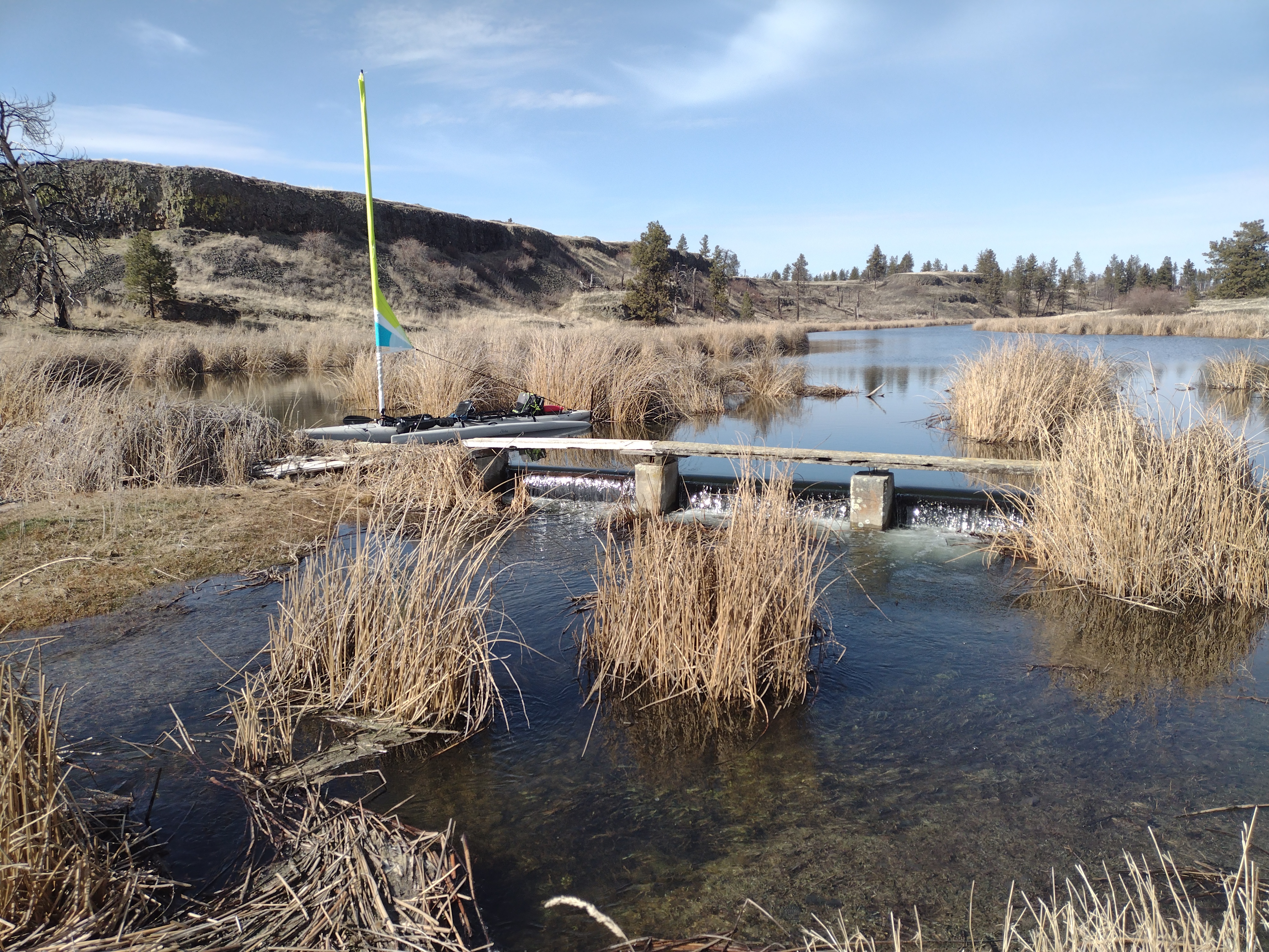
Fourth of July Lake in Adam and Lincoln Counties Washington (access road is in Lincoln County) is a long and narrow desert lake set in a canyon with steep basalt cliffs and steep slopes around it. Its 3 Miles south of Sprague City and Sprague Lake, 3 miles from HWY 90 exit, and 40 miles west from Spokane WA. When one gets on the gravel access road and approaches the lake there is a large level gravel parking lot that can accommodate maybe 40 vehicles. When you pass through the parking area there is a short descending gravel road to the launch. The primitive launch is gravel/rocky/mud/grass. The launch is on the northeast end of the lake. Most of the time there is no water at the launch and even if there was water the depth will be inches to maybe 2 feet right at the launch. The launch itself is 5% to 10% grade, with a slight dip at the end of it of 17%.

There is always water in the lake no matter how hot the summer gets because in part due to its depth up to 45 ft. There is no creeks that enter or exit the lake. The water enters the lake from all directions from spring runoff and rain. Thus one can only use the launch during the wettest times of the year. If there are 2 or more wet years then one could use the launch or when there is a very high snow pack and very wet spring runoff. Being there is non aquatic grass growing in the launch itself, which indicates this launch seldom has water on it.

You might ask how does one get a boat into the lake. If there is water at the launch it requires a light weight shallow draft boat. There is a short gravel road just left of the launch that extends about 100 feet beyond the end of the launch toward the lake, but there is no launch at the end of the road, but one could portage off the end of it, which is 10-17% grade through a very rocky area through cattails. The water depth off this point is also shallow of inches to 2 feet tops, again if there is water present.

So really this lakes is a shore fishing lakes unless you portage kayak or other very light craft via the primitive trails that surround the lake. Would be a great paddleboard lake with the correct gear for super cold water. It would be best to portage via the trails on the south side of the lake as the north side is mostly cliffs or steep descending slopes/hills. I found the south side access points at the waters edge to be 5 to 17% grades, not difficult to access the lake from. Before getting to these access points it does require hiking down some fairly steep rocky slopes.

The depth of the lake does not get significantly deep until about a mile southeast from the launch when it dips to 15 feet, then another half miles it dips to 25 feet, and then ultimately to 45 feet at its deepest (see printable map below).

There are no facilities at the launch or parking area or anywhere around the lake. Camping or overnight parking is not allowed (camping nearby at Downs or Williams Lakes).

This is cattle country so watch your step for those wonderful cow pies. I did see some swans and otters.

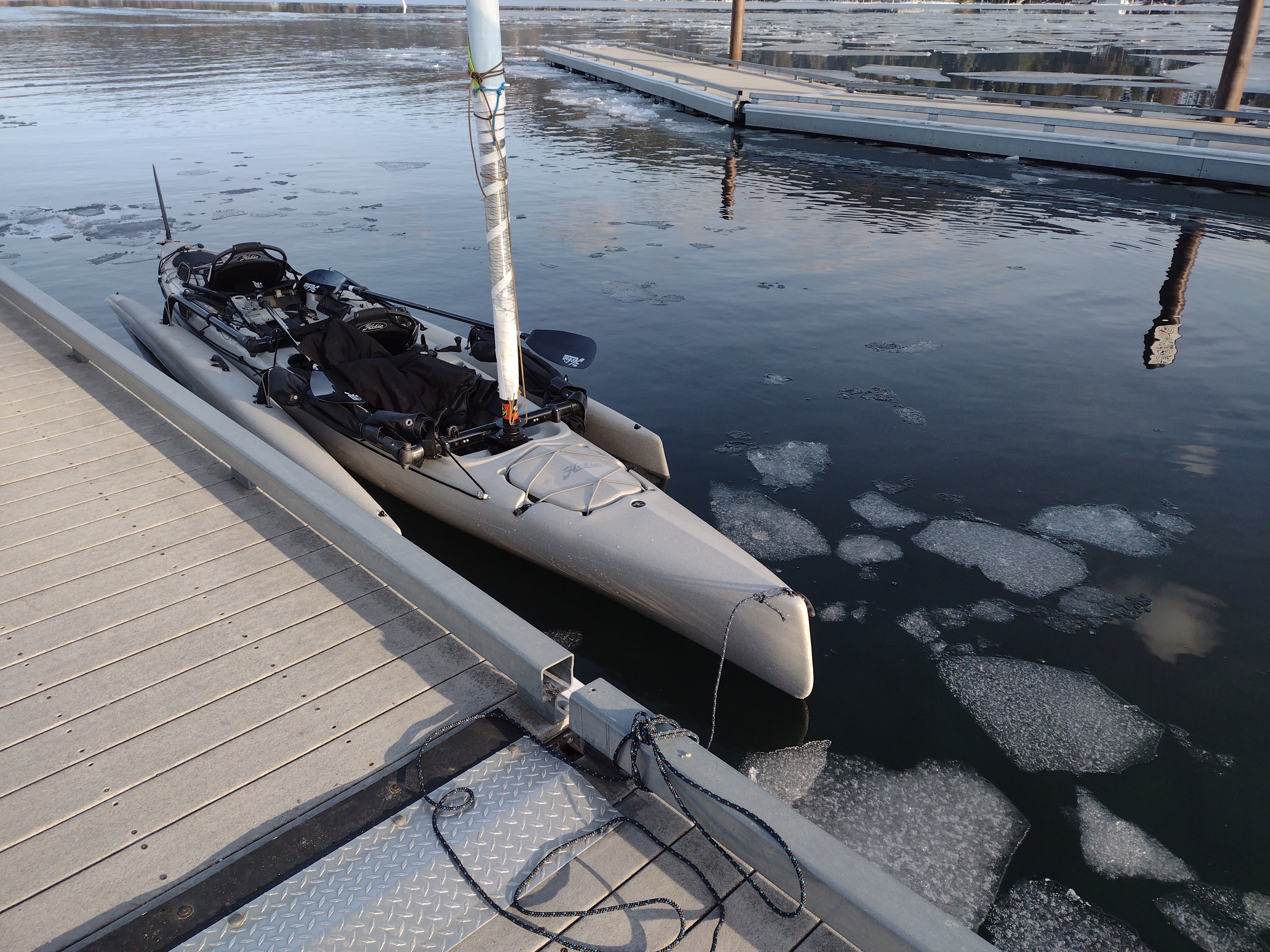
This is a winter lake, meaning the gate that gives access to this lake is open the Friday after Thanksgiving and closes in March (no exact date). Because its open in the winter of course its covered in ice most of the time, thus a great ice fishing lake.

Fishing/Wildlife: Black Crappie, Catfish, Largemouth Bass, Rainbow Trout, Spiny Ray, Yellow Perch. Swans, Geese, Ducks, Otters, Deer. Lake Dimensions & Coordinates: 110 acres; Maximum depth estimated at 45 ft; elevation 1895 ft; Coordinates T20N R38E Sec 1, 11, 12. & T21N R38E Sec 35, 36. Longitude 117d 57m 59s -to- 117d 58m 57s west. Latitude 47d 14m 45s -to- 47d 16m 8s N. Center of lake coordinates is: 47.25243, -117.975721 Directions:  Take exit 245 off of HWY 90 and turn south on HWY 23, go about 2 miles and on your right you will see a gravel road. The gravel road is 0.9 miles long to the launch. The access sign sits a ways off the main road, so this access road is easy to miss. NOTICE: As noted this lake is a winter fishery only so the gate to the lake is locked in warm season. Gate is open Friday after Thanksgiving weekend and closed in late March. Washington Department of Fish and Wildlife (WDFW) manages the fishing on this lake and leases the land from the Department of Natural Resources (DNR).

ACCESSIBILITY: PARKING... Level gravel/rocky and dirt parking area near launch, can accommodate about 30 vehicles; PATHS/TRAILS... No paved paths. There are primitive single track rocky dirt trails around either side of the lake. All trails have deep descents to the lake; RESTROOMS/FACILITIES… None; SENSORY... No sensory tactile markers for those with visual and other impairments. DOCKS/LAUNCHES/PLATFORMS… No dock or platforms, One muddy/rocky primitive launch, 5% grade with short 17% grade right at the end of the launch. Must have significant spring runoff and/or consistent heavy rains for there to be any water at the launch (Gate to lake opens Friday after Thanksgiving and closes the end of March); DIRECT WATER ACCESS… No access for wheeled mobility devices; TRANSFER SYSTEMS... None; CAMPING... Not allowed. Camping nearby at Downs or Williams Lakes; O.T.H.E.R… Oddities/Barriers: Very rocky, sand, and mud; Terrain: Level to very steep. Lots of sand, rocks, mud, and cow dung at different areas around the lake; Environmental Conditions: Cold and windy in the winter and hot during the summer (no summer access allowed); Resources: Food, drinks, and gas at town of Sprague off of I90.
Click on map to enlarge or to print


Make a comment here about your experience at this lake or other questions...

Note... If you hike right off the south end of the lake going south for about a mile you will come upon the very unknown Alkali Lake that is about half the size of Fourth of July Lake and super shallow. No idea if the lake has fish as I doubt it due to its shallow depth and having no water in it, if there is two years of very hot weather, dry winter/drought. There are railroad tracks on the south side of this lake. There is another lake that one could potentially confuse with this lake, which is very popular for fishing in Grant County, south of Banks Lake in eastern WA. 

Saturday, March 25, 2023

Snark Stories

I thought it would be fun to post some old stories of the Sea/Super Snark owners sense the Snark last year went out of production. Some nostalgia. The Sea Snark has been in production sense 1954. The longest production run of any sailboat in history and I might add the most sold of any sailboat in the world. Sadly, the pandemic/plandemic in the state of Michigan was the death of the boat, like with so many other products/businesses. It was particularly bad in blue states like Michigan that had excessive lock downs.

If you want a similar boat in line with the Sea/Super Snark or Sunfish click here to learn about the USA made Rocket. Click Here to learn more.

1960 Sea Snark with Kool cigarette sail logo


First Generation
When I was twelve I scraped together all the money I had made from yard work, doing piecework in my Dad's machine shop, and anything else I could scrounge and bought a sailboat--a Sea Snark, then in it's first incarnation (1960) and I've kept it ever since. My Dad taught me the basics, but soon was sailing solo. The original Snark had an unprotected hull made of expanded polystyrene ("Styrofoam") with a plastic sail and a very flimsy plywood rudder that lasted only two summers.  The plastic sail was soon replaced with a red and white nylon sail bought from the manufacturers. That's me on the far left, peeking around the sail, at age twelve.

Second Generation
I sailed it on Clark Lake in Michigan for most of my growing-up years.  The centerboard was lost and replaced with one made from marine plywood scrounged from the garage.  It didn't see much use during my college days until the summer of my Junior year.  I had my wife-to-be (then girl friend) up to visit.  We had sailed it to the far West end of the lake and practically becalmed when my Dad arrived in his Aztec and buzzed the house to let us know to pick him up in Napoleon.  Kathy was not pleased to meet her future father-in-law looking wind-blown and red-faced.  After we were married a few years Kathy sewed up the blue and yellow sail to replace the now-shredded red and white sail.

Third Generation
When I joined the staff of Campus Crusade in 1974 and moved to Florida, I took the Sea Snark with us.  We sailed it in Tampa bay and Daytona Beach.  Once while sailing peacefully across Tampa Bay a dugong surfaced and exhaled noisily right next to us, scaring us well into the next century.  We move to Indiana in 1976, then California in 1980 where we began to sail on Mission Bay in San Diego and Big Bear Lake in the San Bernardino mountains.  This picture shows me sailing with Josh at about age three.

Fourth Generation
I recently made a new sail from my old hang glider and we tried it out on Mission bay recently.  It was bordered with 1" webbing that was sewn into the boom/spar edges of the sail. Where they cross they were sewn together and a brass grommet inserted.  The stainless steel hinge bolt (between the boom and spar) runs through this grommet and anchors the sail.  The opposite ends of the webbing are anchored to the boom and spar with hose clamps.  Small holes melted every foot along the length of the edges allow nylon cable ties to fix the sail to the boom and spar leaving the aluminum entirely visible.
SEND US YOUR SNARK STORIES AND VIDEOS!

Here are some fun videos of fellow Snark sailors :)

Monday, March 20, 2023

Fishtrap Lake, Spokane and Lincoln Counties, Washington

I just visited this lake and updated this lake info on 3/18/2023. This lake is 35 miles west of Spokane Washington USA just 2 miles off of Interstate 90. If you have questions or comments, please post at the bottom of this page.
- - SEE VIDEO BELOW - -

Fishtrap Lake (196 acres)
This lake was named after the willow fish traps that the Indians used to catch Red Horse Suckers at its outlet creek. The lake is known for its great trout fishing. This popular Lake is great for slow boating and swimming. There is a 3-foot-high cement dam on the south end of the lake the helps keep the water level up during the hot months of the year. As with all the lakes in the Scablands the lake gets a lot of wind throughout the year so it would be a great sailing lake even though because its narrow you will be doing a lot of tacking. Also great for kayaking. Watch out for strong currents at the south end of the lake during early spring runoff when snow is melting or heavy rains. It is long and narrow at 2.2 miles long and 30' deep at its deepest. In the Fishtrap Lake area there are extensive wetlands. There are numerous trails crisscrossing the area, offering several loop hikes and access to Fishtrap Lake and Hog Canyon, wildlife viewing areas. Fishtrap Lake Resort has been on this lake since 1902. It is a private resident only resort, has no camping or day area, their launch is private. Camping is available nearby at Sprague or Williams Lakes. If you are sailing do not get too close to the resort primitive boat launch/docks due to a low hanging cable from a dock to a cliff (clearance from the water is about 8-10 ft depending on water level). There is one public launch right next to this resort that has no obstacles. One could launch a deep draft boat or sportboat/keelboat from this launch. This launch is on an incline so sailors should step their mast on as level ground as possible. There is a sign posted by the resort at the launch on this lake indicating the lake is for canoe and kayaks, however there is no official policy on this, more wishful thinking on the part of the resort people. Due to the narrow width of this lake, water skiing or high-speed boating would be hazardous to the user and others on the lake. There is a horrible public toilet at this public launch, not maintained at all, kind of falling apart. The resort restrooms are private. I would highly recommend bringing your own portable toilet. Seriously good restroom facilities are very limited in this area. If your like Buffalo, they are present on surrounding land. Call the resort about private residence opportunities 509-235-228.

I personally took my Hobie Mirage Tandem Island (TI) out on this lake on March 18, 2023. Winds were very light, so I pedaled my TI pretty much the full length of the lake to and from the launch, which took me 3.5 hours. I did get a few good short runs sailing, but the wind never lasted long. I boated right up to the cement low head dam on the south end of the lake. Was surprised the current was not stronger by the dam this time of year. Below the dam the water is always to shallow to paddle in Fishtrap Creek. Plus, the creek runs through private land and barbwire fences at times runs across the creek. By mid-summer it's likely the water will be too shallow to paddle up to the dam. The lake itself is deep throughout its length other than near the south end marsh area.
Dam on south end of lake

Directions: From Spokane go west or from Moses Lake go east on I-90 to Exit 254. Turn south after getting off the I90 exit onto Old State Highway/Sprague HWY Rd E and travel 2 miles. Turn left/east onto Fishtrap Rd. You will descend a hill and will see the lake and resort. Watch for the public launch sign, on your right/south. It can be easy to miss.
Maps: See printable below. To view a map click on google.com/maps and type in Fishtrap Lake, WA. Info: Visit Fishtrap Lake Resort website https://ftlresort.com or call them at 509-235-2284.

1. Public Boat Launch
ACCESSIBILITY: PARKING... Gravel dirt combo parking lot at 3-7% grade; PATHS/TRAILS... None. Large open gravel area on either side of cement launch. Beware of deep mud on either side of the cement launch pad as you go down toward/into the water; RESTROOMS/FACILITIES… 2 non accessible vault toilets, very old and not maintained. Highly recommend bringing your own portable toilet as there are very few restrooms in this area; SENSORY... No sensory tactile markers for those with visual and other impairments. DOCKS/LAUNCHES/PLATFORMS…One single lane cement grated launch; DIRECT WATER ACCESS… No access for wheeled mobility devices, small gravel and mud access on either side of the cement launch; TRANSFER SYSTEMS... None; CAMPING... None; O.T.H.E.R… Oddities/Barriers: Deep mud during wet times of the year along shoreline; Terrain: Level to about 3-7% grades; H2O/Water: Water normally murky. Water temperature in the summer can be around 60 to 70 degree. Very hot in the summer. High currents on south end of lake during early spring runoff or very heavy rains; Environmental Conditions: High winds and hot summer temperatures; Resources: Food, drinks, and gas in town of Sprague.

2. Fishtrap Resort Launch and Marina
This is an old and rustic private resort... Private residence opportunities 509-235-2284 https://ftlresort.com . We have supplied an accessible assessment of their launch for those interested in having a residence at this rresort.
ACCESSIBILITY: PARKING... Gravel dirt combo parking lot; PATHS/TRAILS... None. Launch pavement serves as path to docks and launch; RESTROOMS/FACILITIES… One restroom in resort building. Not ADA accessible. There are private picnic areas on the grass, drinking water; SENSORY... No sensory tactile markers for those with visual and other impairments. DOCKS/LAUNCHES/PLATFORMS… Five docks none of which are wheeled mobility devices accessible. One gravel single lane launch. Attention there is a low hanging non-electrical cable hanging a few feet on in the lake away from the launch, which will inhibit the launch of sailboats at this launch; DIRECT WATER ACCESS… No access for wheeled mobility devices; TRANSFER SYSTEMS... None; No; O.T.H.E.R… Oddities/Barriers: Deep mud during wet times of the year along shoreline, muddy murky water. Water temperature in the summer can be around 60 to horeline; Terrain: Level to about 5% grades; H2O/Water: Water no70 degree; Environmental Conditions: High winds and hot summer temperatures. Strong currents on south end of lake during spring runoff and heavy rains; Resources: Food, drinks, and gas in town of Sprague.


Click on map to enlarge or to copy to print.

 
- - Click on Pics to Enlarge - -


Comment blow