
RIVER GORGE - From Monroe Street Dam to Nine Mile Falls Dam

INTERACTIVE GOOGLE MAP COMING SOON!...
Nine Mile Reservoir is created by the Nine Mile Dam, constructed in 1925. The Reservoir is a popular area for touring kayaks and canoes due the lack of rapids and typically slower moving water. One could potentially sail safely on the reservoir by mid summer to early fall when there is little or no water going over the falls (little or no current). Of course this area is also popular for fishing. Between the dam and N. Seven Mile Rd. bridge is where the river turns into a reservoir with lake conditions, but the water moves swiftly during most of the year. There are some private docks and rocky areas on the reservoir to watch out for, but other than these obstructions, it's a nice area to boat and fish from.
Information: Visit the Riverside State Park website for info about kayaking, rentals, and camping, etc. http://www.riversidestatepark.org and river flow information at avista utilities http://bit.ly/2lTNpym
RIVER PUT-IN AND TAKE-OUT POINTS

You can access the river from directly under Monroe Street Bridge.
This park runs along the Spokane river but is not well known. Due to the low visibility of this park its known for sometimes attracting homeless people, etc. On W. Water Ave. you will see an old playground under the Monroe Street Bridge. There is a paved path to the river past the old playground. It's best to access the river downstream of the river pylons. There are picnic tables, but no restroom. Restrictions: Watercraft with motors are not allowed on this section of the river from Park Road (Park Road is about a mile up river from Upriver Dam and slightly up river from Boulder Beach) to Plese Flats Park. Wearing a Life Jacket is required. Directions: In the city of Spokane take Exit 280 A or B (Lincoln St. Exit) depending on the directions you are driving. Turn slightly right onto S. Lincoln St. Turn left on to W. Main Ave. Turn slightly right to stay on W. Main Ave. Turn right onto N. Cedar St. Turn left on to W. Water Ave. River access site/park is under the Monroe Street Bridge. Maps: To view a map click on google.com/maps and type Spokane, WA, US. On I90 locate Exit 280 and follow above directions to view the river access sites or use the address of [1400-1699] W. Water Ave. Spokane WA. 99201.

Also known as Water Street & Ash Launch
This launch site stays level all the way to the rivers edge. However it can become busy during the summer so for a calmer, less occupied launch, the Pleasant Valley river walk Park is an alternative. There is no restroom or any other service at the Water Street Launch. Water Street Launch also has a gate to block trailer launching. Next to the gate there is a short trail to the river that is used for non-trailer launching. Parking is limited so it is best to come early if your are looking to park next to the trail. Restrictions: Watercraft with motors are not allowed on this section of the river from Park Road (Park Road is about a mile up river from Upriver Dam and slightly up river from Boulder Beach) to Plese Flats Park. Wearing a Life Jacket is required. Directions: In the city of Spokane take Exit 280 A or B (Lincoln St. Exit) depending on the directions you are driving. Turn slightly right onto S. Lincoln St. Turn left on to W. Main Ave. Turn slightly right to stay on W. Main Ave. Turn right onto N. Cedar St. Turn left on to W. Water Ave. River access site/park is at the very end of W. Water Ave. Maps: To view a map click on the following link google.com/maps and type Spokane, WA. On I90 locate Exit 280 and follow above directions to view the river access sites or use the address of [1400-1699] W. Water Ave. Spokane WA. 99201.


This site is part of the Spokane Centennial Trail system and happens to be a popular fishing spot as well. From the parking lot the path west of the trail bridge can be used to portage a craft from the parking lot to the water. This area is located next to Highbridge Park & Hangman Creek.

ACCESSIBILITY: PARKING... Small gravel parking lot next to paved bike/pedestrian Centennial Trail; PATHS/TRAILS... The paved path that is the Centennial Trail travels across the bridge. Near the bridge and at other nearby locations there are steep gravel/rocky trails to the water. 7% grade or better. At water's edge is rocks, sand, and large boulders to portage over to get to the water; RESTROOMS/FACILITIES… None; SENSORY... No sensory tactile markers for those with visual and other impairments. DOCKS/LAUNCHES/PLATFORMS… None; DIRECT WATER ACCESS… No access for wheeled mobility devices; TRANSFER SYSTEMS... None; CAMPING... None; O.T.H.E.R… Oddities/Barriers: Steep banks and primitive trails; Terrain: Level to about 7% plus grades; H2O/Water: Water in the river is normally pretty clear. Water temperature in the summer can be around 60 degrees. Extreme current and whitewater/rapids. Beware of sudden increases in river levels via Dam spillways; Environmental Conditions: Due to the gorge effect of creating shade, this section of the river can be cold unless there is direct sunlight. River conditions; Resources: Food, drinks, and gas within Spokane.

(Also known as Latah Creek in the Spokane area)
Access Hangman Creek (also known as Latah Creek in the Spokane area) runs along Highbridge Park and into the Spokane River. In the early summertime this is a nice river to paddle from, but later as the summer progresses the water lowers and is too shallow to paddle. Regardless of where you access the creek from, to get to the creek from this park you will have to negotiate a steep banks. To remove your craft from the water, at the end of the creek there is a gravel trail that leads to the Sandifur Bridge parking lot. Some people choose to float this creek in place of the Spokane River because the water is easier to float as opposed to the sometimes rough water areas on the Spokane river. Directions: In the city of Spokane, WA. US take the following Exit. From I-90 Eastbound – Take Exit 280 (Maple St) and turn left onto Walnut; From I-90 Westbound – Take Exit 280 (Maple St) and turn right onto Walnut ; Proceed north to W. 2nd Ave. Turn left onto W. 2nd Ave., get in the far right lane and stay in it to the cross street of S. Oak St. (2nd Ave. starts to veer left at the Rosauers store and turns into Sunset Blvd….don’t veer left, go straight thru neighborhood area) Take right on S. Oak St. to W. Riverside Ave. Turn left on W. Riverside Ave., downhill and after bridge, then turn left on dirt road into Highbridge Park (you see the park sign). Maps: To view a map click on the following link google.com/maps and type Spokane, WA, US. On I90 locate Exit 280 and follow above directions to view the park.

Some people will choose to take their crafts and depart or arrive at this location but this is not a popular site due to all of the many low hanging branches. Some fishermen however, claim that fish will hideout near the trees along this site. There is a preferred access point just a short distance further down the river located right after the TJ Menach Bridge (see in the next section). There is a parking lot at this site because it is near the Centennial Trail System but no bathrooms. Restrictions: Watercraft with motors are not allowed on this section of the river from Park Road (Park Road is about a mile up river from Upriver Dam and slightly up river from Boulder Beach) to Plese Flats Park. Wearing a Life Jacket is required. Directions: In the city of Spokane, WA. (from I-90 Eastbound) take Exit 280 (Maple St) and turn left onto Walnut; From I-90 Westbound, take Exit 280 (Maple St) and turn right onto S. Walnut St. Turn slightly left onto Maple Street Bridge. Stay straight to go onto N. Maple St. Turn Left onto W. Northwest Blvd. Turn sharp Left onto N. TJ Meenach Dr. Before the bridge at the bottom of the hill at the Spokane River turn right onto the off ramp. Turn left onto W Downriver Dr./N. Pettet Dr. and pass under the bridge. Immediately to your right you will see a parking lot to your destination. Maps: To view a map click on the following link google.com/maps and type Spokane, WA, US. On I90 locate Exit 280 and follow above directions to view the parking area/river access. Or you can type in 3410 W Fort George Wright, Spokane, WA 99224-5204. This address is across the bridge/river from this river access site/park.

This is one of the preferred locations used along the Spokane River for put-in and take-out. White water kayakers that desire to access water at the Bowl & Pitcher will launch at TJ Menach Bridge, Pettet Drive, or at The Wall. Down river there is class IV whitewater. Because of this no one should use this launch without being an expert level whitewater kayaker/rafter. At this site there is paved parking, restrooms, a picnic area, and a wide kayak/raft launch area. The Centennial Trail system also runs past this site. Restrictions: Watercraft with motors are not allowed on this section of the river from Park Road (Park Road is about a mile up river from Upriver Dam and slightly up river from Boulder Beach) to Plese Flats Park. Wearing a Life Jacket is required. Directions: In the city of Spokane, WA., from I-90 Eastbound, take Exit 280 (Maple St) and turn left onto Walnut; From I-90 Westbound, take Exit 280 (Maple St) and turn right onto S. Walnut St. Turn slightly left onto Maple Street Bridge. Stay straight to go onto N. Maple St. Turn Left onto W. Northwest Blvd. Turn sharp Left onto N. TJ Meenach Dr. Before the bridge at the bottom of the hill at the Spokane River turn right onto the off ramp. Turn right onto W Downriver Dr./N. Pettet Dr. Just up the road on the left you will see a park next to the river; this is the place. Maps: To view a map click on the following link google.com/maps and type Spokane, WA. On I90 locate Exit 280 and follow above directions to view the parking area/river access. Or 3410 W Fort George Wright, Spokane, WA 99224-5204. This address is across the bridge/river from this river access site/park.

The Wall Access and Downriver Disc Golf Course Park
"The Wall" is the name the local kayakers give this particular river access point related to the 2 foot tall man-made brick wall (more like a brick fence) and 10 foot tall brick tower wall structure at this access site. On one end of the fence is a sign that says "Aubrey L. White Parkway." Across the street from this sign is a sign that says "Riverside State Park Recreation Area." Past these signs and on the right there are several places to park. From the parking area walk down the hill to the river's edge. If the bank is steep just walk down river a ways and you will find a gradual grade area to access the river from. If you are float tubing from up river this is the place to take out before hitting the whitewater area of the river. The gradual area the kayaks launch from may not be a good place for those that are float tubing to take out from because the water moves swiftly; so taking tubes out at the steep bank may be better before hitting swift water. Officially this site is called the Downriver Disc Golf Course Park. Restrictions: Watercraft with motors are not allowed on this section of the river from Park Road (Park Road is about a mile up river from Upriver Dam and slightly up river from Boulder Beach) to Plese Flats Park. Wearing a Life Jacket is required. Directions: In the city of Spokane, WA. and from I-90 Eastbound, take Exit 280 (Maple St) and turn left onto Walnut; From I-90 Westbound take Exit 280 (Maple St) and turn right onto S. Walnut St.; Turn slightly left onto Maple Street Bridge. Stay straight to go onto N. Maple St. Turn left onto W. Northwest Blvd. Turn sharp left onto N. TJ Meenach Dr. Before the bridge at the bottom of the hill at the Spokane River turn right onto the off ramp. Turn right onto W Downriver Dr. On this road you will come to where the road splits. Stay to the left onto N. Aubrey L. White Parkway. When on this road pass the park sign, brick fence, and wall tower. Drive a short distance and park along the road. This is the place. Maps: To view a map click on the following link google.com/maps and type Spokane, WA, US. On I90 locate Exit 280 and follow the above directions to view the parking area/river access. Or type in 3410 W Fort George Wright, Spokane, WA 99224-5204. This address is across the bridge/river from TJ Meenach Park.
This is a site you can either put in, or take-out at. The shoreline is covered in rocks and boulders but is still a good location to boat and fish from. There is a small parking lot next to the northwest gate of the wastewater treatment plant. You will have to portage a few hundred feet down a trail in a wooded area to the the river's edge. It's a beautiful place. There are no restrooms or running water. Restrictions: Watercraft with motors are not allowed on this section of the river from Park Road (Park Road is about a mile up river from Upriver Dam and slightly up river from Boulder Beach) to Plese Flats Park. Wearing a Life Jacket is required. Directions: In the city of Spokane, WA. US, from I-90 Eastbound, take Exit 280 (Maple St) and turn left onto Walnut. From I-90 Westbound, take Exit 280 (Maple St) and turn right onto S. Walnut St. Turn slightly left onto Maple Street Bridge. Stay straight to go onto N. Maple St. Turn Left onto W. Northwest Blvd. Turn sharp Left onto N. TJ Meenach Dr. Before the bridge at the bottom of the hill at the Spokane River turn right onto the off ramp. Turn right onto W Downriver Dr. Travel down this road a few miles and you come to the Spokane Wastewater Treatment Plant. Just after you pass the plant you will see a gravel road on the left. Drive down this short gravel road to the small parking area where you will find a short trail to the river. Maps: To view a map click on the following link google.com/maps and type Spokane, WA, US. On I90 locate Exit 280 and follow above directions to view the parking area/river access. Or 3410 W Fort George Wright, Spokane, WA 99224-5204. This address is across the bridge/river from TJ Meenach Park.
Bowl and Pitcher
The river area at Bowl and Pitcher is a popular white water area (Class V) and is in the hart of the Spokane River Gorge. Only expert white water sportsmen should venture into this area of the river particularly during spring run off. There is no formal launch at this site however one can park at the lower parking near this area and carry their kayak down the trail near the pedestrian bridge. There are restrooms and running water. Restrictions: Watercraft with motors are not allowed on this section of the river from Park Road (Park Road is about a mile up river from Upriver Dam and slightly up river from Boulder Beach) to Plese Flats Park. Wearing a Life Jacket is required. Directions: In the city of Spokane, WA. US, from I-90 Eastbound, take Exit 280 (Maple St) and turn left onto Walnut. From I-90 Westbound, take Exit 280 (Maple St) and turn right onto S. Walnut St. Turn slightly left onto Maple Street Bridge. Stay straight to go onto N. Maple St. Turn Left onto W. Northwest Blvd. Turn sharp Left onto N. TJ Meenach Dr. Before the bridge at the bottom of the hill at the Spokane River turn right onto the off ramp. Turn right onto W Downriver Dr. Travel down this road a few miles and you will pass the Spokane Wastewater Treatment Plant, continue on until you see the Bowl and Pitcher Sign, turn right into the park. Follow the paved road down the hill to the fee station (may or may not be open) and pass it, follow the road to the right a short distance to the parking area. In the parking area you will find a large path to the pedestrian bridge and to the right of this bridge is a rocky area you can launch from. Maps: To view a map click on the following link google.com/maps and type Spokane, WA, US. On I90 locate Exit 280 and follow above directions to view the parking area/river access. Or type in Spokane River, Bowl and Pitcher.

Just before Plese Flats Park and after the side road of W. Rifle Club Rd. there is an informal take-out used by some of the local kayakers to allow them to get off the river a little sooner after the whitewater or keep them from having to use the more busy Plese Flats Park. Parking is limited at this site so if you have to park along the road watch out for cyclists and motor vehicles. Attention must be paid to signs that limit or prohibit parking within Riverside State Park. Restrictions: Watercraft with motors are not allowed on the section of the river from Plante's Ferry Park to Plese Flats Park. Wearing a Life Jacket is required. Directions: In the city of Spokane, WA. US, from I-90 Eastbound, take Exit 280 (Maple St) and turn left onto Walnut; From I-90 Westbound, take Exit 280 (Maple St) and turn right onto S. Walnut St. Turn slightly left onto Maple Street Bridge. Stay straight to go onto N. Maple St. Turn left onto W. Northwest Blvd. Turn sharp left onto N. TJ Meenach Dr. Before the bridge at the bottom of the hill at the Spokane River turn right onto the off ramp. Turn right onto W Downriver Dr. On this road you will pass the Waste Water Treatment Plant, Park Headcounters/Visitor Center, and W. Rifle Club Rd (if you get to Plese Flats Park you have gone too far). You will see a short loop paved road which quickly exits then re-enters the road. This is the place. Maps: To view a map click on the following link google.com/maps and type in Spokane, WA, US. On I90 locate Exit 280 and follow above directions to view the parking area/river access. Or type in 3410 W Fort George Wright, Spokane, WA 99224-5204. This address is across the bridge/river from TJ Meenach Park.

This is the main take-out site after navigating the Bowl & Pitcher whitewater area, and a put in site for touring kayaks headed towards Nine Mile Dam. There are restrooms, grassy picnic areas, paved parking, and a large easily accessed launch for non-motorized craft. Short posts block trailer launching. This is by far the nicest water access park along this section of the river. The Centennial Trail runs past the park. Restrictions: Watercraft with motors are not allowed on this section of the river from Park Road (Park Road is about a mile up river from Upriver Dam and slightly up river from Boulder Beach) to Plese Flats Park. Wearing a Life Jacket is required. Directions: In the city of Spokane, WA., from I-90 Eastbound, take Exit 280 (Maple St) and turn left onto Walnut. From I-90 Westbound, take Exit 280 (Maple St) and turn right onto S. Walnut St. Turn slightly left onto Maple Street Bridge. Stay straight to go onto N. Maple St. Turn left onto W. Northwest Blvd. Turn sharp left onto N. TJ Meenach Dr. Before the bridge at the bottom of the hill at the Spokane River turn right onto the off ramp. Turn right onto W Downriver Dr. Travel down this road past the Wastewater Treatment Plant and after a few more miles you will come to Plese Flats Park. Maps: To view a map click on the following link google.com/maps and type in Spokane, WA. On I90 locate Exit 280 and follow the above directions to view the parking area/river access. Or type in 3410 W Fort George Wright, Spokane, WA 99224-5204.

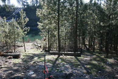
11. Nine Mile Dam Reservoir Informal Take-OutThis launch site is a bit of a mystery to most people in the area even though at Plese Flats Park there is a sign indicating this is a kayak take out site. Avista has plans to develop this site with a parking lot and access trail for non-motorized craft. Currently one can launch a kayak or small sailboat from this site. There is limited parking along the road and a Centennial Trail parking lot just a mile up the road from this site with restrooms. Please park at the Centennial parking lot so as not to irritate the officials at the dam. It is about a mile walk from the parking lot to the reservoir access site. There are restrooms at the Centennial Trail parking lot. Caution must be applied when launching and retrieving from this site due to it's close proximity to the Dam. Restrictions: DO NOT LAUNCH OR RETRIEVE from this site during spring runoff or when there are fast/strong currents. One must where a Lifejacket at all times. Directions: In the city of Spokane, WA., from I-90 Eastbound, take Exit 280 (Maple St) and turn left onto Walnut. From I-90 Westbound, take Exit 280 (Maple St) and turn right onto S. Walnut St. Turn slightly left onto Maple Street Bridge. Stay straight to go onto N. Maple St. Turn left onto W. Northwest Blvd. Turn right onto N. Cochran St. This street (N. Cochran St). becomes N. Driscoll Blvd. Turn slightly left onto N. Nine Mile Rd. Turn left onto W. Charles Rd. Turn left onto W. Carlson Rd. On your left you will see a short dirt road next to the reservoir just before the road starts up a hill. Up this road up the hill are the Centennial Trail parking lot and restrooms. Maps: To view a map click on the following link http://www.mapquest.com and type Spokane, WA. On I90 locate Exit 280 and follow above directions to view the parking area/river access. Or type in 9711 W. Charles Road, Nine Mile Falls, WA 99026.
No comments:
Post a Comment