Tuesday, October 25, 2016

Lake Pend Oreille, Bonner & Kootenai Counties, Idaho

LAKE PEND OREILLE (85,960 acres)

See Farragut State Park campsite evaluation at the bottom of this page.

Want the feel of the Ocean on an Inland Lake then Lake Pend Oreille is your ticket. This lake is great for almost any size boat, but at times has ocean like swells and can possibly have very rough seas like conditions (largest lake in Idaho). So keep your attention to the weather reports, particularly when on the east side of the lake where its challenging to hide from bad weather due to the lack of places to hid from bad weather.

Some say Lake Pend Oreille is the largest lake in the lower 48 states due to volume + shoreline + length + depth...

Lake Pend Oreille is the 4th deepest navigable lake in the United States of America (including the Great Lakes). It has 111 miles of shoreline, is 43 miles long, fed by the Clark Fork River and other smaller rivers and streams, and its outlet is the Pend Oreille River that empties into the Columbia River. It is 11,158 feet deep or at least 1200 or deeper. US Navy does not supply official depth readings where they operate. The lake is so ideal in shape and depth that the US Navy test submarines out of Bayview (south end of lake).

In the lower 48 States, excluding the Great Lakes, Lake Pend Oreille is the 2nd largest lake in volume, including Reservoirs. Lake Tahoe is the largest in volume but smaller in overall shoreline and length. Rating lakes by surface area is a poor measure as there are many lakes and reservoirs that are just a few inches to under a foot or two in depth that are not navigable by boat, so volume is a better measure. So, when adding volume + shoreline + length + depth Lake Pend Oreille is the largest lake in the 48 states States. Iliamna Lake in Alaska is the largest lake overall in the 50 states (USA).

The scenery is spectacular with islands and mountains to the north and sheer cliffs to south (home to a mountain goat population). The city of Bayview known for its floating houses (north end of the lake) is by far the official sailboat town on this lake and has one congested public boat launch (watch for power lines when stepping your mast). Honestly its not a good location to launch from during the busy summer months due to the heavy boat traffic and lack of vehicle with trailer parking; and when leaving you have to travel out of a narrow channel that can also be congested.

Next to Bayview Idaho is Farragut State Park the largest park in Idaho and neighbor to Bayview, (the official site of Inland WWII era training facility). Launching from Eagle Boat Launch is best as compared to launch from the Bayview launch, providing far more room for parking vehicles with boat trailers; though it can be at times congested in summer months. The best thing about this boat launch is that it is right on the open water with lots of dock space. For kayaks and dinghies there is a nice pebble beach to launch from and park at. There is a pump-out station and a reasonable fee to enter the park and use the boat launch ramp. During the summer there is also an evasive species wash station; do not expect to enter or leave this site without your boat and trailer being inspected. Beaver Bay rec. area at Farragut State Park (see picture below) has a swim area and is a nice place for kayakers to rest and use the restroom. Button Hook Bay at Farragut State Park (see picture below) has docks but no restrooms near by; you will have to hike about 1.5 miles to Beaver Bay to use a restroom. Button Hook Bay is a popular boating destination due to its beauty and a way to get out of the weather.

The city of Sandpoint is on the Northwest end of the lake and is a popular powerboat area with shallower and warmer waters. The city has two large launch areas, parks, and ample parking. The city also maintains a marina with some public space available for visitors. Fishing: Fish species info coming soon. See sign when fishing at this lake. For more fishing info call 208-769-1414.

LAKE LINKS

SAILING/WIND CONDITION INFO - Lake Pend Oreille has distinct wind patterns depending upon where you are that are useful for those sailing or water skiing/wakeboarding on the lake. On the South end of the lake (Bayview & Farragut State Park area) the prevailing winds come typically from the Southwest. Usually the prevailing winds during the summer months come from the east. There are very high mountains around the south end of the lake that can at times can create thermal winds. With these high mountains it leaves very few spots to avoid the large waves that the wind and storms can create. On the North end of the lake by Sandpoint there are typically three different wind patterns: In the summer breezes come steady from an Eastern direction. But again when weather fronts come to this area they usually bring a Southwest wind. And sometimes during the night a wind will come from the north, from Canada, but usually die by noon.
View pictures and info about boat launches, access points, etc. below!

Lake Pend Oreille Boat Launches, Access Points, Mooring, Camping

1. Dog Beach - Sandy beach, dog dock, benches, walking/ biking/rollerblading paved trail. Directions: To access the beach take the Sandpoint Exit (not Kootenai, Clark Fork, Sandpoint, HWY 200 exit) on the south side of the town. As you come off the exit you will see a Serenity Lee Trail parking lot next to the Conoco Gas Station that gives access to the beach. Its about a mile walk or bike to the beach... heading east and then north on the trailer. The beach is on the north end of Long Bridge on HWY 95 in Sandpoint. Maps: See interactive google map above or visit google.com/maps type in Pend Oreille Lake, Bonner County, ID. or specifically GPS coordinates 48.265669, -116.537742. Parking GPS coordinates 48.271071, -116.544996
ACCESSIBILITY: PARKING... Paved parking lot; PATHS/TRAILS... Paved paths/trail to beach gravel area that then leads to the beach; RESTROOMS/FACILITIES/SHADE… Fully accessible restroom at the parking lot. Shade via trees; DOCKS/LAUNCHES/PLATFORMS… No docks/platforms. No developed launch. Launch from sandy beach; DIRECT WATER ACCESS… No developed access for wheeled mobility devices; TRANSFER SYSTEMS... None; SENSORY... No sensory tactile markers for those with visual and other impairments; CAMPING... No; O.T.H.E.R… Oddities/Barriers: Sand; Terrain: Mostly level and sandy; H2O/Water: Water normally clear. Water temperature in the summer can be around 60 to 70 degree. No drinking water available; Environmental Conditions: Varies; Resources: Food, drinks, and gas in town of Sandpoint, ID.


2. Sandpoint Boat Launch - Double launch, restrooms, park, sandy beaches, plenty of parking, running water,. Directions: From downtown Sandpoint Idaho, on First Ave.(HWY 95). Turn right/east onto Bridge St. Follow signs to boat launch/park. Maps: View interactive google map above or visit google.com/maps type in Lake Pend Oreille, Bonner County, ID. or GPS coordinates 48.272043, -116.541544
ACCESSIBILITY: PARKING... Large paved parking lot; PATHS/TRAILS... Paved paths/trails throughout park, large paved area at launch area; RESTROOMS/FACILITIES/SHADE… Fully accessible restrooms. Shade via trees; DOCKS/LAUNCHES/PLATFORMS… Two accessible launch docks. One single lane and one double lane paved cement launches at about 5% grade; DIRECT WATER ACCESS… No developed access for wheeled mobility devices. There is a very long very sandy beach; TRANSFER SYSTEMS... None; SENSORY... No sensory tactile markers for those with visual and other impairments; CAMPING... No; O.T.H.E.R… Oddities/Barriers: Sand all along the shoreline; Terrain: Level to 5% grade at launches; H2O/Water: Water clear until mid to late summer. Water temperature in the summer can be around 60 to 70 degree. No drinking water available; Environmental Conditions: Varies; Resources: Food, drinks, and gas in town of Sandpoint, ID.


3. Sandpoint City Marina - Both seasonal slips and visitor slips. Directions: In downtown Sandpoint Idaho from First Ave (HWY 95). Turn right/east onto Bridge St.. After crossing the bridge and going under the railroad bridge, turn left/west onto Train Station Road. Pass the motel and follow the gravel road to the marina. Maps: See interactive google map above or visit google.com/maps type in Pend Oreille Lake, Bonner County, ID. or GPS coordinates 48.275834, -116.541783
ACCESSIBILITY: PARKING... Paved parking lot; PATHS/TRAILS... Paved accessible paths/trails along marina and to docks; RESTROOMS/FACILITIES/SHADE… Fully accessible restrooms with in park area. Shade via trees; DOCKS/LAUNCHES/PLATFORMS… Marina docks. Developed launch in park area; DIRECT WATER ACCESS… No developed access for wheeled mobility devices directly into the water; TRANSFER SYSTEMS... None; SENSORY... No sensory tactile markers for those with visual and other impairments; CAMPING... No; O.T.H.E.R… Oddities/Barriers: Nothing unusual; Terrain: Level to 7% grades on gangways; H2O/Water: Water normally clear. Water temperature in the summer can be around 60 to 70 degree. Drinking water available; Environmental Conditions: Varies; Resources: Food, drinks, and gas in town of Sandpoint, ID.


4. Third Avenue Pier - Dock, small sandy beach, picnic table, benches. Limited parking along the street, best to park in downtown Sandpoint and walk to the pier. Where this pier is, is where the old long bridge was. Directions: In Sandpoint on Pine Street, turn south on Third Street/S. 3rd Ave. and travel until you get to the lake. Parking is limited along residential streets. One could also parking in downtown Sandpoint and walk to the pier as it would be a beautiful walk. Maps: See interactive google map below or visit google.com/maps type in Lake Pend Oreille, Bonner County, ID. or GPS coordinates 48.267362, -116.550355
ACCESSIBILITY: PARKING... Paved parking lot, limited parking; PATHS/TRAILS... Paved area up to the dock; RESTROOMS/FACILITIES/SHADE… None. No shade; DOCKS/LAUNCHES/PLATFORMS… One fully accessible dock with wide platform at end of dock. No developed launch. Launch from small sandy beach; DIRECT WATER ACCESS… No developed access for wheeled mobility devices; TRANSFER SYSTEMS... None; SENSORY... No sensory tactile markers for those with visual and other impairments; CAMPING... No; O.T.H.E.R… Oddities/Barriers: Sand; Terrain: level; H2O/Water: Water normally clear. Water temperature in the summer can be around 60 to 70 degree. No drinking water available; Environmental Conditions: Varies; Resources: Food, drinks, and gas in town of Sandpoint, ID.


5. Lakeview Park & Memorial Field - Paved boat launch, two docks, restrooms, covered picnic tables, group shelter, paved & gravel paths, basketball & tennis courts, playground, arboretum, museum, and gift shop, running water. No beach. Directions: Traveling west and then southwest on HWY 2 out of Sandpoint turn left (south) onto S. Boyer Ave. until it T's into Lakeshore Drive. Turn right onto Lakeview Blvd/Ontario St. Then almost immediately turn left into Lakeview Park. This park is approximately 3.5 miles from downtown Sandpoint Idaho. Maps: View interactive google map above and visit google.com/maps type in Lake Pend Oreille, Bonner County, ID. or GPS coordinates 48.264340, -116.557925
ACCESSIBILITY: PARKING... Large parking lot; PATHS/TRAILS... Paved paths/trail along short shoreline, and wide paved area to and at launch; RESTROOMS/FACILITIES/SHADE… Fully accessible restrooms. Shade via trees; DOCKS/LAUNCHES/PLATFORMS… Has docks and then sometimes the docks are not there, none of which is accessible to wheelchairs. Paved double lane cement launch at about 7% grade; DIRECT WATER ACCESS… No developed access for wheeled mobility devices. Absolutely no access to water other than via launch; TRANSFER SYSTEMS... None; SENSORY... No sensory tactile markers for those with visual and other impairments; CAMPING... No; O.T.H.E.R… Oddities/Barriers: Steep bank, no access other than at launch; Terrain: Level to 7% grade at launch. Steep banks to steep for access; H2O/Water: Water clear until late summer. Water temperature in the summer can be around 60 to 70 degree. Drinking water available; Environmental Conditions: Varies; Resources: Food, drinks, and gas in town of Sandpoint, ID.


6. Oden Bay Wildlife Park - Beaches, 4 car gravel/mud parking lot (no room for vehicles with boat trailers), hiking trails, campsites with fire rings, wooded area, marches, no restroom or running water. If are camping and have a vehicle with a boat trailer you will need to drive to the boat launches to park (#6 & 7) Great place to camp and then visit Fisherman's Island. Once could pull ones boat up to the beach or anchor in Oden Bay. Directions: From Sandpoint Idaho on HWY 95 take HWY 200 going east; turn right onto Sunnyside Road (there is a sign at this turnoff that says "Oden Bay."). Follow this road to the boat launch. Maps: See interactive google map above or visit google.com/maps type in Pend Oreille Lake/River, Bonner County, ID. or GPS coordinates 48.304528, -116.427217 . Parking lot GPS coordinates 48.305273, -116.425457
ACCESSIBILITY: PARKING... Gravel, dirt/mud parking lot; PATHS/TRAILS... No developed paths/trails. Primitive single track trail to beach area; RESTROOMS/FACILITIES/SHADE… None. Shade via trees; DOCKS/LAUNCHES/PLATFORMS… No docks/platforms. No developed launch. Launch from bank or shallow sand/dirt/mud beach; DIRECT WATER ACCESS… No developed access for wheeled mobility devices; TRANSFER SYSTEMS... None; SENSORY... No sensory tactile markers for those with visual and other impairments; CAMPING... Primitive camping along shoreline; O.T.H.E.R… Oddities/Barriers: Mud; Terrain: Mostly level; H2O/Water: Water normally clear. Water temperature in the summer can be around 60 to 70 degree. No drinking water available; Environmental Conditions: Varies; Resources: Food, drinks, and gas in town of Sandpoint, ID.


7. Oden Bay Access - Primitive launch for light weight craft, beaches, limited parking along the road. The primitive launch is next to the sign on the tree that says "No Campfires." When parking along the road watch traffic for you and those with you safety. Directions: From Sandpoint Idaho on HWY 95 take HWY 200 going east; turn right onto Sunnyside Road (there is a sign at this turnoff that says "Oden Bay."). Follow this road to the boat launch. Maps: See interactive google map below or Visit google.com/maps type in - Lake/River, - County, ID. or GPS coordinates 48.290004, -116.412903
ACCESSIBILITY: PARKING... Gravel, dirt/mud parking along road; PATHS/TRAILS... No developed paths/trails; RESTROOMS/FACILITIES/SHADE… None. Shade via trees; DOCKS/LAUNCHES/PLATFORMS… No docks/platforms. No developed launch. Launch from bank; DIRECT WATER ACCESS… No developed access for wheeled mobility devices; TRANSFER SYSTEMS... None; SENSORY... No sensory tactile markers for those with visual and other impairments; CAMPING... No; O.T.H.E.R… Oddities/Barriers: Mud/sand; Terrain: Level mostly; H2O/Water: Water normally clear. Water temperature in the summer can be around 60 to 70 degree. No drinking water available; Environmental Conditions: Extreme ocean like storms and large waves; Resources: Food, drinks, and gas in town of Sandpoint, ID.


8. Fisherman Island - Island with small rocky beaches and steep banks. No restroom, running water, or docks. This Island is a day use only area and no camping or fires are allowed. This site is managed by the Idaho Department of Fish & Game and is designated an Important Bird Area. During high water the Island appears to be two Islands (one big and one small Island). Bald Eagles, Osprey, and Western Grebes make this Island its home so when accessing this Island be quite and enjoy the beauty of the area. Directions: This Island can be accessed via (7) Sunnyside Boat Launch or (6) Hawkin's Point Launch, or (9) Oden Bay Access and then boating to the Island. From Sandpoint Idaho on HWY 95 take HWY 200 going east; turn right onto Sunnyside Road (there is a sign at this turnoff that says "Oden Bay."). Follow this road to either boat launch. Maps: See interactive google map top of page or visit google.com/maps type in Lake Pend Oreille, Bonner County, ID. or GPS coordinates 48.284188, -116.418206
ACCESSIBILITY: No accessibility access features give access to this Island.


9. Sunnyside Access Boat Launch - Single launch, rocky beach, small gravel parking lot, no restroom or running water. Directions: From Sandpoint Idaho on HWY 95 take HWY 200 going east; turn right onto Sunnyside Road (there is a sign at this turnoff that says "Oden Bay."). Follow this road to the boat launch. Maps: View interactive google map above or visit google.com/maps type in Lake Pend Oreille, Bonner County, ID. or GPS coordinates 48.279786, -116.383325
ACCESSIBILITY: PARKING... Small gravel/dirt parking area; PATHS/TRAILS... No developed paths/trails; RESTROOMS/FACILITIES/SHADE… None. Shade via trees; DOCKS/LAUNCHES/PLATFORMS… No docks/platforms. Paved single lane cement launch at about 6% grade; DIRECT WATER ACCESS… No developed access for wheeled mobility devices. Absolutely no access to water other than via launch; TRANSFER SYSTEMS... None; SENSORY... No sensory tactile markers for those with visual and other impairments; CAMPING... No; O.T.H.E.R… Oddities/Barriers: Rocks shoreline; Terrain: Level to 6% grades; H2O/Water: Water clear until late summer. Water temperature in the summer can be around 60 to 70 degree. No drinking water available; Environmental Conditions: Extreme ocean like storms and large waves; Resources: Food, drinks, and gas in town of Sandpoint, ID.


10. Hawkin's Point Boat Launch - Paved launch, rocky beach, gravel parking lot, restroom, no running water, dock. Directions: From Sandpoint Idaho on HWY 95 take HWY 200 going east; turn right onto Sunnyside Road (there is a sign at this turnoff that says "Oden Bay."). Follow this road to the boat launch. Maps: View interactive google map above or visit google.com/maps type in Lake Pend Oreille, Bonner County, ID. or GPS coordinates 48.282801, -116.378773
ACCESSIBILITY: PARKING... Gravel parking lot; PATHS/TRAILS... No developed paths/trails; RESTROOMS/FACILITIES/SHADE… None. Shade via trees; DOCKS/LAUNCHES/PLATFORMS… One dock that with effort one could get on with a wheelchair. Not designated wheelchair accessible. Paved single lane cement launch at about 5% grade; DIRECT WATER ACCESS… No developed access for wheeled mobility devices; TRANSFER SYSTEMS... None; SENSORY... No sensory tactile markers for those with visual and other impairments; CAMPING... No; O.T.H.E.R… Oddities/Barriers: Mud and rocks along shoreline; Terrain: Level to 5% grade; H2O/Water: Water clear until late summer. Water temperature in the summer can be around 60 to 70 degree. No drinking water available; Environmental Conditions: Extreme ocean like storms and large waves; Resources: Food, drinks, and gas in town of Sandpoint, ID.


11. Pack River Access - Access to the river via short gravel/muddy path on either side of the pack river bridge. No restroom or running water. Just down the road (southeast) there is an access point to the Pack River Delta (no restroom or running water at this site either). Directions: From Sandpoint Idaho on HWY 95, take HWY 200 heading east to the Pack River Delta area. On the north end of the delta next to pack river bridge you will see a wide paved shoulder. On either side of the bride there is a short gravel/dirt path to the water. At the waters edge it is muddy. The east side of the bridge is the best place to launch with less mud. This river access site can be affected by the lake water level making it difficult in non-summer months to access the river due to the muddy shoreline being exposed. Maps: See interactive google map above or visit google.com/maps type in Lake Pend Oreille, Bonner County, ID. or GPS coordinates 48.323665, -116.384808
ACCESSIBILITY: PARKING... Gravel, dirt/mud parking along road; PATHS/TRAILS... No developed paths/trails. Steep incline into river that enters the Pack Delta bay to the lake; RESTROOMS/FACILITIES/SHADE… None. No shade; DOCKS/LAUNCHES/PLATFORMS… No docks/platforms. No developed launch. Launch from very steep bank; DIRECT WATER ACCESS… No developed access for wheeled mobility devices; TRANSFER SYSTEMS... None; SENSORY... No sensory tactile markers for those with visual and other impairments; CAMPING... No; O.T.H.E.R… Oddities/Barriers: Steep lose dirt, rocks bank, mud at shoreline; Terrain: Varies; H2O/Water: Water normally clear. Water temperature in the summer can be around 60 to 70 degree. No drinking water available; Environmental Conditions: Extreme ocean like storms and large waves; Resources: Food, drinks, and gas in town of Sandpoint, ID.


12. Pack River Delta Launch - Rough rocky launch, rocky beach, no restroom or running water. This is a popular launch and fishing site due to it being the only launch on the delta. To enter the lake from this site one must pass under a low railroad bridge. There are also some other access points northwest of this site along this highway, particularly at the bridge where the highway crosses the Pac River that one can access the river or delta via portaging to the river and launching ones kayak/canoe. Directions: From Sandpoint Idaho on HWY 95, take HWY 200 heading east to the Pack River Delta area. On the South end of the delta next to HWY 200 you will see an expanded paved shoulder. On the south end of this shoulder is a primitive launch area. Depending on lake depth, this launch can be quite rough. You can see the railroad tracks on a dike just a few hundred feet from this launch. Maps: View interactive google map above or visit google.com/maps type in Lake Pend Oreille, Bonner County, ID. or GPS coordinates 48.299046, -116.365623
ACCESSIBILITY: PARKING... Gravel, dirt parking area along road; PATHS/TRAILS... No developed paths/trails; RESTROOMS/FACILITIES/SHADE… None. Shade via trees; DOCKS/LAUNCHES/PLATFORMS… No dock/platform. Single lane broke pavement/gravel/dirt combo launch at about 7% grade; DIRECT WATER ACCESS… No developed access for wheeled mobility devices. Absolutely no access to water other than via launch; TRANSFER SYSTEMS... None; SENSORY... No sensory tactile markers for those with visual and other impairments; CAMPING... No; O.T.H.E.R… Oddities/Barriers: Marine vegetation along shoreline; Terrain: Level to 7% grades; H2O/Water: Water clear until late summer. Water temperature in the summer can be around 60 to 70 degree. No drinking water available; Environmental Conditions: Varies; Resources: Food, drinks, and gas in town of Hope, ID.


13. Trestle Creek Boat Launch & Park - Paved launch, dock, beach, restroom, large parking lot, park, running water. On the west side of the large lawn area is a shallow bay area that is great for swimming. During the summer this water is warm as compared to the rest of the lake that tends to have cool water temperatures. Directions: From Sandpoint Idaho on HWY 95 take HWY 200 going east past the Pack River Delta area. Continue on until you get to the Trestle Creek Recreational Area sign where you will turn right (south). Maps: View interactive google map or visit google.com/maps type in Lake Pend Oreille, Bonner County, ID. or GPS coordinates 48.276760, -116.347075
ACCESSIBILITY: PARKING... Gravel parking lot; PATHS/TRAILS: No developed paths/trails; RESTROOMS/FACILITIES/SHADE… Fully accessible restrooms. Shade via trees; DOCKS/LAUNCHES/PLATFORMS… One accessible dock. Paved single lane cement launch at about 5% grade; DIRECT WATER ACCESS… No developed access for wheeled mobility devices; TRANSFER SYSTEMS... None; SENSORY... No sensory tactile markers for those with visual and other impairments; CAMPING... No; O.T.H.E.R… Oddities/Barriers: Sandy shoreline; Terrain: Level to 5% grades; H2O/Water: Water clear until late summer. Water temperature in the summer can be around 60 to 70 degree. No drinking water available; Environmental Conditions: Extreme ocean like storms and large waves; Resources: Food, drinks, and gas in town of Hope, ID.


14. Hope Boat Basin Launch - Paved double launch, docks, beach, restroom, swim area, no running water. Sheriff department marine division boat is moored at this location. This launch was updated at the end of 2020 with longer cement launch pads, ideal for launching deep draft boats such as sailboats with fixed keels/Keelboats; Directions: From Sandpoint Idaho on HWY 95, take HWY 200 going east. Near milepost 45 next to the bridge. On Lake Pend Oreille you will see a boat launch under the bridge on HWY 200. Maps: View interactive google map above or visit google.com/maps type in Lake Pend Oreille, Bonner County, ID. or GPS coordinates 48.250446, -116.315434
ACCESSIBILITY: PARKING... Large paved parking lot; PATHS/TRAILS... No developed paths/trails but wide paved area at launch and wide beach area; RESTROOMS/FACILITIES/SHADE… Fully accessible restrooms. Shade via trees; DOCKS/LAUNCHES/PLATFORMS… Two launch docks. Paved double lane cement launch at about 5% grade; DIRECT WATER ACCESS… No developed access for wheeled mobility devices. Wide paved area next to beach areas that gives really good access to the water, with assistance a persons using wheeled mobility devices could get into the water; TRANSFER SYSTEMS... None; SENSORY... No sensory tactile markers for those with visual and other impairments; CAMPING... No; O.T.H.E.R… Oddities/Barriers: Nothing unusual; Terrain: Level to 5% grades; H2O/Water: Water clear until late summer. Water temperature in the summer can be around 50 to 60 degree. No drinking water available; Environmental Conditions: Extreme ocean like storms and large waves; Resources: Food, drinks, and gas in town of Hope, ID.


15. Pringle Park Access Boat Launch - Paved single launch, restroom, rocky beach, small gravel parking lot. Directions: From Sandpoint Idaho on HWY 95 take HWY 200 heading east. This boat launch is between the Trestle Creek Recreation Area and Holiday Shores Resort. Maps: View interactive map above or visit google.com/maps type in Lake Pend Oreille, Bonner County, ID. or GPS coordinates 48.239148, -116.293447
ACCESSIBILITY: PARKING... Gravel parking lot; PATHS/TRAILS... Short paved sidewalk along shoreline; RESTROOMS/FACILITIES/SHADE… Fully accessible restrooms. Shade via trees; DOCKS/LAUNCHES/PLATFORMS… One accessible dock. Paved single lane cement launch at about 5% grade; DIRECT WATER ACCESS… No developed access for wheeled mobility devices. Absolutely no access to water other than via launch; TRANSFER SYSTEMS... None; SENSORY... No sensory tactile markers for those with visual and other impairments; CAMPING... No; O.T.H.E.R… Oddities/Barriers: Sandy, rocky along shoreline; Terrain: Level to 5% grade at launch; H2O/Water: Water clear until late summer. Water temperature in the summer can be around 50 to 60 degree. No drinking water available; Environmental Conditions: Extreme ocean like storms and large waves; Resources: Food, drinks, and gas in town of Hope, ID.


16. Holiday Shores Resort Marina & Boat Launch - Paved launch, dock, store, slips, running water, limited parking spaces. Directions: From Sandpoint Idaho on HWY 95 take HWY 200 going east. When you near East Hope you will see this resort. Maps: View interactive google map or visit google.com/maps type in Lake Pend Oreille, Bonner County, ID. or GPS coordinates 48.236257, -116.287008
ACCESSIBILITY: PARKING... Paved parking lot; PATHS/TRAILS... No developed paths/trails. Paved area at dock/launch area; RESTROOMS/FACILITIES/SHADE… Fully accessible restrooms at resort. No shade; DOCKS/LAUNCHES/PLATFORMS… One dock at launch not wheelchair accessible and marina docks. Paved single lane cement launch at about 6% grade; DIRECT WATER ACCESS… No developed access for wheeled mobility devices. Absolutely no access to water other than via launch; TRANSFER SYSTEMS... None; SENSORY... No sensory tactile markers for those with visual and other impairments; CAMPING... No; O.T.H.E.R… Oddities/Barriers: No access to water other than via launch and dock; Terrain: Level to 6% grades; H2O/Water: Water clear until late summer. Water temperature in the summer can be around 50 to 60 degree. No drinking water available; Environmental Conditions: Extreme ocean like storms and large waves; Resources: Food, drinks, and gas in town of Hope, ID.


17. Kramer Marina & Boat Launch - Paved launch, dock, store, running water, small paved parking lot. Directions: From Sandpoint Idaho on HWY 95 take HWY 200 going east. When you come to East Hope you will see this resort. Maps: View interactive google map above or visit google.com/maps type in Chatcolet Lake, Benewah County, ID. or GPS coordinates 48.234575, -116.283382
ACCESSIBILITY: PARKING... Paved parking lot; PATHS/TRAILS... No developed paths/trails; RESTROOMS/FACILITIES/SHADE… Restrooms not fully accessible at resort. Shade via trees; DOCKS/LAUNCHES/PLATFORMS… One dock at launch not wheelchair accessible. Marina docks. Paved single lane cement launch at about 6% grade; DIRECT WATER ACCESS… No developed access for wheeled mobility devices. Absolutely no access to water other than via launch; TRANSFER SYSTEMS... None; SENSORY... No sensory tactile markers for those with visual and other impairments; CAMPING... No; O.T.H.E.R… Oddities/Barriers: Mud and rocks along shoreline; Terrain: Level to 6% grades; H2O/Water: Water clear until late summer. Water temperature in the summer can be around 50 to 60 degree. Drinking water available; Environmental Conditions: Extreme ocean like storms and large waves; Resources: Food, drinks, and gas in town of Hope, ID.


18. Hope Marina & Boat Launch - launch, marina, store, fuel, slips, running water, boat services, paved parking lot. Directions: From Sandpoint Idaho on HWY 95 take HWY 200 going east. This resort is in Hope Idaho. Maps: View interactive google map above or visit google.com/maps type in Lake Pend Oreille, Bonner County, ID. or GPS coordinates 48.229078, -116.276570
ACCESSIBILITY: PARKING... Large paved parking lot; PATHS/TRAILS... No developed paths/trails; RESTROOMS/FACILITIES/SHADE… Fully accessible restrooms in store. Shade inside store; DOCKS/LAUNCHES/PLATFORMS… One dock next to launch, not accessible to wheelchairs. Paved single lane cement launch at about 6% grade; DIRECT WATER ACCESS… No developed access for wheeled mobility devices. Absolutely no access to water other than via launch; TRANSFER SYSTEMS... None; SENSORY... No sensory tactile markers for those with visual and other impairments; CAMPING... No; O.T.H.E.R… Oddities/Barriers: Mud and rocks along shoreline; Terrain: Level to 6% grade at launch; H2O/Water: Water clear until late summer. Water temperature in the summer can be around 50 to 60 degree. Drinking water available; Environmental Conditions: Varies; Resources: Food, drinks, and gas in town of Hope, ID.


19. Sam Owens State Park Boat Launch - Paved launch, beach, restrooms, running water, camping, park, paved parking lot. https://www.fs.usda.gov/recarea/ipnf/recreation/recarea/?recid=6796 Directions: From Sandpoint Idaho on HWY 95 take HWY 200 going east. When you past through Hope Idaho turn left onto Hope Peninsula Road. Follow this road to the Sam Owens Park Road. Maps: View interactive google map above or visit google.com/maps type in Lake Pend Oreille, Bonner County, ID. or GPS coordinates 48.217574, -116.288714
ACCESSIBILITY: PARKING... Large paved parking lot; PATHS/TRAILS... No developed paths/trails but several paved park roads works well for wheeled mobility devices; RESTROOMS/FACILITIES/SHADE… Fully accessible restrooms. Shade via trees; DOCKS/LAUNCHES/PLATFORMS… No docks/platforms. Paved single lane cement launch at about 5% grade; DIRECT WATER ACCESS… No developed access for wheeled mobility devices. Beautiful sandy beaches; TRANSFER SYSTEMS... None; SENSORY... No sensory tactile markers for those with visual and other impairments; CAMPING... Accessible tent and RV campsites; O.T.H.E.R… Oddities/Barriers: Sandy shoreline; Terrain: Level to 5% grades; H2O/Water: Water clear until late summer. Water temperature in the summer can be around 50 to 60 degree. No drinking water available; Environmental Conditions: Extreme ocean like storms and large waves; Resources: Food, drinks, and gas in town of Hope, ID.


20. Island View Trailer Resort Boat Launch & Marina - Hard packed gravel launch, small marina, running water, camping, limited gravel parking lot. Directions: From Sandpoint Idaho on HWY 95 travel on HWY 200 heading east. When you past through Hope Idaho turn left onto Hope Peninsula Road. Follow this road to until you come to this resort. Maps: View interactive google map above or visit google.com/maps type in Lake Pend Oreille, Bonner County, ID. or GPS coordinates 48.208839, -116.288650
ACCESSIBILITY: PARKING... Small dirt/gravel parking area at launch; PATHS/TRAILS... No developed paths/trails; RESTROOMS/FACILITIES/SHADE… Non accessible restroom. Shade via trees; DOCKS/LAUNCHES/PLATFORMS… Two small short docks not wheelchair accessible. Single lane dirt/gravel launch at about 4% grade; DIRECT WATER ACCESS… No developed access for wheeled mobility devices; TRANSFER SYSTEMS... None; SENSORY... No sensory tactile markers for those with visual and other impairments; CAMPING... RV campsites with hookups; O.T.H.E.R… Oddities/Barriers: Rocky shoreline; Terrain: Level to 4% grade at launch; H2O/Water: Water clear until late summer. Water temperature in the summer can be around 50 to 60 degree. Drinking water available; Environmental Conditions: Extreme ocean like storms and large waves; Resources: Food, drinks, and gas in town of Hope, ID.


21. Denton Slough Sportsman Access - Shoreline fishing access, long gravel road and parking, restroom. One can launch a kayak, canoe, or light weight dinghy from the shoreline. No launch, dock, or running water. Directions: From Sandpoint Idaho on HWY 95 take HWY 200 going east. Pass through Hope Idaho; once next to water again (Denton Slough), you will shortly see the sportsman access sign (There is an "adopt a wetland" sign showing water foul on it next to the access road). Maps: See interactive google map above or visit google.com/maps type in Lake Pend Oreille, Bonner County, ID. or GPS coordinates 48.192735, -116.246576
ACCESSIBILITY: PARKING... Gravel, dirt/mud parking along shoreline; PATHS/TRAILS... No developed paths/trails; RESTROOMS/FACILITIES/SHADE… None. Shade via trees; DOCKS/LAUNCHES/PLATFORMS… No docks/platforms. No developed launch. Launch from low bank; DIRECT WATER ACCESS… No developed access for wheeled mobility devices; TRANSFER SYSTEMS... None; SENSORY... No sensory tactile markers for those with visual and other impairments; CAMPING... No; O.T.H.E.R… Oddities/Barriers: Mud; Terrain: Level; H2O/Water: Water normally clear. Water temperature in the summer can be around 50 to 60 degree. No drinking water available; Environmental Conditions: Varies; Resources: Food, drinks, and gas in town of Hope, ID.


22. Clark Fork River Driftyard - launch, restroom, parking, 3 day camping limit, no running water. This site is closed from March 1 through June 15 for waterfowl nesting. For further information contact the Idaho Department of Fish & Game at 208-769-1414. https://idfg.idaho.gov/ Directions: Idaho on HWY 200 between Clark Fork and Hope Idaho - Turn south onto Driftwood Yard Road. Follow this road to its end. Physical features clue... looking southwest and seeing a lot of driftwood. Driftwood Yard Road is, of course, next to all the driftwood. Maps: View interactive google map above or visit interactive map above or visit google.com/maps type in Clark Fork River, Bonner County, ID. or GPS coordinates 48.173430, -116.231910
ACCESSIBILITY: PARKING... Gravel parking lot; PATHS/TRAILS... Paved path from restroom to launch dock; RESTROOMS/FACILITIES/SHADE… Fully accessible restrooms. No shade; DOCKS/LAUNCHES/PLATFORMS… One launch dock. Paved single lane cement launch at about 5% grade; DIRECT WATER ACCESS… No access for wheeled mobility devices. Absolutely no access to water other than via launch; TRANSFER SYSTEMS... None; SENSORY... No sensory tactile markers for those with visual and other impairments; CAMPING... No; O.T.H.E.R… Oddities/Barriers: Mud and marine vegetation along shoreline; Terrain: Level to 5% grade at launch; H2O/Water: Water clear until lake summer. Water temperature in the summer can be around 50 to 60 degree. No drinking water available; Environmental Conditions: Varies; Resources: Food, drinks, and gas in town of Clark Fork, ID.


23. Johnson Creek Recreation Area - Launch, dock, muddy beach, restroom, 3 camping limit, no running water. During spring runoff can have high currents. Directions: In Clark Fork Idaho on HWY 200 - turn south onto Stephen Rd. (sportsman access signs also point the way), then left/east onto River Rd. After crossing the bridge over the river take an immediate right onto Johnson Creek Rd. (NF 278). Follow this road all the way to the Johnson Creek Recreation Area sign, turn right/west and proceed to the launch/camping area. Maps: View interactive google map above or visit interactive google map above or visit google.com/maps type in Clark Fork River, Bonner County, ID. or GPS coordinates 48.138897, -116.228777
ACCESSIBILITY: PARKING... Gravel parking lot; PATHS/TRAILS... Some wide gravel paths/open areas to the river banks. Paved path from launch to restroom; RESTROOMS/FACILITIES/SHADE… Fully accessible restrooms. Shade via trees; DOCKS/LAUNCHES/PLATFORMS… One launch dock between cement double lane launch at about 6% grade; DIRECT WATER ACCESS… No access for wheeled mobility devices. Absolutely no access to water other than via launch or dirt/gravel/muddy area next to launch but again is not improved for wheelchair access; TRANSFER SYSTEMS... None; SENSORY... No sensory tactile markers for those with visual and other impairments; CAMPING... Primitive camping around launch area; O.T.H.E.R… Oddities/Barriers: Mud, dirty all along shoreline; Terrain: Level to 6% grade at launch; H2O/Water: Water clear until late summer. Water temperature in the summer can be around 50 to 60 degree. No drinking water available; Environmental Conditions: Varies; Resources: Food, drinks, and gas in town of Clark Fork, ID.


24. Lee's Point - Dock, vault toilet, skipping stone beach, picnic tables, fire rings, 4 camp sites. No restrooms. This is a spit that extends into the lake and at times open to weather systems depending on wind direction. There is a beautiful marsh and large mountain behind the spit. On the south side of a spit is a nice bay to anchor in but if weather is an issue one could anchor on the north side of the spit but make sure not to anchor in the river channel, and watch the depth as it is 2-10 feet during summer lake levels. Water depth at the dock is 4-5 feet during the summer but during the winter when the lake is drawn down there is not water at the dock. The skipping stone beach is always available to beach at no matter the water level. Directions: To access this site the closest launch is Johnson Creek #23 in the Clark Fork delta; Maps: See interactive google map above or visit google.com/maps type in Clark Fork River, Bonner County, ID. or GPS coordinates 48.149492, -116.249572
ACCESSIBILITY: This site includes a mooring buoy; PARKING... See number 11 for parking info; PATHS/TRAILS... Sand, pebble path from dock to beach camping area, not wheelchair accessible; RESTROOMS/FACILITIES/SHADE… Fully accessible restroom. Shade via trees; DOCKS/LAUNCHES/PLATFORMS… One long landing dock. Not a floating dock so if the water level is low its a bit of a climb to get onto the dock; DIRECT WATER ACCESS… No access for wheeled mobility devices; TRANSFER SYSTEMS... None; SENSORY... No sensory tactile markers for those with visual and other impairments; CAMPING... Primitive camping at this site along beach opposite dock; O.T.H.E.R… Oddities/Barriers: Lots of sand and pebbles; Terrain: Sand and pebbles; H2O/Water: Water normally clear. Water temperature in the summer can be around 50 to 60 degree. No drinking water available; Environmental Conditions: Extreme ocean like storms and large waves; Resources: Food, drinks, and gas in town of Clark Fork, ID.


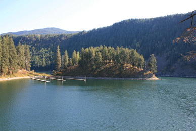
25. Long Beach (pictures below this paragraph) - 4 mooring buoys, 4 miles of rocky and sandy beaches below Green Monarch Mountain, one vault toilet, campsites, fire rings, primitive hiking trails. No running water. Anchoring is difficult due to the deep water off the beaches but there are some shallow areas that are possible to anchor at, however these areas have rocky bottoms, which can make it difficult to get an anchor to set in. There are 4 mooring buoys spread out about a mile apart from each other. Each mooring buoy has a beach near it with campsite and fire ring, however only one campsite has a restroom, and three of the camp sites have access to hike the mountain (see info below). West of the beaches along the steep mountain range is Deadman, Indian and Windy points. Directions: To access this site the closest launch is Johnson Creek #23 in the Clark Fork delta; 
 Maps: See interactive google map above or visit google.com/maps type in Clark Fork River, Bonner County, ID. or GPS coordinates 48.144016, -116.262744 of mooring buoy.
ACCESSIBILITY: Site includes a mooring buoy; PARKING... See number 11 for parking/launch info; PATHS/TRAILS... Sand, pebble beach camping area, not wheelchair accessible; RESTROOMS/FACILITIES/SHADE… One fully accessible restroom. Shade via trees; DOCKS/LAUNCHES/PLATFORMS… No docks/platforms; DIRECT WATER ACCESS… No access for wheeled mobility devices; TRANSFER SYSTEMS... None; SENSORY... No sensory tactile markers for those with visual and other impairments; CAMPING... Primitive camping along beach; O.T.H.E.R… Oddities/Barriers: Lots of sand and pebbles; Terrain: Level at shoreline to progressively more includes as one progresses up the mount; H2O/Water: Water normally clear. Water temperature in the summer can be around 50 to 60 degree. No drinking water available; Environmental Conditions: Extreme ocean like storms and large waves; Resources: Food, drinks, and gas in town of Clark Fork, ID.


A. This mooring/campsite is closes to Lee's Landing near Johnson Creek Boat Launch. It has a nice beach for camping with no restroom. Not a site to hike the mountain from but has a nice rocky area to jump into the water and swim from. Directions: To access this site the closest launch is Johnson Creek #23 in the Clark Fork deltaMaps: See interactive google map above or visit google.com/maps type in Clark Fork River, Bonner County, ID. or GPS coordinates 48.130832, -116.284826 of mooring buoy.
ACCESSIBILITY: Site includes a mooring buoy; PARKING... See number 11 for parking/launch info; PATHS/TRAILS... Sand, pebble beach camping area, not wheelchair accessible; RESTROOMS/FACILITIES/SHADE… None. Shade via trees; DOCKS/LAUNCHES/PLATFORMS… No docks/platforms; DIRECT WATER ACCESS… No access for wheeled mobility devices; TRANSFER SYSTEMS... None; SENSORY... No sensory tactile markers for those with visual and other impairments; CAMPING... Primitive camping along beach; O.T.H.E.R… Oddities/Barriers: Lots of sand and pebbles; Terrain: Level at shoreline to progressively more includes as one progresses up the mount; H2O/Water: Water normally clear. Water temperature in the summer can be around 50 to 60 degree. No drinking water available; Environmental Conditions: Extreme ocean like storms and large waves; Resources: Food, drinks, and gas in town of Clark Fork, ID.


B. This mooring/campsite is the second closest to Lee's Landing near Johnson Creek Boat Launch. It has a nice long beach with several campsite with a single vault toilet/restroom, and access to hike the mountain. It may be possible to anchor off this beach if you have the appropriate anchor for a rocky lake bottom. Directions: To access this site the closest launch is Johnson Creek #23 in the Clark Fork delta; Maps: See interactive google map above or visit google.com/maps type in Clark Fork River, Bonner County, ID. or GPS coordinates 48.123742, -116.314507
ACCESSIBILITY: Site includes a mooring buoy; PARKING... See number 11 for parking/launch info; PATHS/TRAILS... Sand, pebble beach camping area, not wheelchair accessible; RESTROOMS/FACILITIES/SHADE… One fully accessible restroom. Shade via trees; DOCKS/LAUNCHES/PLATFORMS… No docks/platforms; DIRECT WATER ACCESS… No access for wheeled mobility devices; TRANSFER SYSTEMS... None; SENSORY... No sensory tactile markers for those with visual and other impairments; CAMPING... Primitive camping along beach; O.T.H.E.R… Oddities/Barriers: Lots of sand and pebbles; Terrain: Level at shoreline to progressively more includes as one progresses up the mount; H2O/Water: Water normally clear. Water temperature in the summer can be around 50 to 60 degree. No drinking water available; Environmental Conditions: Extreme ocean like storms and large waves; Resources: Food, drinks, and gas in town of Clark Fork, ID.


C. This mooring/campsite is third closest to Lee's Landing near Johnson Creek Boat Launch. It has a nice beach, well defined campsite with no restroom, and access to hike the mountain. Directions: To access this site the closest launch is Johnson Creek #23 in the Clark Fork delta; Maps: See interactive google map above or visit google.com/maps type in Clark Fork River, Bonner County, ID. or GPS coordinates 48.125987, -116.324394
ACCESSIBILITY: Site includes mooring buoy; PARKING... See number 11 for parking/launch info; PATHS/TRAILS... Sand, pebble beach camping area, not wheelchair accessible; RESTROOMS/FACILITIES/SHADE… None. Shade via trees; DOCKS/LAUNCHES/PLATFORMS… No docks/platforms; DIRECT WATER ACCESS… No access for wheeled mobility devices; TRANSFER SYSTEMS... None; SENSORY... No sensory tactile markers for those with visual and other impairments; CAMPING... Primitive camping along beach; O.T.H.E.R… Oddities/Barriers: Lots of sand and pebbles; Terrain: Level at shoreline to progressively more includes as one progresses up the mount; H2O/Water: Water normally clear. Water temperature in the summer can be around 50 to 60 degree. No drinking water available; Environmental Conditions: Extreme ocean like storms and large waves; Resources: Food, drinks, and gas in town of Clark Fork, ID.


D. This mooring/campsite is 4th closest to Lee's Landing near Johnson Creek Boat Launch is just northeast of Deadman's Point by Indian Point. It has a beach, primitive campsite with no restroom, and access to hike the mountain. Directions: To access this site the closest launch is Johnson Creek #23 in the Clark Fork deltaMaps: See interactive google map above or visit google.com/maps type in Clark Fork River, Bonner County, ID. or GPS coordinates 48.130058, -116.367157
ACCESSIBILITY: Site includes a mooring buoy; PARKING... See number 11 for parking/launch info; PATHS/TRAILS... Sand, pebble beach camping area, not wheelchair accessible; RESTROOMS/FACILITIES/SHADE… None. Shade via trees; DOCKS/LAUNCHES/PLATFORMS… No docks/platforms; DIRECT WATER ACCESS… No access for wheeled mobility devices; TRANSFER SYSTEMS... None; SENSORY... No sensory tactile markers for those with visual and other impairments; CAMPING... Primitive camping along beach; O.T.H.E.R… Oddities/Barriers: Lots of sand and pebbles; Terrain: Level at shoreline to progressively more includes as one progresses up the mount; H2O/Water: Water normally clear. Water temperature in the summer can be around 50 to 60 degree. No drinking water available; Environmental Conditions: Extreme ocean like storms and large waves; Resources: Food, drinks, and gas in town of Clark Fork, ID.


26. Granite Point Dock - rocky beach, restroom, small parking area. Directions: From HWY 95 travel east on Bunco Rd (3 miles east of Athol Idaho on HWY 95) to the first big hill. Bunco Road turns into 332 and to gravel but is well packed all the way to Lakeview Idaho (after Lakeview, this road significantly narrows and becomes rougher). When you begin going up the hill you will see a sign just past a large parking lot indicating mileage to Lakeview (19 miles) and Clark Fork (47 miles). Road 332 will take you to road 278; which takes you all the way to Lakeview, and on to Granite Point (you will pass Whisky Rock on the way). There are signs giving you directions all the way to Lakeview, but not to Granite Point. When you past the signs to Whiskey Rock campground you will need to stay alert to see the small sign to Granite Point. Most locals do not know there is a road to the Granite Point dock. Maps: View interactive google map above or visit google.com/maps type in Lake Pend Oreille, Bonner County, ID. or GPS coordinates 48.084752, -116.429799
ACCESSIBILITY: PARKING... Gravel/dirt parking area; PATHS/TRAILS... No developed paths/trails. Primitive trail along shoreline to the dock; RESTROOMS/FACILITIES/SHADE… None. Shade via trees; DOCKS/LAUNCHES/PLATFORMS… One non floating dock. Launch from bank; DIRECT WATER ACCESS… No developed access for wheeled mobility devices; TRANSFER SYSTEMS... None; SENSORY... No sensory tactile markers for those with visual and other impairments; CAMPING... No; O.T.H.E.R… Oddities/Barriers: Rocks and marine vegetation along shoreline; Terrain: Level to 5% grades; H2O/Water: Water clear until late summer. Water temperature in the summer can be around 60 to 70 degree. No drinking water available; Environmental Conditions: Extreme ocean like storms and large waves; Resources: Food, drinks, and gas nothing nearby.


27. Whisky Rock Bay Campground - docks, 2 mooring buoys  (when present) primitive boat launch, beach, restrooms, campground, hiking trails, picnic area, restrooms, no running water. https://www.fs.usda.gov/recarea/ipnf/recreation/recarea/?recid=6796

This county dock facility is located on the middle portion of the lake on the east side. This location is vulnerable from storms coming from the Northwest with little protection. Directions: From HWY 95 travel east on Bunco Rd (3 miles east of Athol Idaho on HWY 95) to the first big hill. Bunco Road turns into 332 and to gravel but is well packed all the way to Lakeview Idaho(after Lakeview, this road significantly narrows and becomes rougher). When you begin going up the hill you will see a sign just past a large parking lot indicating mileage to Lakeview (19 miles) and Clark Fork (47 miles). Road 332 will take you to road 278; which takes you all the way to Lakeview, and on to Whisky Rock. There is a very clear sign to this campground. Follow the sign once in the park to the picnic area. Once at the end of this road there is a small sign showing the way to the primitive boat launch. Most locals do not know there is a primitive boat launch at this site. Maps: View interactive google map or visit google.com/maps type in Lake Pend Oreille, Bonner County, ID. or GPS coordinates 48.051540, -116.454186 . Campground GPS coordinates 48.050668, -116.456195
ACCESSIBILITY: PARKING... Gravel/dirt parking area; PATHS/TRAILS... No developed paths/trails. Primitive trail along shoreline. Paved road through camp area; RESTROOMS/FACILITIES/SHADE… One accessible restroom in camp area. Another restroom facility at bay area but not accessible to wheelchairs. Shade via trees; DOCKS/LAUNCHES/PLATFORMS… One long dock next to campground, not next to launch. Single primitive dirt/gravel/sand launch at about 6% grade; DIRECT WATER ACCESS… No developed access for wheeled mobility devices; TRANSFER SYSTEMS... None; SENSORY... No sensory tactile markers for those with visual and other impairments; CAMPING... Beautiful forested campground with primitive campsites, not designated for wheelchairs but but several campsites that are accessible wheelchairs; O.T.H.E.R… Oddities/Barriers: Mud, rocks, marine vegetation along shoreline; Terrain: Level to 6% grades; H2O/Water: Water clear until late summer. Water temperature in the summer can be around 60 to 70 degree in bay. No drinking water available; Environmental Conditions: Extreme ocean like storms and large waves; Resources: Food, drinks, and gas nothing nearby.


28. Cedar Creek Public Dock - dock, no restroom. Directions: From HWY 95 travel east on Bunco Rd (3 miles east of Athol Idaho on HWY 95) to the first big hill. Bunco Road turns into 332 and to gravel but is well packed all the way to Lakeview Idaho (after Lakeview, this road significantly narrows and becomes rougher). When you begin going up the hill you will see a sign just past a large parking lot indicating mileage to Lakeview (19 miles) and Clark Fork (47 miles). Road 332 leads to road 278; which takes you all the way to Lakeview, and on to Cedar Creek. There is a small sign indicating you are at Cedar Creek; pass this sign and make a sharp turn to the right to get to the dock facility with small parking area. This is a private land with public access and will remain open as long as the public takes care of it. You could launch a kayak from the dock or shore but that is it. Maps: See interactive google map below or Visit google.com/maps type in Lake Pend Oreille, Bonner County, ID. or GPS coordinates 48.019010, -116.450410
ACCESSIBILITY: PARKING... Small gravel, dirt/mud parking area; PATHS/TRAILS... No developed paths/trails; RESTROOMS/FACILITIES/SHADE… None. Shade via trees; DOCKS/LAUNCHES/PLATFORMS… One non floating dock. No developed launch. Launch from bank or dock; DIRECT WATER ACCESS… No developed access for wheeled mobility devices due to trail from parking area is rough and rocky; TRANSFER SYSTEMS... None; SENSORY... No sensory tactile markers for those with visual and other impairments; CAMPING... No; O.T.H.E.R… Oddities/Barriers: Rocky shoreline; Terrain: level mostly, very rocky; H2O/Water: Water normally clear. Water temperature in the summer can be around 50 to 60 degree. No drinking water available; Environmental Conditions: Extreme ocean like storms and large waves; Resources: Food, drinks, and gas nothing nearby.


29. Lakeview Boat Launch and Dock - dock with breakwater, restroom, no running water, small beach, very limited parking. If there is not room for parking due to other vehicles drive back up the road to the town after launching and parking along the street. Great place to swim due to the shallow area along the dock. Directions: From HWY 95 travel east on Bunco Rd (3 miles east of Athol Idaho on HWY 95) to the first big hill. Bunco Road turns into 332 and gravel but is well packed all the way to Lakeview Idaho (after Lakeview, this road significantly narrows and becomes rougher). When you begin going up the hill you will see a sign just past a large parking lot indicating mileage to Lakeview (19 miles) and Clark Fork (47 miles). Road 332 will take you to road 278; which takes you all the way to Lakeview. There are signs giving directions all the way to Lakeview. Stay alert as some of the signs were made by locals, are not big, and are placed on trees. Once you have entered this small town follow the main road all the way down to the lake. Maps: View interactive google map above or visit google.com/maps type in Lake Pend Oreille, Bonner County, ID. or GPS coordinates 47.973183, -116.453171
ACCESSIBILITY: PARKING... Small gravel/dirt parking area; PATHS/TRAILS... No developed paths/trails;  RESTROOMS/FACILITIES/SHADE… One old restroom that is not wheelchair accessible. No shade; DOCKS/LAUNCHES/PLATFORMS… One long non floating dock wheelchair accessible dock, protected with breakwater. Single lane gravel/sand launch at about 4% grade; DIRECT WATER ACCESS… No developed access for wheeled mobility devices. Absolutely no access to water other than via launch; TRANSFER SYSTEMS... None; SENSORY... No sensory tactile markers for those with visual and other impairments; CAMPING... No; O.T.H.E.R… Oddities/Barriers: sand; Terrain: Level to 4% grade at launch; H2O/Water: Water clear. Water temperature in the summer can be around 50 to 60 degree. No drinking water available; Environmental Conditions: Extreme ocean like storms and large waves; Resources: Food, drinks, and gas nothing nearby. Services across the lake at Bayview Idaho.


30. Farragut State Park Buttonhook Bay - docks, restrooms, running water via 1.5 mile hike, hiking trails, camping. If the docks are full the bay here is a popular place to anchor in due to its shallower depths than most of Windy Bay that is 400 to 800 feet deep. Directions: From Athol Idaho on HWY 95 travel east on HWY 54 toward Bayview and Farragut State Park (follow the signs). Directions to bay facility and other sites are shown here. Maps: See interactive google map below or Visit google.com/maps type in Lake Pend Oreille, Bonner County, ID. or GPS coordinates 47.952396, -116.574396
ACCESSIBILITY: PARKING... Gravel, dirt/mud parking within park; PATHS/TRAILS... No developed accessible paths/trails, however there is a wide dirt trail to this site. Can be accessed with a wheelchair when not wet; RESTROOMS/FACILITIES/SHADE… Fully accessible restrooms within the park. Shade via trees; DOCKS/LAUNCHES/PLATFORMS… One large/long dock with three long fingers. No developed launch. Launch lightweight watercraft from bank/dock; DIRECT WATER ACCESS… No developed access for wheeled mobility devices; TRANSFER SYSTEMS... None; SENSORY... No sensory tactile markers for those with visual and other impairments; CAMPING... Fully accessible tent and RV campsites with hookups; O.T.H.E.R… Oddities/Barriers: Mud; Terrain: mostly dirt and some gravel, and paved areas in parking area of level to 7% grades; H2O/Water: Water normally clear. Water temperature in the summer can be around 50 to 60 degree. Drinking water available; Environmental Conditions: Extreme ocean like storms and large waves; Resources: Food, drinks, and restaurants in towns of Athol and Bayview, ID. Vehicle gas stations in Athol only. Boat fueling dock in Bayview. See Farragut State Park campsite and day use areas evaluations at the bottom of this page.


31. Beaver Bay & Swim Area - designated swim area, rocky beach, restrooms, running water. Nice place to anchor in or kayak/canoe from. Directions: From Athol Idaho on HWY 95 travel east on HWY 54 toward Bayview and Farragut State Park (follow the signs); enter the park headquarters. Directions to the recreation site and other facilities are shown here. Maps: See interactive google map below or Visit google.com/maps type in Lake Pend Oreille, Bonner County, ID. or GPS coordinates 47.954623, -116.569027
ACCESSIBILITY: PARKING... Paved parking lot above bay next to restrooms; PATHS/TRAILS... No developed accessible paths/trails, however there is a steep dirt trail to this bay below at about 8%; RESTROOMS/FACILITIES/SHADE… Fully accessible restrooms. Shade via trees; DOCKS/LAUNCHES/PLATFORMS… No docks/platforms. No developed launch. Launch lightweight watercraft from beach in bay; DIRECT WATER ACCESS… No developed access for wheeled mobility devices; TRANSFER SYSTEMS... None; SENSORY... No sensory tactile markers for those with visual and other impairments; CAMPING... Fully accessible tent and RV campsites with hookups; O.T.H.E.R… Oddities/Barriers: Sand; Terrain: Mostly dirt and some sand of about 5-8% grades; H2O/Water: Water normally clear. Water temperature in the summer can be around 50 to 60 degree. Drinking water available; Environmental Conditions: Extreme ocean like storms and large waves; Resources: Food, drinks, and restaurants in town of Athol and Bayview, ID. Vehicle gas stations in Athol only. Boat fueling dock in Bayview. See Farragut State Park campsite and day use areas evaluations at the bottom of this page.


32. Farragut State Park, Eagle Boat Launch - restrooms, running water, docks, beach, camping, hiking/mountain bike trails. Invasive species boat wash station. Directions: From Athol Idaho on HWY 95 travel east on HWY 54 towards Bayview and Farragut State Park (follow the signs); enter the park headquarters entrance. Directions to the launch and other facilities are shown here. Maps: View interactive google map above or visit google.com/maps type in Lake Pend Oreille, Bonner County, ID. or GPS coordinates 47.965126, -116.545771
ACCESSIBILITY: PARKING... Large upper and lower parking lots; PATHS/TRAILS... Paved accessible paths into/from parking lot and launch area of 6 to 8% scopes/grades. Wide paved area at launch and beach area; RESTROOMS/FACILITIES/SHADE… Fully accessible restrooms. Shade via trees; DOCKS/LAUNCHES/PLATFORMS… Three accessible long launch docks. 4 lane paved launch of 5% scope/grade; DIRECT WATER ACCESS… No developed access for wheeled mobility devices but paved launch is right next to a beach. South beach is covered in large boulders. Small north beach is sand and uneven surface soon to be smoothed out in 2021 for better access. Wheeled mobility devices can potentially get stuck in the soft sand; TRANSFER SYSTEMS... None; SENSORY... No sensory tactile markers for those with visual and other impairments; CAMPING... Fully accessible tent and RV campsites with hookups; O.T.H.E.R… Oddities/Barriers: Sand; Terrain: mostly dirt and some gravel, and paved areas in parking area of level to 7% grades; H2O/Water: Water normally clear. Water temperature in the summer can be around 50 to 60 degree. Drinking water available; Environmental Conditions: Extreme ocean like storms and large waves; Resources: Food, drinks, and restaurants in towns of Athol and Bayview, ID. Vehicle gas stations in Athol only. Boat fueling dock in Bayview. See Farragut State Park campsite and day use areas evaluations at the bottom of this page.


33. McDonald Hudson Bay Resort & Marina - launch, marina, store, fuel, slips, running water, boat services. If you need support for your boat, etc. this is the place to get it on this end of the lake (south end of lake). Directions: From Athol Idaho on HWY 95 travel east on HWY 54 to Bayview Idaho. Once coming down the hill into Bayview watch for the East Hudson Bay Road to your right. Follow this road to North McDonalds Road, which leads to the resort. Maps: View interactive google map above or visit google.com/maps type in Lake Pend Oreille, Bonner County, ID. or GPS coordinates 47.976528, -116.552621
ACCESSIBILITY: PARKING... Gravel parking lot; PATHS/TRAILS... No developed paths/trails. Wide paved areas along shoreline; RESTROOMS/FACILITIES/SHADE… Restrooms not considered wheelchair accessible. No shade; DOCKS/LAUNCHES/PLATFORMS… Many non accessible docks within marina. Paved single lane cement launch at about 8% grade; DIRECT WATER ACCESS… No developed access for wheeled mobility devices. Absolutely no access to water other than via launch; TRANSFER SYSTEMS... None; SENSORY... No sensory tactile markers for those with visual and other impairments; CAMPING... No; O.T.H.E.R… Oddities/Barriers: No access other than at launch; Terrain: Level to 8% grade at launch; H2O/Water: Water clear. Water temperature in the summer can be around 50 to 60 degree. No drinking water available; Environmental Conditions: Extreme ocean like storms and large waves; Resources: Food, drinks, and restaurants in towns of Athol and Bayview, ID. Vehicle gas stations in Athol only. Boat fueling dock in Bayview.


34. Bayview Public Boat Launch - launch, docks, restroom, running water, very limited vehicle with trailer parking. During the summer this launch is very congested and so launching from the Farragut State Park launch may be a better choice. If you are launching a sailboat from this site watch out for the power lines. Directions: From Athol Idaho on HWY 95 travel east on HWY 54 to Bayview Idaho. Once in Bayview watch for the Bayview City boat launch sign. Maps: View interactive google map above or visit google.com/maps type in Lake Pend Oreille, Bonner County, ID. or GPS coordinates 47.980824, -116.558497
ACCESSIBILITY: PARKING... Small paved parking lot; PATHS/TRAILS... No developed paths/trails, however there is a wide paved area at launch site; RESTROOMS/FACILITIES/SHADE… Fully accessible restrooms. No shade; DOCKS/LAUNCHES/PLATFORMS… Two launch docks. Paved double lane cement launch at about 8% grade; DIRECT WATER ACCESS… No developed access for wheeled mobility devices. Absolutely no access to water other than via launch; TRANSFER SYSTEMS... None; SENSORY... No sensory tactile markers for those with visual and other impairments; CAMPING... No; O.T.H.E.R… Oddities/Barriers: Private shoreline other than at launch; Terrain: Level to 8% grade at launch; H2O/Water: Water clear. Water temperature in the summer can be around 50 to 60 degree. Drinking water available at store across the street; Environmental Conditions: Extreme ocean like storms and large waves; Resources: Food, drinks, and restaurants in towns of Athol and Bayview, ID. Vehicle gas stations in Athol only. Boat fueling dock in Bayview.


35. Evans Landing Picnic Ground -  two mooring buoys, long beach, no restroom or running water. Day use area only! https://www.fs.usda.gov/recarea/ipnf/recreation/recarea/?recid=6796 Directions: The closest Launch sites to this landing are directly across the lake at Whiskey Rock and Granite Point. Good for kayaks and small dinghies, but for larger boats, launch at either Bayview or Farragut State Park. See map for landing location. Directions to access this site the closest launch is Johnson Creek #23 in the Clark Fork delta or across the lake at Whiskey Rock Park the is only used for light weight boat launchingMaps: See interactive google map below or visit google.com/maps type in Lake Pend Oreille, Bonner County, ID. or GPS coordinates 48.074944, -116.531794
ACCESSIBILITY: Two mooring buoys at this site; PARKING... See number 23 or 27 for parking/launch info; PATHS/TRAILS... Sand, pebble beach camping area, not wheelchair accessible; RESTROOMS/FACILITIES/SHADE… One fully accessible restroom. Shade via trees; DOCKS/LAUNCHES/PLATFORMS… No docks/platforms; DIRECT WATER ACCESS… No access for wheeled mobility devices; TRANSFER SYSTEMS... None; SENSORY... No sensory tactile markers for those with visual and other impairments; CAMPING... Primitive camping along beach; O.T.H.E.R… Oddities/Barriers: Lots of sand and pebbles; Terrain: Level at shoreline to progressively more includes as one progresses up the mounts; H2O/Water: Water normally clear. Water temperature in the summer can be around 50 to 60 degree. No drinking water available; Environmental Conditions: Extreme ocean like storms and large waves; Resources: Food, drinks, and gas in towns of Bayview or Hope, ID.


36. Maiden Rock picnic ground -  three mooring buoys, long beach, camping, restroom, no running water. https://www.fs.usda.gov/recarea/ipnf/recreation/recarea/?recid=6796 Directions: The closest Launch sites to this landing are directly across the lake at Whiskey Rock and Granite Point. Good launches for kayaks and small dinghies; for larger boats it is best to launch at Bayview or Farragut State Park. See map for landing location. Directions: To access this site the closest launch either at is Johnson Creek #23 in the Clark Fork delta or at #27 at Whiskey Rock Park, which is only suitable for launching lightweight boat from; Maps: View interactive google map below/above or visit google.com/maps and type in GPS coordinates 48.099004, -116.510031
ACCESSIBILITY: Three mooring buoys at this site. PARKING... See number #23 or #27 for parking/launch info; PATHS/TRAILS... Sand, pebble beach camping area, not wheelchair accessible; RESTROOMS/FACILITIES/SHADE… One fully accessible restroom. Shade via trees; DOCKS/LAUNCHES/PLATFORMS… No docks/platforms; DIRECT WATER ACCESS… No access for wheeled mobility devices; TRANSFER SYSTEMS... None; SENSORY... No sensory tactile markers for those with visual and other impairments; CAMPING... Primitive camping along beach; O.T.H.E.R… Oddities/Barriers: Lots of sand and pebbles; Terrain: Level at shoreline to progressively more includes as one progresses up the mounts; H2O/Water: Water normally clear. Water temperature in the summer can be around 50 to 60 degree. No drinking water available; Environmental Conditions: Extreme ocean like storms and large waves; Resources: Food, drinks, and gas in towns of Bayview or Hope, ID.


37. Talache Landing Sportsman Access - long beach, limited parking, no launch or running water. the Talache beach/sportsman access area is split in half by a few homes/private property. The north side of the houses/private property is the place to launch kayaks, canoes, and lightweight dinghies from (again there is no launch at this site) and is a day use only area. The south side of the houses/private property there is several spots to camp (overnight usage allowed) after hiking down a rough and at times steep trail to the water's edge. Beaching your boat or anchoring is possible along this two part beach. There is also an old mine on display on the south part of this sportsman access... called the Old Mexico Mine. Directions: From Sagle Idaho on HWY 95 take Sagle Road. Turn right onto Talache Road/Forest Service Road 2233; follow it to the lake. The road takes a sharp turn to the left towards the main beach. On the right is a narrow gravel road leading to a camping and beach area. Maps: See interactive google map below or visit google.com/maps type in Lake Pend Oreille, Bonner County, ID. or GPS coordinates north section 48.128958, -116.478296 and south section with mine 48.125342, -116.482540
ACCESSIBILITY: PARKING... Gravel, dirt/mud parking along road; PATHS/TRAILS... No developed paths/trails; RESTROOMS/FACILITIES/SHADE… None. Shade via trees; DOCKS/LAUNCHES/PLATFORMS… No docks/platforms. No developed launch. Launch from shallow bank; DIRECT WATER ACCESS… No developed access for wheeled mobility devices; TRANSFER SYSTEMS... None; SENSORY... No sensory tactile markers for those with visual and other impairments; CAMPING... Primitive Camping on the south end of the road on the south side past the private homes; O.T.H.E.R… Oddities/Barriers: Sand; Terrain: level mostly at north section, and about 7% grades at south section; H2O/Water: Water normally clear. Water temperature in the summer can be around 50 to 60 degree. No drinking water available; Environmental Conditions: Extreme ocean like storms and large waves; Resources: Food, drinks, and gas in town of Sagle, ID.


38. Garfield Bay Public Boat Launch & Garfield Bay Campground - launch, docks, beach, park, large paved parking lot, restroom, running water, RV & campsites across the street at GARFIELD BAY CAMPGROUND https://www.fs.usda.gov/recarea/ipnf/recreation/recarea/?recid=6796 Directions: From Sagle Idaho on HWY 95 take E. Sagle Rd, turn right onto Garfield Bay Rd. Follow the sign to this launch and campground. Maps: Visit google.com/maps type in Lake Pend Oreille, Bonner County, ID. or GPS coordinates 48.187652, -116.437341
ACCESSIBILITY: PARKING... Large paved parking lot; PATHS/TRAILS... No developed paths/trails. Wide paved area at launch and along beach area; RESTROOMS/FACILITIES/SHADE… Fully accessible restrooms. Shade via trees; DOCKS/LAUNCHES/PLATFORMS… Two fully accessible docks. Paved two single lane cement launches at about 8% grades; DIRECT WATER ACCESS… No developed access for wheeled mobility devices. Could access water via beach but is very soft sandy beach; TRANSFER SYSTEMS... None; SENSORY... No sensory tactile markers for those with visual and other impairments; CAMPING... Accessible tent and RV campsites at campground across the street from the launch facility; O.T.H.E.R… Oddities/Barriers: Soft sandy shoreline. Parking late is mostly on an incline; Terrain: 3 to 8% grades; H2O/Water: Water clear. Water temperature in the summer can be around 50 to 60 degree. No drinking water available; Environmental Conditions: Extreme ocean like storms and large waves; Resources: Food, drinks, and gas in town of Sagle, ID.


39. Green Bay - 3 Mooring buoys, skipping stone beaches, 2 vault toilets, campsites, picnic tables, barbecue grills, miles of hiking/biking/interpretative trails. No docks, running water, RV or trailer camping sites. The road to this campground is rough with ruts and loose gravel, and at times is steep. This road is not suited for vehicles towing trailers. Towing a light weight trailer is possible but you will need to tow with a vehicle that has 4x4. There is no launch at this site but walking your kayak/canoe to the beach is fairly easy via the wide trails to the beaches past the restrooms. When driving down the road near the campground taking the road to the right (west) when the road Y's to the parking lot is closest to the water. Directions: From Sagle Idaho on HWY 95 take Sagle Rd east, turn right onto Garfield Bay Rd. Travel past Garfield Bay Launch and Campground to Garfield Bay Cutoff Road. Follow Garfield Bay Cutoff Road a short distance and turn right at the Green Bay Campground sign. The road name is not posted (Green Bay Rd). Travel a little over a mile to the Y in the road. Turn right at this Y, there is a sign indicating Green Bay Campground. Travel down this road to Green Bay campground. When you near the end of the road you can turn right or left to two separate parking lots. Turning right takes you to a parking lot that is close to the water for easier launching/water access. Maps: See interactive google map below or visit google.com/maps type in Lake Pend Oreille, Bonner County, ID. or GPS coordinates 48.177477, -116.407310
ACCESSIBILITY: PARKING... Gravel, dirt/mud parking lots; PATHS/TRAILS... Non wheelchair accessible steep wide trails to pebble beach; RESTROOMS/FACILITIES/SHADE… One accessible restroom. Shade via trees; DOCKS/LAUNCHES/PLATFORMS… No docks/platforms. No developed launch. Launch from beach; DIRECT WATER ACCESS… No developed access for wheeled mobility devices; TRANSFER SYSTEMS... None; SENSORY... No sensory tactile markers for those with visual and other impairments; CAMPING... Primitive camping; O.T.H.E.R… Oddities/Barriers: Loose dirt on trails and deep pebble beaches; Terrain: Varies from level to 8%; H2O/Water: Water normally clear. Water temperature in the summer can be around 50 to 60 degree. No drinking water available; Environmental Conditions: Extreme ocean like storms and large waves; Resources: Food, drinks, and gas in town of Sagle, ID.


40. Glengary Bay Marina & Primitive Boat Launch - This is a private marina for members only. 2 cabin rentals, additional associated dock space for extra fee. Facility includes a primitive launch, marina with 3 major docks, 49 slips and additional visitor dock spaces, running water, and single stall restroom, 2 rental cabins, grass picnic area. Call 208-000-0000 to get on the mooring waiting list or to rent a cabin/slip. Directions: From Sagle Idaho on HWY 95 take Sagle Rd east, at the end of this road, turn right/south onto Glengary Bay Rd along the east shore of Gamlin Lake (going straight would put you on Martin Bay Rd, wrong way). When Glengary Bay Rd takes a hard right (south), go straight onto Marina Rd, which ends at the marina/launch.   Maps: Visit google.com/maps type in Glengary Bay Marina Idaho or GPS coordinates 48.222572, -116.372446
ACCESSIBILITY: PARKING... This site/facility is not accessible to persons with disAbilities, particularly those who use wheeled mobility devices/Wheelchairs.


 41. Bottle Bay Marina & Boat Launch - launch, marina, store, restaurant, fuel, slips, restrooms, running water, boat services. Directions: From Sagle Idaho on HWY 95 take Sagle Rd, turn left onto Bottle Bay Rd. Watch for the sign to this resort. Maps: View interactive google map above or visit google.com/maps type in Lake Pend Oreille, Bonner County, ID. or GPS coordinates 48.238034, -116.445431
ACCESSIBILITY: PARKING... Small paved parking lot; PATHS/TRAILS... No developed paths/trails but wide paved road to launch and small beach area; RESTROOMS/FACILITIES/SHADE… Restrooms not considered wheelchair accessible. Shade via trees; DOCKS/LAUNCHES/PLATFORMS… One none wheelchair accessible main dock with several fingers. Paved single lane cement launch at about 5% grade; DIRECT WATER ACCESS… No developed access for wheeled mobility devices. Absolutely no access to water other than via launch; TRANSFER SYSTEMS... None; SENSORY... No sensory tactile markers for those with visual and other impairments; CAMPING... No; O.T.H.E.R… Oddities/Barriers: Only access to water is via launch; Terrain: Level to 7% grades; H2O/Water: Water clear until late summer. Water temperature in the summer can be around 60 to 70 degree. No drinking water available; Environmental Conditions: Varies; Resources: Food, drinks, and gas in town of Sandpoint, ID.


42. Bottle Bay Road Access & Trail - bank launching/fishing, rocky bank shoreline, restroom just up the road (west), no running water, limited vehicle and vehicle with trailer parking at trailhead site. Do not park along the road as there is no room for it. Seems some people tend to drive very quickly along this road so be cautious and watch for traffic for you and those with you. Directions: Traveling from Sandpoint or Coeur d'Alene Idaho on HWY 95 turn east onto Bottle Bay Rd. Follow this road until you come around a big sweeping turn that takes you to a point where you can no longer see the HWY 95 Long Bridge and railroad bridge on the lake. Keep an eye out to the right for the trailhead paved parking lot with vault toilet building (see picture below). The lake access point is up (east) the road from this trailhead parking lot on the right curve. When walking along the road watch traffic for you and those with you safety. Maps: See interactive google map below or visit google.com/maps type in Lake Pend Oreille, Bonner County, ID. or GPS coordinates for lake access 48.262781, -116.486084 and coordinates for restroom and trailhead 48.262424, -116.493048
ACCESSIBILITY: PARKING... Gravel dirt parking along road and at restroom/trailhead; PATHS/TRAILS... No developed paths/trails at lakeside. Single track trail at Trailhead/Restroom; RESTROOMS/FACILITIES/SHADE… Fully accessible restroom up the road (west) at Trailhead. Shade via trees; DOCKS/LAUNCHES/PLATFORMS… No docks/platforms. No developed launch. Launch/fish from very steep bank; DIRECT WATER ACCESS… No developed access for wheeled mobility devices; TRANSFER SYSTEMS... None; SENSORY... No sensory tactile markers for those with visual and other impairments; CAMPING... No; O.T.H.E.R… Oddities/Barriers: Mud; Terrain: Varies; H2O/Water: Water normally clear. Water temperature in the summer can be around 50 to 60 degree. No drinking water available; Environmental Conditions: Extreme ocean like storms and large waves; Resources: Food, drinks, and gas in town of Sandpoint, ID.


43. Sagle Creek Access - Primitive gravel/muddy launching, grass and muddy shoreline, no restroom or running water, limited vehicle and vehicle with trailer parking along road. This is a fabulous place to access the Sagle Creek channel to fish or go from the launch out into Lake Pend Oreille near the HWY 95 Long Bridge. Directions: Traveling from Sandpoint or Coeur d'Alene Idaho on HWY 95 turn east onto Bottle Bay Rd. Follow this road a short distance to the first small bridge, you will see the Sagle Creek channel. Before the bridge is rough short gravel road to the primitive launch. When parking along the road watch traffic for you and those with you safety. Maps: View interactive google map above or visit google.com/maps type in Lake Pend Oreille, Bonner County, ID. or GPS coordinates 48.230056, -116.537696
ACCESSIBILITY: PARKING... Small dirt/mud parking area; PATHS/TRAILS... No developed paths/trails; RESTROOMS/FACILITIES/SHADE… None. Shade via trees; DOCKS/LAUNCHES/PLATFORMS… No dock/platform. Launch from low bank; DIRECT WATER ACCESS… No developed access for wheeled mobility devices. Absolutely no access to water other than via the bank; TRANSFER SYSTEMS... None; SENSORY... No sensory tactile markers for those with visual and other impairments; CAMPING... No; O.T.H.E.R… Oddities/Barriers: Mud and marine vegetation along shoreline; Terrain: Level to 6% grade; H2O/Water: Water clear until late summer. Water temperature in the summer can be around 60 to 70 degree. No drinking water available; Environmental Conditions: Varies; Resources: Food, drinks, and gas in town of Sandpoint, ID.


44. Sandpoint Fish Hatchery & Waterlife Discovery Center - Dock, boardwalk, picnic tables, hiking trails, large parking lot. Info: This historic 1904 fish hatchery is being developed into educational aquatic center as a joint venture between the Idaho Fish & Game and the Idaho Fish & Wildlife Foundation that is currently under development. The focused is about teaching of course about the local marine and wildlife. This site includes 10 acres of forest and wetlands, that also include the 1904 Historic Fish Hatchery that is still in use for Rainbow Trout recovery. Directions: From HWY 95 at the south end of Long Bridge turn west on Lakeshore Drive. Drive 1.5 miles to the WaterLife Discovery Center. The center is located at the mouth of a small stream that is west of the HWY 95 long bridge on Lake Pend Oreille. Maps: See interactive google map below or Visit google.com/maps type in Lake Pend Oreille, Bonner County, ID. or GPS coordinates 48.230263, -116.563731
ACCESSIBILITY: PARKING... Gravel parking lot; PATHS/TRAILS... Paved accessible paths around hatchery grounds, and to public dock; RESTROOMS/FACILITIES/SHADE… Fully accessible restrooms within Hatchery building. Shade via trees; DOCKS/LAUNCHES/PLATFORMS… One fully accessible dock. No developed launch. Not a place designed to launch from but one could launch a kayak/canoe from the dock; DIRECT WATER ACCESS… No developed access for wheeled mobility devices; TRANSFER SYSTEMS... None; SENSORY... No sensory tactile markers for those with visual and other impairments; CAMPING... No; O.T.H.E.R… Oddities/Barriers: Nothing unusual; Terrain: Level to 5% grades; H2O/Water: Water normally clear. Water temperature in the summer can be around 50 to 60 degree. Drinking water available; Environmental Conditions: Varies; Resources: Food, drinks, and gas in town of Sandpoint, ID.


45. Springy Point Landing - launch, dock, beach, restrooms, camping, running water. Directions: Just before crossing the bridge to Sandpoint or just after crossing the bridge from Sandpoint turn west onto Riverview Rd. About 3 miles down the road watch for the Springy Point Recreational Area sign. Maps: View interactive google map above or visit google.com/maps type in Lake Pend Oreille, Bonner County, ID. or GPS coordinates 48.237124, -116.586338
ACCESSIBILITY: PARKING... Pave upper and lower parking lots; PATHS/TRAILS... No developed paths/trails but there is paved road to boat launch and next to beach; RESTROOMS/FACILITIES/SHADE… Fully accessible restrooms. Shade via trees; DOCKS/LAUNCHES/PLATFORMS… One fully accessible dock. Paved single lane cement launch at about 6% grade; DIRECT WATER ACCESS… No developed access for wheeled mobility devices. However pavement goes right up to small soft sandy beach next to boat launch; TRANSFER SYSTEMS... None; SENSORY... No sensory tactile markers for those with visual and other impairments; CAMPING... Accessible tent and RV campsites with hookups; O.T.H.E.R… Oddities/Barriers: Mud and soft sand shoreline; Terrain: Level to 6% grades; H2O/Water: Water clear until late summer. Water temperature in the summer can be around 60 to 70 degree. Drinking water available; Environmental Conditions: Varies; Resources: Food, drinks, and gas in town of Sandpoint, ID.


46. Dover Launch, Marina, & Park - Paved fee launch, docks, marina, sandy beach with swim platform/dock, park, dog park, walking trails, beautiful marsh, restrooms, running water, store. This access/launch is placed in the Lake Pend Oreille section because some consider this is the furthest west point to access Lake Pend Oreille even though its official on the Pend Oreille River. Dover City and Dover Resort are a collaborative group that has developed a stunning park with beautiful wood bridges over the marsh channels, beautiful park that is open to people as well as dogs. The resort maintains the launch and marina. The fee to launch is $19 a bit high when you can launch just down stream on the Pend Oreille River for free or in Sandpoint Idaho for a small fee. Sailors beware there are some power lines that cross the river near the launch and marina. The city maintains the beach and dock, Directions: On Highway 2. in Dover turn south at the Dover Bay turnoff, go west past the Discovery Center on Railroad Avenue to Dover Bay Way and turn left. Follow to Lakeshore Drive and turn right. Dover City Beach and Park is at end of this road next to City Hall. On your way to the launch/park you will pass through an upscale housing development. Maps: See interactive google map below or Visit google.com/maps type in Lake Pend Oreille, Bonner County, ID. or GPS coordinates for boat launch 48.245007, -116.614622 , Coordinates for beach 48.246327, -116.618615
ACCESSIBILITY: PARKING... Paved parking lots; PATHS/TRAILS... Pave accessible paths to launch dock and to beach area; RESTROOMS/FACILITIES/SHADE… Fully accessible restrooms. Shade via trees; DOCKS/LAUNCHES/PLATFORMS… One accessible launch dock. One paved launch at 5% grade; DIRECT WATER ACCESS… No developed access for wheeled mobility devices but paved path does get close to the waters edge at the sandy beach; TRANSFER SYSTEMS... None; SENSORY... No sensory tactile markers for those with visual and other impairments; CAMPING... No; O.T.H.E.R… Oddities/Barriers: Sand; Terrain: Mostly level to 5% grade at launch; H2O/Water: Water normally clear. Water temperature in the summer can be around 60 to 70 degree. No drinking water available; Environmental Conditions: Varies; Resources: Food, drinks at Dover Resort cafe and food, drinks, and gas in town of Sandpoint, ID.

MARINA INFO - There are 7 commercial marinas on the lake. Check them out below.

Sandpoint Marina: 120 E. Lake Street, Sandpoint, Idaho 84864. A full-service marina with all amenities and 24-hour gas. At the north end of the Long Bridge on Hwy. 95 at The Old Power House. Phone: 208-263-3083. Website: http://www.sandpointwaterfront.com

Bottle Bay Resort Marina: 115 Resort Road, Sagle, Idaho 83860. The Marina has a restaurant, moorage for both seasonal customers and guests, fishing, pontoon, canoe, kayak rentals. Phone: 208-263-5916. Website: http://www.bottlebayresort.com

Hope Marine Services. 47392 Highway 200, Hope, Idaho 83836. Your full-service, year-round stop. Boat sales, full-service shop, accessories, boat charters, adjacent to the Floating Restaurant. Phone: 208-264-5105. Website: http://www.hopemarine.com

Harbor Marina: Harbor Marine is located in Garfield Bay, which is just 15 miles from Sandpoint Idaho and right in the middle of the western shore of the lake. It's about an 18-mile boat ride to either Sandpoint. It's also in an area known by fishermen as a place where big ones are caught. There are courtesy tie-ups at Harbor Marina, along with services of gas, restaurant, tackle, snacks, and boating supplies. The Forest Service maintains a public boat launch, swimming area and campground. Phone: 208-263-9595.

Bitter End Marina: 17280 E. Bitterend Marina Rd. Bayview, Idaho. 83803. This is a private sailboat marina for members only. There is no launch site at this marina. Phone: 208-683-2534.
MacDonalds Hudson Bay Resort & Marina: This is a private marina but has some guest moorage available. Services include a gas station, store with snacks, tackle, ice, and some sailboat parts. There is a boat ramp at this location but one should call first to arrange usage and trailer storage. This resort does rent out a 20' Ranger sailboat, and also has a crane available to lift keelboats in and out of the water. On a side note... For those who like to house browse, there are also some floating houses there that are fun to check out. Phone: 208-683-2534. Website: http://www.macdonaldsresort.com

Buttonhook Bay & Marina: Button Hook marina is officially part of Farragut State Park at the farthest South end of the lake. You can't miss going to this marina if nothing else just to check out the beauty of it. Its also is the most protected bay on the lake with several docks to park at or you can anchor nicely in the bay as well. There is a a swimming area and trail that leads to showers; this trail also leads to several beautiful routes to hike on. See website at http://www.idahoparks.org/parks/farragut.aspx

5 Idaho National Forest Service boating sites - http://www.fs.fed.us/ipnf/rec/yourplace/cgguide/map.html

There are no BLM boater sites on Lake Pend Oreille

MAP: See interactive google map near the start of this page, or visit google.com/maps and type in Bayview, Idaho, Kootenai County, Idaho for the south end of the lake or Sandpoint Idaho, Bonner County, Idaho for the north end of the lake.

Boat launch info - http://www.co.kootenai.id.us/departments/parkswaterways/facilities/bayviewlaunch.asp - Farragut State Park & boat launch https://parksandrecreation.idaho.gov/parks/farragut

Phone #'s: Bayview Boat Launch 446-1275; Sandpoint City Beach 263-7811; Farragut State Park 683-2425; Samowen Park 265-6600; Springy Point 437-3133; Trestle Creek 437-3133; Johnson Creek 437-3133; Bottle Bay Resort/Marina 263-5916; Lake Pend Oreille Cruises 255-5253; Sandpoint Marina 263-3083; Windbag Marina 263-7811

Click to enlarge the map or print
 
ACCESSIBLE CAMPSITES, CABIN, AND DAY USE AREAS
 
The following campsites have been determined to be fully accessible to those who use wheeled mobility devices. This is camping so make sure your wheeled mobility devices such as wheelchairs have knobby off road tires. All campsites have gravel camping areas. Note that if the ground is wet there may be mud and soft surfaces. Campsites can become non accessible without notice due to erosion, etc. Farragut Park Officials do a great job maintaining the sites.

There are 4 large camping areas in the park, two day use areas, one large boat launch facility. There are several cabins in the park but only one is accessible to wheeled mobility devices... see Willow Cabins info below. The park also includes gravel paths and one paved path from Sunrise Day Use Area to the boat launch and back with no greater than 7% scope/grade.

Snowberry Campground - Note the trail to the restroom is gravel and not wide enough for wheelchairs. Use paved road through campground to access the restroom. Sites that ARE accessible: 101, 102. 103, 106, 106,
108, 110, 113, 117, 120, 121, 122, 126, 128, 129, 133, 134, 136, 137, 138, 139, 141, 142, 143. Accessible Restrooms.

Whitetail Campground - Sites that ARE accessible: 2, 5, 7, 34, 38, 39, 40, 41, 42, 45, 49. Accessible Restrooms.

Gilmore Campground - This is the most accessible campground within Farragut State Park. Sites tend to have more room around fire pits than the other campgrounds in the park. Water faucets have accessible knobs. All trails are paved other than the trail across large field, which is gravel but wheelchair accessible when dry. Sites that are NOT accessible: 304, 305, 306, 307, 309, 310, 311, 313, 317, 322, 332, 333, 343, 366, 377, 397. 330, 332, 334 have slight inclines. Accessible Restroom with paved paths.

Waldron Campground - This is the most accessible campground within Farragut State Park. Sites tend to have more room around fire pits than the other campgrounds in the park. Water faucets have accessible knobs. All trails are paved other than the trail across the large field, which is gravel but wheelchair accessible when dry. Sites that are NOT accessible: 182, 189, 192, 196, 201, 202, 216. Accessible Restroom with paved paths.

Bottonhook Group Camps - Sites that ARE accessible: TBA. Accessible Restrooms. See number 31 above on this page for water access info.

Willow Cabins - There are 7 cabins in the park but only one is accessible to wheeled mobility devices/wheelchair, etc., this cabin is called SYRINGA within Willow Cabins/Day Use Area. This cabin only has room for one wheelchair with L shaped floor space of 6'x11' along bed to door and 50"x5' at foot of bed by the door. Door is 33" wide and includes a 1.5" high transition strip. There is also a fire pit and accessible picnic table next to the cabin. Includes a large bunk bed (6'x53". lower bed/bunk 16" from floor to top of mattress), air-conditioned, and power outlet. There is no restroom in the cabin, but there is a public accessible restroom via a direct paved path nearby. See Willow and Sunrise Day Use Areas for info about the area around the cabin.

Willow Day Use Area - This day use park overlooks Lake Pend Oreille. Very beautiful location. Includes binocular stand so one can look across the lake to possibility see the Mountain Goats (binoculars to high for one to look through while seated in a wheelchair so bring your own binoculars); Accessible Picnic tables.  Fire Pits, restrooms with paved path, and paved parking lot. Large open grass area. See adjacent Sunrise Day Use Areas which includes pavilions, etc.

Sunrise Day Use Area - This a very large day use area that includes very large grass field area, 2 accessible pavilion's for rent (one small and one large), restrooms, playground, 2 large gravel parking lots with one paved pad with two accessible parking lot spaces. Also includes volleyball and horseshoe sand pits. One main paved path on the east side of the field with one short off shoot path on the southeast corner of the field to the boat launch and back with no greater than 7% scope/grade. Accessible Restroom with paved paths. See adjacent Willow Day Use Areas info above, which includes picnic, cabins for rent, etc. Also see adjacent Eagle Boat launch information above number 32.

Beaver Bay Day Use and Swim Area - See number 30 above on this page for detailed information.

No comments:

Post a Comment